List of waterfalls in Canada
The following list of waterfalls of Canada include all waterfalls of superlative significance.
Tallest waterfalls
By overall height
As of 2020[update], there are 18 confirmed waterfalls with an overall height of at least 400 m (1,300 ft).[1]
| Waterfall | Image | Height | Province | Coordinates | |
|---|---|---|---|---|---|
| m | ft | ||||
| James Bruce Falls |  | 840 | 2,760 | British Columbia | 50°13′08″N 123°46′57″W / 50.2189°N 123.7825°W / 50.2189; -123.7825 (James Bruce Falls) |
| Madden Falls |  | 579 | 1,900 | British Columbia | 49°53′20″N 123°19′01″W / 49.8889°N 123.3170°W / 49.8889; -123.3170 (Madden Falls) |
| Swiftcurrent Falls | 537 | 1,762 | British Columbia | 53°07′49″N 119°19′03″W / 53.1304°N 119.3176°W / 53.1304; -119.3176 (Swiftcurrent Falls) | |
| Kingcome Valley Falls | 520 | 1,710 | British Columbia | 51°16′10″N 126°12′46″W / 51.2695°N 126.2128°W / 51.2695; -126.2128 (Kingcome Valley Falls) | |
| Schwartzenbach Falls | 520 | 1,710 | Nunavut | 66°30′30″N 65°31′30″W / 66.5083°N 65.5250°W / 66.5083; -65.5250 (Schwartzenbach Falls) | |
| Francis Falls | 518 | 1,699 | British Columbia | 50°39′33″N 124°11′47″W / 50.6591°N 124.1965°W / 50.6591; -124.1965 (Francis Falls) | |
| Storey Peak Falls | 480 | 1,570 | British Columbia | 50°00′17″N 123°21′53″W / 50.0047°N 123.3648°W / 50.0047; -123.3648 (Storey Peak Falls) | |
| Cerberus Falls | 475 | 1,558 | British Columbia | 51°53′39″N 117°04′19″W / 51.8941°N 117.0720°W / 51.8941; -117.0720 (Cerberus Falls) | |
| Kiwi Falls | 475 | 1,558 | British Columbia | 50°09′18″N 126°12′44″W / 50.1549°N 126.2122°W / 50.1549; -126.2122 (Kiwi Falls) | |
| Bush Mountain Falls | 466 | 1,529 | British Columbia | 51°49′22″N 117°08′01″W / 51.8228°N 117.1335°W / 51.8228; -117.1335 (Bush Mountain Falls) | |
| Unnamed waterfall | 460 | 1,510 | British Columbia | 51°17′56″N 125°44′16″W / 51.2989°N 125.7378°W / 51.2989; -125.7378 ("Unnamed") | |
| Bedard Falls | 457 | 1,499 | British Columbia | 49°58′53″N 123°20′49″W / 49.9815°N 123.3469°W / 49.9815; -123.3469 (Bedard Falls) | |
| Unnamed waterfall | 457 | 1,499 | British Columbia | 50°18′45″N 123°56′09″W / 50.3124°N 123.9357°W / 50.3124; -123.9357 ("Unnamed") | |
| Harmony Falls | 444 | 1,457 | British Columbia | 49°51′23″N 123°59′55″W / 49.8565°N 123.9985°W / 49.8565; -123.9985 (Harmony Falls) | |
| Michael Falls | 442 | 1,450 | British Columbia | 51°28′25″N 116°31′07″W / 51.4736°N 116.5186°W / 51.4736; -116.5186 (Michael Falls) | |
| Della Falls | 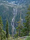 | 440 | 1,440 | British Columbia | 49°27′16″N 125°32′11″W / 49.4544°N 125.5363°W / 49.4544; -125.5363 (Della Falls) |
| South Phillips Glacier Falls | 427 | 1,401 | British Columbia | 53°07′24″N 119°13′23″W / 53.1232°N 119.2230°W / 53.1232; -119.2230 (South Phillips Glacier Falls) | |
| Bishop Falls | 410 | 1,350 | British Columbia | 58°40′31″N 133°27′12″W / 58.6753°N 133.4534°W / 58.6753; -133.4534 (Bishop Falls) | |
By tallest single drop
As of 2020[update], there are 14 confirmed waterfalls to have a single unbroken drop with a height of at least 150 m (490 ft).[2]
| Waterfall | Image | Height | Province | Coordinates | |
|---|---|---|---|---|---|
| m | ft | ||||
| Cerberus Falls | 475 | 1,558 | British Columbia | 51°53′39″N 117°04′19″W / 51.8941°N 117.0720°W / 51.8941; -117.0720 (Cerberus Falls) | |
| Odegaard Falls | 271 | 889 | British Columbia | 52°14′29″N 126°17′33″W / 52.2415°N 126.2924°W / 52.2415; -126.2924 (Odegaard Falls) | |
| Hunlen Falls |  | 260 | 850 | British Columbia | 52°16′36″N 125°46′21″W / 52.2768°N 125.7724°W / 52.2768; -125.7724 (Hunlen Falls) |
| Takakkaw Falls | 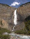 | 260 | 850 | British Columbia | 51°30′00″N 116°28′23″W / 51.5001°N 116.4730°W / 51.5001; -116.4730 (Takakkaw Falls) |
| Hamill Creek Falls | 255 | 837 | British Columbia | 50°14′24″N 116°35′06″W / 50.2401°N 116.5851°W / 50.2401; -116.5851 (Hamill Creek Falls) | |
| Pissing Mare Falls |  | 255 | 837 | Newfoundland and Labrador | 49°42′37″N 57°39′39″W / 49.7104°N 57.6609°W / 49.7104; -57.6609 (Pissing Mare Falls) |
| Francis Falls | 244 | 801 | British Columbia | 50°39′33″N 124°11′47″W / 50.6591°N 124.1965°W / 50.6591; -124.1965 (Francis Falls) | |
| South Phillips Glacier Falls | 244 | 801 | British Columbia | 53°07′24″N 119°13′23″W / 53.1232°N 119.2230°W / 53.1232; -119.2230 (South Phillips Glacier Falls) | |
| Middle Cummins Falls | 220 | 720 | British Columbia | 52°10′00″N 117°59′25″W / 52.1667°N 117.9904°W / 52.1667; -117.9904 (Middle Cummins Falls) | |
| Schwartzenbach Falls | 200 | 660 | Nunavut | 66°30′30″N 65°31′30″W / 66.5083°N 65.5250°W / 66.5083; -65.5250 (Schwartzenbach Falls) | |
| Michael Falls | 158 | 518 | British Columbia | 51°28′25″N 116°31′07″W / 51.4736°N 116.5186°W / 51.4736; -116.5186 (Michael Falls) | |
| Bow Glacier Falls |  | 154 | 505 | Alberta | 51°39′12″N 116°29′57″W / 51.6532°N 116.4992°W / 51.6532; -116.4992 (Bow Glacier Falls) |
| Lady Wilsons Falls | 152 | 499 | Alberta | 52°01′37″N 116°49′00″W / 52.0269°N 116.8167°W / 52.0269; -116.8167 (Lady Wilsons Falls) | |
| Madden Falls | | 152 | 499 | British Columbia | 49°53′20″N 123°19′01″W / 49.8889°N 123.3170°W / 49.8889; -123.3170 (Madden Falls) |
Waterfalls by average flow rate
As of 2021[update], there are 25 confirmed waterfalls with an average flow rate or discharge of at least 100 m3/s (3,500 cu ft/s).[3][4][5]
| Waterfall | Image | Discharge | Province | Coordinates | |
|---|---|---|---|---|---|
| m3/s | ft3/s | ||||
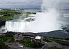
| Niagara Falls |  | 2,407 | 85,000 | Ontario / New York (U.S.) | 43°04′38″N 79°04′32″W / 43.077305°N 79.07562°W / 43.077305; -79.07562 (Horseshoe Falls (Niagara Falls)) |
| Vermilion Falls |  | 1,812 | 64,000 | Alberta | 58°22′11″N 114°52′18″W / 58.36972°N 114.87176°W / 58.36972; -114.87176 (Vermilion Falls) |
| Limestone Falls |  | 1,464 | 51,700 | Quebec | 57°28′45″N 69°18′36″W / 57.4791°N 69.3099°W / 57.4791; -69.3099 (Limestone Falls) |
| Pyrite Falls |  | 1,464 | 51,700 | Quebec | 57°26′00″N 69°14′32″W / 57.4333°N 69.2422°W / 57.4333; -69.2422 (Pyrite Falls) |
| Virginia Falls |  | 1,000 | 35,000 | Northwest Territories | 61°36′26″N 125°44′12″W / 61.60722°N 125.73667°W / 61.60722; -125.73667 (Virginia Falls) |
| Shale Falls |  | 934 | 33,000 | Quebec | 56°44′39″N 69°01′04″W / 56.7443°N 69.0179°W / 56.7443; -69.0179 (Shale Falls) |
| Chaudière Falls |  | 500 | 18,000 | Quebec | 46°42′53″N 71°16′57″W / 46.71472°N 71.28250°W / 46.71472; -71.28250 (Chaudière Falls (Chaudière River)) |
| Granite Falls |  | 453 | 16,000 | Quebec | 55°50′42″N 68°25′25″W / 55.8450°N 68.4235°W / 55.8450; -68.4235 (Granite Falls) |
| Little Eaton Canyon Falls |  | 317 | 11,200 | Quebec | 55°31′46″N 68°17′40″W / 55.5294°N 68.2945°W / 55.5294; -68.2945 (Little Eaton Canyon Falls) |
| Lower Eaton Canyon Falls |  | 317 | 11,200 | Quebec | 55°33′46″N 68°11′50″W / 55.5627°N 68.1973°W / 55.5627; -68.1973 (Lower Eaton Canyon Falls) |
| Nastapoca Falls |  | 317 | 11,200 | Quebec | 56°54′54″N 76°31′46″W / 56.915004°N 76.529509°W / 56.915004; -76.529509 (Nastapoca Falls) |
| Tuktu Falls | 317 | 11,200 | Quebec | 55°32′36″N 68°14′44″W / 55.5432°N 68.2456°W / 55.5432; -68.2456 (Tuktu Falls) | |
| Twin Falls | 317 | 11,200 | Quebec | 56°53′54″N 76°24′12″W / 56.8984°N 76.4032°W / 56.8984; -76.4032 (Twin Falls (Nastapoca River)) | |
| Upper Eaton Canyon Falls |  | 317 | 11,200 | Quebec | 55°33′29″N 68°12′57″W / 55.5581°N 68.2158°W / 55.5581; -68.2158 (Upper Eaton Canyon Falls) |
| Alexandra Falls |  | 282 | 10,000 | Northwest Territories | 60°30′02″N 116°16′45″W / 60.50056°N 116.27917°W / 60.50056; -116.27917 (Alexandra Falls) |
| Louise Falls |  | 282 | 10,000 | Northwest Territories | 60°30′12″N 116°14′29″W / 60.5033°N 116.2414°W / 60.5033; -116.2414 (Louise Falls) |
| Rearguard Falls |  | 171 | 6,000 | British Columbia | 52°58′24″N 119°21′51″W / 52.97333°N 119.3641°W / 52.97333; -119.3641 (Rearguard Falls) |
| Montmorency Falls |  | 130 | 4,600 | Quebec | 46°53′27″N 71°8′51″W / 46.89083°N 71.14750°W / 46.89083; -71.14750 (Montmorency Falls) |
| Baileys Chute |  | 122 | 4,300 | British Columbia | 52°04′19″N 120°11′33″W / 52.07204°N 120.19255°W / 52.07204; -120.19255 (Baileys Chute) |
| Marcus Falls | 122 | 4,300 | British Columbia | 52°04′28″N 120°12′00″W / 52.0744°N 120.1999°W / 52.0744; -120.1999 (Marcus Falls) | |
| Athabasca Falls |  | 113 | 4,000 | Alberta | 52°39′51″N 117°53′01″W / 52.66417°N 117.88361°W / 52.66417; -117.88361 (Athabasca Falls) |
| Osprey Falls | 113 | 4,000 | British Columbia | 52°08′24″N 120°11′36″W / 52.1400°N 120.1933°W / 52.1400; -120.1933 (Osprey Falls) | |
| Dawson Falls |  | 107 | 3,800 | British Columbia | 51°57′55″N 120°07′25″W / 51.9654°N 120.1235°W / 51.9654; -120.1235 (Dawson Falls) |
| Helmcken Falls |  | 107 | 3,800 | British Columbia | 51°57′14″N 120°10′40″W / 51.9538°N 120.1779°W / 51.9538; -120.1779 (Helmcken Falls) |
| The Mushbowl | 107 | 3,800 | British Columbia | 51°57′51″N 120°07′48″W / 51.9643°N 120.1301°W / 51.9643; -120.1301 (The Mushbowl) | |
Notable waterfalls by province
| Waterfall | Image | Watercourse | Drop | Width | Type | Coordinates | Ref |
|---|---|---|---|---|---|---|---|
| Athabasca Falls | 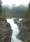 | Athabasca River | 24 m (79 ft) | 18 m (59 ft) | Segmented Horsetail | 52°39′51″N 117°53′01″W / 52.66417°N 117.88361°W / 52.66417; -117.88361 (Athabasca Falls) | [6] |
| Bow Falls |  | Bow River | 9 m (30 ft) | 37 m (121 ft) | Cascade | 51°9′57″N 115°33′35″W / 51.16583°N 115.55972°W / 51.16583; -115.55972 (Bow Falls) | [7] |
| Bow Glacier Falls |  | Bow River | 120 m (390 ft) | 57 m (187 ft) | Horsetail | 51°39′11″N 116°29′57″W / 51.65306°N 116.49917°W / 51.65306; -116.49917 (Bow Glacier Falls) | [8] |
| Bridal Veil Falls (Banff) |  | An unnamed stream | 86 m (282 ft) | 5 m (16 ft) | Tiered Plunges | 52°11′01″N 117°03′07″W / 52.18361°N 117.05194°W / 52.18361; -117.05194 (Bridal Veil Falls) | [9] |
| Crescent Falls |  | Bighorn River | Tiered | 52°23′14″N 116°21′15″W / 52.38722°N 116.35417°W / 52.38722; -116.35417 (Crescent Falls) | [10] | ||
| Crypt Falls |  | Hellroaring Creek | 175 m (574 ft) | 15 m (49 ft) | Horsetail | 49°0′18″N 113°50′35″W / 49.00500°N 113.84306°W / 49.00500; -113.84306 (Crypt Falls) | [11] |
| Elbow Falls |  | Elbow River | Cascade | 50°51′31″N 114°47′32″W / 50.85861°N 114.79222°W / 50.85861; -114.79222 (Elbow Falls) | [12] | ||
| Fossil Falls | Foch Creek | 150 m (490 ft) | 23 m (75 ft) | Tiered Horsetails | 50°35′28″N 115°11′56″W / 50.59111°N 115.19889°W / 50.59111; -115.19889 (Fossil Falls) | [13] | |
| Geraldine Falls | Geraldine Creek | 152 m (499 ft) | 15 m (49 ft) | Tiered Horsetails | 52°36′01″N 117°56′20″W / 52.60028°N 117.93889°W / 52.60028; -117.93889 (Geraldine Falls) | [14] | |
| Kerkeslin Falls | An unnamed stream | Tiered Horsetails | disputed[nb 1] | [15] | |||
| Kitchener Creek Falls | Kitchener Creek | 122 m (400 ft) | 122 m (400 ft) | 5 m (16 ft) | 52°15′31″N 117°18′11″W / 52.25861°N 117.30306°W / 52.25861; -117.30306 (Kitchener Creek Falls) | [17] | |
| Lineham Falls | Lineham Creek | 125 m (410 ft) | 49°04′40″N 114°03′21″W / 49.07778°N 114.05583°W / 49.07778; -114.05583 (Lineham Falls) | [18] | |||
| Lower Sunwapta Falls |  | Sunwapta River | 17 m (56 ft), 26 m (85 ft) | 8 m (26 ft), 8 m (26 ft) | Tiered Horsetails, Tiered Plunges | 52°31′57″N 117°38′42″W / 52.53250°N 117.64500°W / 52.53250; -117.64500 (Sunwapta Falls) | ,[19] [20] |
| Maligne Canyon Falls | Maligne Canyon | [21] | |||||
| Murchison Falls | An unnamed stream | 180 m (590 ft) | 30 m (98 ft) | Segmented Plunges | 51°55′09″N 116°41′15″W / 51.91917°N 116.68750°W / 51.91917; -116.68750 (Murchison Falls) | [22] | |
| O'Shaughnessy Falls | [21] | ||||||
| Panther Falls |  | Nigel Creek | 66 m (217 ft) | 12 m (39 ft) | Plunge | 52°10′54″N 117°3′29″W / 52.18167°N 117.05806°W / 52.18167; -117.05806 (Panther Falls) | [23] |
| Sideways Falls (Big Bend Falls) | An unnamed stream | 106 m (348 ft) | 15 m (49 ft) | Tiered Horsetails | 52°09′46″N 117°04′01″W / 52.16278°N 117.06694°W / 52.16278; -117.06694 (Sideways Falls) | [24] | |
| Siffleur Falls | 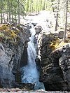 | Siffleur River | 52°1′14″N 116°21′58″W / 52.02056°N 116.36611°W / 52.02056; -116.36611 (Siffleur Falls) | [25] | |||
| Snake Indian Falls | Snake Indian River | [21] | |||||
| Tangle Falls | [21] |
| Image | Waterfall | Watercourse | Drop | Width | Type | Coordinates | Ref |
|---|---|---|---|---|---|---|---|
| Kwasitchewan Falls |  | Grass River | 14 m (46 ft) | 55°15′55″N 98°17′22″W / 55.2653°N 98.2895°W / 55.2653; -98.2895 (Kwasitchewan Falls) | [26] | ||
| McGillvray Falls | |||||||
| Muhigan Falls | Muhigan River | 19 m (62 ft) | 54°41′17″N 98°35′31″W / 54.6880°N 98.5920°W / 54.6880; -98.5920 (Muhigan Falls) | [27] | |||
| Pisew Falls |  | Grass River | 13 m (43 ft) | 47 m (154 ft) | 55°11′50″N 98°23′51″W / 55.19722°N 98.39750°W / 55.19722; -98.39750 (Pisew Falls) | [28] | |
| Rainbow Falls | |||||||
| Sturgeon Falls | |||||||
| Wekusko Falls Provincial Park | |||||||
| Whitemouth Falls Provincial Park |
| Waterfall | Image | Watercourse | Drop | Width | Type | Coordinates | Ref |
|---|---|---|---|---|---|---|---|
| Grand Falls |  | Saint Croix River | 45°16′30″N 67°28′43″W / 45.275°N 67.4785°W / 45.275; -67.4785 (Grand Falls) | [29] | |||
| Nepisiguit (Grand) Falls | "Grand Falls, Nepisiguit River, before 1874" [1] | Nepisiguit River | 75 m (246 ft) | Segmented Block | 47°24′19″N 65°47′29″W / 47.40528°N 65.79139°W / 47.40528; -65.79139 (Nepisiguit Grand Falls) |
| Waterfall | Image | Watercourse | Drop | Width | Type | Coordinates | Ref |
|---|---|---|---|---|---|---|---|
| Aviron Bay Falls | 213 m (699 ft) | 12 m (39 ft) | Tiered | [30] | |||
| Churchill Falls |  | Churchill River | 75 m (246 ft) | segmented Block | 53°36′00″N 64°18′57″W / 53.60000°N 64.31583°W / 53.60000; -64.31583 (Churchill Falls) | [31][32] | |
| Grand Falls | Exploits River | 43 m (141 ft) | [33] | ||||
| Grand Falls | Hamilton River | 92 m (302 ft) | 46 m (151 ft) | Slide, Plunge | [34] | ||
| Muskrat Falls | Churchill River | 15 m (49 ft) | 53°14′44″N 60°46′17″W / 53.24556°N 60.77139°W / 53.24556; -60.77139 (Muskrat Falls) | ||||
| Pissing Mare Falls | | Burnt Woods Brook | 350 m (1,150 ft) | Plunge, Cascade | [35][36][37] | ||
| Rattling Brook Falls |  | Rattling Brook | 140 m (460 ft) | Tiered | [38] | ||
| Sandy Pond Falls | 220 m (720 ft) | Plunge, Cascades | [39] | ||||
| Scott Falls | Unknown River | 27 m (89 ft) | [33] | ||||
| Thomas Falls | Unknown River | 31 m (102 ft) | [33] | ||||
| Twin Falls | Unknown River | 53 m (174 ft) | [40] |
| Waterfall | Image | Watercourse | Drop | Width | Type | Coordinates | Ref |
|---|---|---|---|---|---|---|---|
| Alexandra Falls |  | Hay River | 33 m (108 ft) | 117 m (384 ft) | Vertical Block | 60°30′02″N 116°16′48″W / 60.5005°N 116.2799°W / 60.5005; -116.2799 (Alexandra Falls) | [41] |
| Cameron Falls |  | Cameron River | 17 m (56 ft) | Steep cascade | 62°31′14″N 113°41′16″W / 62.5206°N 113.6877°W / 62.5206; -113.6877 (Cameron Falls) | [42] | |
| Lady Evelyn Falls | Kakisa River | 17 m (56 ft) | 116 m (381 ft) | Vertical Block | 60°57′53″N 117°19′46″W / 60.9646°N 117.3295°W / 60.9646; -117.3295 (Lady Evelyn Falls) | [43] | |
| Louise Falls | | Hay River | 15 m (49 ft) | 183 m (600 ft) | Vertical Block | 60°30′10″N 116°14′34″W / 60.5029°N 116.2427°W / 60.5029; -116.2427 (Louise Falls) | [44] |
| Marengo Falls | Marengo Creek | 30 m (98 ft) | ? | Veiling Horsetail | 61°35′39″N 125°48′08″W / 61.5942°N 125.8022°W / 61.5942; -125.8022 (Marengo Falls) | [45] | |
| Virginia Falls |  | South Nahanni River | 90 m (300 ft) | 305 m (1,001 ft) | Segmented Horsetails | 61°36′27″N 125°44′20″W / 61.6074°N 125.7389°W / 61.6074; -125.7389 (Virginia Falls) | [46] |
| Waterfall | Image | Watercourse | Drop | Width | Type | Coordinates | Ref |
|---|---|---|---|---|---|---|---|
| Barrow Falls | Barrow River | 27 m (89 ft) | 67°19′17″N 81°22′30″W / 67.3213°N 81.3751°W / 67.3213; -81.3751 (Barrow Falls) | [47] | |||
| Kattimannap Qurlua |  | Hood River | 49 m (161 ft) | ? | Segmented Plunges | 67°05′43″N 108°47′51″W / 67.0952°N 108.7974°W / 67.0952; -108.7974 (Wilberforce Falls) | [48] |
| Kazan Falls |  | Kazan River | 25 m (82 ft) | 63°42′51″N 95°50′48″W / 63.7142°N 95.8467°W / 63.7142; -95.8467 (Kazan Falls) | [49] | ||
| Kingaunmiut Falls | Hood River | 25 m (82 ft) | Steep cascade | 66°51′26″N 110°44′30″W / 66.8573°N 110.7417°W / 66.8573; -110.7417 (Kingaunmiut Falls) | [50] |
| Image | Waterfall | Watercourse | Drop | Width | Class | Type | Reference | Coordinates |
|---|---|---|---|---|---|---|---|---|
 | Niagara Falls | Niagara River | 53 m (174 ft) | 671 m (2,201 ft) | Segmented Block | [51][52] | 43°04′38″N 79°04′32″W / 43.077305°N 79.07562°W / 43.077305; -79.07562 (Horeshoe Falls Niagara Falls) | |
 | Horseshoe Falls | Niagara River | 52 m (171 ft) | Segmented Block | [51] | 43°04′48″N 79°04′16″W / 43.080°N 79.071°W / 43.080; -79.071 (Niagara Falls) | ||
| Big Beaver Falls | Kapuskasing River | 18 m (59 ft) | [33] | |||||
 | Bridal Veil Falls | Kagawong River | 11 m (36 ft) | Plunge | [53] | 45°54′02″N 82°15′23″W / 45.90048°N 82.25651°W / 45.90048; -82.25651 (Bridal Veil Falls) | ||
| Bridal Veil Falls | Agawa River | 69 m (226 ft) | [54] | |||||
 | Chats Falls | Ottawa River | 16 m (52 ft) | 45°28′35″N 76°14′55″W / 45.47639°N 76.24861°W / 45.47639; -76.24861 (Chats Falls) | ||||
 | Chaudière Falls | Ottawa River | 15 m (49 ft) | 60 m (200 ft) | [55][56] | 45°25′14″N 75°43′20″W / 45.42056°N 75.72222°W / 45.42056; -75.72222 (Chaudière Falls (Ottawa River)) | ||
 | Fenelon Falls, Ontario | Trent-Severn Waterway | 15 m (49 ft) | 7 m (23 ft) 30 m (98 ft) | Plunge | [57] | 44°32′08″N 78°44′13″W / 44.53556°N 78.73694°W / 44.53556; -78.73694 (Fenelon Falls) | |
 | Fourth Falls | Larder River | [58] | 47°53′06″N 79°46′38″W / 47.885°N 79.7772222°W / 47.885; -79.7772222 (Fourth Falls) | ||||
| Helen Falls | Lady Evelyn River | 25 m (82 ft) | Cascade | [59][60] | 47°17′31″N 80°20′02″W / 47.29194°N 80.33389°W / 47.29194; -80.33389 (Helen Falls) | |||
 | Hog's Back Falls | Rideau River | 18 m (59 ft) | artificially created | [61] | 45°22′16″N 75°41′49″W / 45.371021°N 75.697024°W / 45.371021; -75.697024 (Hog's Back Falls) | ||
 | Inglis Falls | Sydenham River | 18 m (59 ft) | cascade | [62] | 44°31′33″N 80°56′05″W / 44.525701°N 80.93482°W / 44.525701; -80.93482 (Inglis falls) | ||
 | Kakabeka Falls | Kaministiquia River | 40 m (130 ft) | Plunge | [63] | 48°24′10″N 89°37′32″W / 48.4029°N 89.6256°W / 48.4029; -89.6256 (Kakabeka Falls) | ||
 | Onaping Falls | Onaping River | Cascade | |||||
 | Rideau Falls | Rideau River | [64] | 45°26′29″N 75°41′46″W / 45.441405°N 75.69623°W / 45.441405; -75.69623 (Rideau Falls) | ||||
| Rideau Chutes | Rideau River | [65] | 47°27′N 75°42′W / 47.450°N 75.700°W / 47.450; -75.700 (Rideau Chutes) | |||||
 | Albion Falls | Red Hill Creek | 19 m (62 ft) | 18 m (59 ft) | classical/cascade | [66] | 43°12′02″N 79°49′11″W / 43.200472°N 79.819676°W / 43.200472; -79.819676 | |
| Ancaster Heights Falls | Tiffany tributary | 13.4 m (44 ft) | 1.8 m (5.9 ft) | high terraced ribbon cascade | [66] | |||
| Betzner Falls | Spring tributary | 6.3 m (21 ft) | 9 m (30 ft) | Twin Classic Cascade | [67] | |||
| Billy Green Falls | Battlefield Creek | 17 m (56 ft) | 6 m (20 ft) | Ribbon | [66] | 43°12′26″N 79°45′59″W / 43.207160°N 79.766355°W / 43.207160; -79.766355 | ||
 | Borer's Falls | Borer's Creek | 15 m (49 ft) | high ribbon-style | [68] | 43°16′52.33″N 79°55′51.71″W / 43.2812028°N 79.9310306°W / 43.2812028; -79.9310306 (Borers Falls) | ||
| Dog Falls | Kaministiquia River | 47 m (154 ft) | [33] | |||||
| Wawaitin Falls | Mattagami River | 38 m (125 ft) | [33] | |||||
| White's Falls | Six Mile Lake | 38 m (125 ft) | [33] | |||||
| Aubrey Falls | Mississagi River | 33 m (108 ft) | [33] | |||||
| Pigeon Falls | Pigeon River | 27 m (89 ft) | [33] | |||||
| High Falls | Onaping River | 24 m (79 ft) | [33] | |||||
| Schist Falls | Pukaskwa River | 24 m (79 ft) | [33] | |||||
| Smoky Falls | Mattagami River | 24 m (79 ft) | [33] | |||||
| Christopher Falls | Opasatika River | 23 m (75 ft) | [33] | |||||
| Partridge Falls | Pigeon River | 21 m (69 ft) | [33] | |||||
| Steephill Falls | Magpie River | 21 m (69 ft) | [33] | |||||
| Boundary Falls | Grindstone Tributaries | 6 m (20 ft) | 2 m (6.6 ft) | high ribbon-style | [69] | |||
| Webster's Falls | Spencer Creek | 22 m (72 ft) | 30 m (98 ft) | Curtain/Plunge | [70] | 43°16′34″N 79°58′51″W / 43.276241°N 79.980898°W / 43.276241; -79.980898 |
| Waterfall | Image | Watercourse | Drop | Width | Type | Coordinates | Ref |
|---|---|---|---|---|---|---|---|
| Brador Falls |  | Brador River | 51°30′25″N 57°14′52″W / 51.5069°N 57.2479°W / 51.5069; -57.2479 (Brador Falls) | [71] | |||
| Chats Falls | | Ottawa River | 11 m (36 ft) | 45°28′35″N 76°14′55″W / 45.47639°N 76.24861°W / 45.47639; -76.24861 (Chats Falls) | [72] | ||
| Chaudière Falls | | Chaudière River | 35 m (115 ft) | 240 m (790 ft) | 46°42′47″N 71°17′10″W / 46.71306°N 71.28611°W / 46.71306; -71.28611 (Chaudière Falls (Chaudière River)) | [73][74] | |
| Chaudière Falls | | Ottawa River | 15 m (49 ft) | 60 m (200 ft) | 45°25′14″N 75°43′20″W / 45.42056°N 75.72222°W / 45.42056; -75.72222 (Chaudière Falls (Ottawa River)) | [55][56] | |
| Granite Falls | | Caniapiscau River | 21 m (69 ft) | 55°50′38″N 68°25′22″W / 55.84389°N 68.42278°W / 55.84389; -68.42278 (Granite Falls) | [33] | ||
| Kabir Kouba |  | Saint-Charles River | 28 m (92 ft) | 46°51′19″N 71°21′20″W / 46.85528°N 71.35556°W / 46.85528; -71.35556 (Kabir Kouba) | [75][76] | ||
| Kempt Falls | Kempt River | 48°01′42″N 66°47′16″W / 48.02833°N 66.78778°W / 48.02833; -66.78778 (Kempt Falls) | [77] | ||||
| Limestone Falls | | Caniapiscau River | 22 m (72 ft) | 335 m (1,099 ft) | 57°28′53″N 69°18′35″W / 57.48139°N 69.30972°W / 57.48139; -69.30972 (Limestone Falls) | [78] | |
| Monte-à-Peine Falls | Image | Assumption River | 46°12′11″N 73°33′28″W / 46.2031°N 73.5578°W / 46.2031; -73.5578 (Monte-à-Peine Falls) | [79] | |||
| Montmorency Falls | 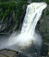 | Montmorency River | 84 m (276 ft) | 46°53′27″N 71°8′51″W / 46.89083°N 71.14750°W / 46.89083; -71.14750 (Montmorency Falls) | [80] | ||
| Neigette Falls |  | Neigette River | 48°26′14″N 68°18′59″W / 48.43722°N 68.31639°W / 48.43722; -68.31639 | [81] | |||
| Ouiatchouan Falls | 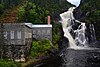 | Ouiatchouan River | 79 m (259 ft) | 48°25′56″N 72°10′06″W / 48.43222°N 72.16833°W / 48.43222; -72.16833 (Ouiatchouan Falls) | [33] | ||
| Pico Falls |  | Gilmour Creek | 48°01′36″N 66°57′21″W / 48.0267°N 66.9557°W / 48.0267; -66.9557 (Picot Falls) | [82] | |||
| Saint Anne Falls |  | Sainte-Anne River | 70 m (230 ft) | 47°04′23″N 70°52′39″W / 47.07306°N 70.87750°W / 47.07306; -70.87750 (Saint Anne Falls) | [83] | ||
| Shale Falls | | Caniapiscau River | 18 m (59 ft) | 56°44′39″N 69°01′05″W / 56.74417°N 69.01806°W / 56.74417; -69.01806 (Shale Falls) | [33] | ||
| Shawinigan Falls |  | Saint-Maurice River | 46 m (151 ft) | 46°31′51″N 72°45′40″W / 46.53086°N 72.76102°W / 46.53086; -72.76102 (Shawinigan Falls) | [33] | ||
| Vauréal Falls |  | Vauréal River | 49°33′37″N 62°41′35″W / 49.56028°N 62.69306°W / 49.56028; -62.69306 (Vauréal Falls) | [84] |
| Waterfall | Image | Watercourse | Height | Width | Type | Coordinates | Ref |
|---|---|---|---|---|---|---|---|
| Elizabeth Falls | Fond du Lac River | 34 m (112 ft) | 59°10′48″N 105°33′24″W / 59.1801°N 105.5566°W / 59.1801; -105.5566 (Elizabeth Falls) | [85] | |||
| Hunt Falls | Grease River | 15 m (49 ft) | 60 m (200 ft) | 59°28′40″N 106°25′35″W / 59.4778°N 106.4263°W / 59.4778; -106.4263 (Hunt Falls) | [86] | ||
| Kettle Falls | Churchill River | 5 m (16 ft) | 134 m (440 ft) | 55°32′54″N 103°14′26″W / 55.5483°N 103.2406°W / 55.5483; -103.2406 (Kettle Falls) | [87] | ||
| Nistowiak Falls |  | Rapid River | 10 m (33 ft) | Segmented | 55°23′46″N 104°21′59″W / 55.39611°N 104.36639°W / 55.39611; -104.36639 (Nistowiak Falls) | [88] | |
| Spruce Falls | Swan River | 55°37′N 102°27′W / 55.617°N 102.450°W / 55.617; -102.450 (Spruce Falls) | [89] |
| Waterfall | Image | Watercourse | Height | Width | Type | Coordinates | Ref |
|---|---|---|---|---|---|---|---|
| Otter Falls |  | Aishihik River | 61°04′54″N 136°59′42″W / 61.0818°N 136.9950°W / 61.0818; -136.9950 (Otter Falls) | [90] | |||
| Rancheria Falls | Rancheria River | 8 m (26 ft) | Cascade | 60°04′40″N 130°49′43″W / 60.0778°N 130.8287°W / 60.0778; -130.8287 (Rancheria Falls) | [91] |
See also
Notes
- ^ The identity and location of this waterfall is uncertain; one location is given at worldwaterfalldatabase.com[15] and the other is reported by ice climbers.[16]
References
- ^ "Waterfalls in Canada - World Waterfall Database". www.worldwaterfalldatabase.com. Retrieved 2020-10-31.
- ^ "Tallest and Largest Waterfalls at the World Waterfall Database". www.worldwaterfalldatabase.com. Retrieved 2020-11-01.
- ^ "Waterfalls in Canada - World Waterfall Database". www.worldwaterfalldatabase.com. Retrieved 2020-11-01.
- ^ "Graphique des données à une station hydrométrique Montmorency". www.cehq.gouv.qc.ca. Retrieved 2020-11-02.
- ^ "Graphique des données à une station hydrométrique Chaudière". www.cehq.gouv.qc.ca. Retrieved 2020-11-04.
- ^ "Athabasca Falls, Alberta, Canada". World Waterfall Database. Retrieved 2017-06-17.
- ^ "Bow Falls, Alberta, Canada". World Waterfall Database. Retrieved 2017-06-17.
- ^ "Bow Glacier Falls, Alberta, Canada". World Waterfall Database. Retrieved 2017-06-17.
- ^ "Bridal Veil Falls, Alberta, Canada". World Waterfall Database. Retrieved 2017-06-17.
- ^ "Upper Crescent Falls, Alberta, Canada". World Waterfall Database. Retrieved 2017-06-17.
- ^ "Crypt Falls, Alberta, Canada". World Waterfall Database. Retrieved 2017-06-17.
- ^ "Elbow Falls, Alberta, Canada". World Waterfall Database. Retrieved 2017-06-17.
- ^ "Fossil Falls, Alberta, Canada". World Waterfall Database. Retrieved 2017-06-18.
- ^ "Geraldine Falls, Alberta, Canada". World Waterfall Database. Retrieved 2017-06-18.
- ^ a b "Kerkeslin Falls, Alberta, Canada". World Waterfall Database. Retrieved 2017-06-18.
- ^ "Kerkeslin Falls, II, WI 3 : Climbing, Hiking & Mountaineering". www.summitpost.org. Retrieved 2017-06-18.
- ^ "Kitchener Creek Falls, Alberta, Canada". World Waterfall Database. Retrieved 2017-06-18.
- ^ "Lineham Falls, Alberta, Canada". World Waterfall Database. Retrieved 2017-06-18.
- ^ "Sunwapta Falls, Alberta, Canada". World Waterfall Database. Retrieved 2017-06-17.
- ^ "Lower Sunwapta Falls, Alberta, Canada". World Waterfall Database. Retrieved 2017-06-17.
- ^ a b c d "Waterfalls Alberta". Mat Quigley. Retrieved 2013-02-06.
- ^ "Murchison Falls, Alberta, Canada - World Waterfall Database". www.worldwaterfalldatabase.com. Retrieved 2020-12-03.
- ^ "Panther Falls, Alberta, Canada". World Waterfall Database. Retrieved 2017-06-17.
- ^ "Sideways Falls, Alberta, Canada". World Waterfall Database. Retrieved 2017-06-18.
- ^ "Siffleur Falls, Alberta, Canada". World Waterfall Database. Retrieved 2017-06-17.
- ^ "Kwasitchewan Falls, Manitoba, Canada - World Waterfall Database". www.worldwaterfalldatabase.com. Retrieved 2020-12-03.
- ^ "Muhigan Falls, Manitoba, Canada - World Waterfall Database". www.worldwaterfalldatabase.com. Retrieved 2020-12-03.
- ^ "Pisew Falls, Manitoba, Canada - World Waterfall Database". www.worldwaterfalldatabase.com. Retrieved 2020-12-03.
- ^ "Grand Falls, Maine, United States - World Waterfall Database". www.worldwaterfalldatabase.com. Retrieved 2020-11-30.
- ^ "British Columbia – Canada". World Waterfalls. Bryan Swan & Dean Goss. 1985–2008. Retrieved 2008-11-07.
- ^ "Churchill Falls - History". Reprinted Courtesy of Churchill Falls (Labrador) Corporation Compiled by Peter Green - IEEE. Retrieved 2008-11-09.
- ^ "Query Record Details: Churchill Falls". Natural Resources Canada. Government of Canada. Archived from the original on 2011-08-17. Retrieved 2008-11-09.
- ^ a b c d e f g h i j k l m n o p q r s "The Atlas of Canada - Waterfalls". Natural Resources Canada. Government of Canada. 2007-10-19. Archived from the original on 2008-10-24. Retrieved 2008-11-07.
- ^ "Niagara Falls". World Waterfalls. Bryan Swan & Dean Goss. 1985–2008. Archived from the original on 2008-12-18. Retrieved 2008-11-07.Rated as 15th tallest waterfall in the world
- ^ Encyclopedia of Newfoundland and Labrador, ISBN 0-9693422-1-7.
- ^ "Newfoundland Gros Morne National Park". 2008-11-09. Archived from the original on 2008-12-07. Retrieved 2008-11-09.Photo of the Pissing Mare Falls
- ^ "Pissing Mare Falls – British Columbia – Canada". World Waterfalls. Bryan Swan & Dean Goss. 1985–2008. Retrieved 2008-11-07.
- ^ "Rattling Brook Falls – Newfoundland – Canada". World Waterfalls. Bryan Swan & Dean Goss. 1985–2008. Retrieved 2008-11-07.
- ^ "Sandy Pond Falls – Newfoundland – Canada". World Waterfalls. Bryan Swan & Dean Goss. 1985–2008. Retrieved 2008-11-07.
- ^ "Twin Falls NL - Satellite photo". Google Maps. Retrieved 2008-11-09.
- ^ "Alexandra Falls – Northwest Territories, Canada". World Waterfall Database. Retrieved 2020-03-17.
- ^ "Cameron Falls, Northwest Territories, Canada - World Waterfall Database". www.worldwaterfalldatabase.com. Retrieved 2020-12-04.
- ^ "Lady Evelyn Falls, Northwest Territories, Canada - World Waterfall Database". www.worldwaterfalldatabase.com. Retrieved 2020-11-09.
- ^ "Louise Falls, Northwest Territories, Canada - World Waterfall Database". www.worldwaterfalldatabase.com. Retrieved 2020-11-09.
- ^ "Marengo Falls, Northwest Territories, Canada - World Waterfall Database". www.worldwaterfalldatabase.com. Retrieved 2020-11-09.
- ^ "Virginia Falls, Northwest Territories, Canada - World Waterfall Database". www.worldwaterfalldatabase.com. Retrieved 2020-11-09.
- ^ "Barrow Falls, Nunavut, Canada - World Waterfall Database". www.worldwaterfalldatabase.com. Retrieved 2020-12-04.
- ^ "Wilberforce Falls, Nunavut, Canada - World Waterfall Database". www.worldwaterfalldatabase.com. Retrieved 2020-11-09.
- ^ "Kazan Falls, Nunavut, Canada - World Waterfall Database". www.worldwaterfalldatabase.com. Retrieved 2020-12-04.
- ^ "Kingaunmiut Falls, Nunavut, Canada - World Waterfall Database". www.worldwaterfalldatabase.com. Retrieved 2020-12-04.
- ^ a b "City Profile for Niagara Falls, Ontario". Retrieved 2008-10-06.
- ^ "Niagara Falls". World Waterfalls. Bryan Swan & Dean Goss. 1985–2008. Archived from the original on 2008-12-18. Retrieved 2008-11-07.Rated as 10th largest in the world
- ^ Harris, Mark (September 2, 2003). "Waterfalls of Ontario—Bridal Veil Falls (Kagawong)". Waterfalls of Ontario.ca/. Archived from the original on 2009-03-10. Retrieved 2008-11-07.
- ^ "Bridal Veil Falls". Great Lakes Waterfalls and Beyond. 25 Mar 2008. Retrieved 2008-11-07.
- ^ a b Harris, Mark (September 2, 2003). "Waterfalls of Ontario—Ottawa Valley Index". Archived from the original on 2008-07-23. Retrieved 2008-11-07.
- ^ a b Corbet, Ron (July 30, 2005). "Chaudiere Falls at the heart of Ottawa's history". The Ottawa Citizen. Canwest Digital Media, Canwest Publishing Inc. Archived from the original on 2012-11-05. Retrieved 2008-11-07.
- ^ Harris, Mark (September 2, 2003). "Waterfalls of Ontario—Fenelon Falls". Archived from the original on 2009-03-22. Retrieved 2008-11-07.
- ^ "Fourth Falls". Natural Resources Canada. October 6, 2016.
- ^ Harris, Mark (September 2, 2003). "Waterfalls of Ontario—Northeast Waterfall Region". Archived from the original on 2009-03-10. Retrieved 2008-11-07.
- ^ "GeoNames Query—Helen Falls : Query Record Details". Natural Resources Canada. Government of Canada. 2008-11-09. Archived from the original on 2011-06-08. Retrieved 2008-11-09.
- ^ "Nomination of the Rideau Canal for Inscription in the World Heritage List". Parks Canada. Government of Canada. 2008-11-09. Archived from the original on 2013-01-01. Retrieved 2008-11-09.Also called Hogs Back Falls
- ^ "Inglis Falls". day trips canada. 4 June 2008. Retrieved 2008-11-09.
- ^ "Waterfalls of Ontario—Kakabeka Falls". Archived from the original on 2007-07-04. Retrieved 2007-09-21.
- ^ "GeoNames Query—Rideau Falls : Query Record Details". Natural Resources Canada. Government of Canada. 2008-11-09. Archived from the original on 2011-06-08. Retrieved 2008-11-09.
- ^ "GeoNames Query—Rideau Chutes] : Query Record Details". Natural Resources Canada. Government of Canada. 2008-11-09. Archived from the original on 2011-06-08. Retrieved 2008-11-09.
- ^ a b c "Hamilton- Waterfall Capital of the World". (www.cityofwaterfalls.ca). Retrieved 2008-07-09.
- ^ "Hamilton Naturalist's Club: Protecting Nature since 1919". (www.hamiltonnature.org/). Retrieved 2008-08-06.
- ^ "Borer's Falls Ontario, Canada". EXPLORE Magazine. Archived from the original on 2008-10-12. Retrieved 2008-07-25.
- ^ "Hamilton Waterfalls: Boundary Falls". (www.hamiltonnature.org). Archived from the original on 2008-10-14. Retrieved 2008-07-29.
- ^ "Webster's Falls".
- ^ "BLANC-SABLON (BRADOR) - Cote-Nord Tourism". tourismecote-nord.com. Retrieved 2020-12-30.
- ^ "Chats Falls, Ontario, Canada - World Waterfall Database". www.worldwaterfalldatabase.com. Retrieved 2020-11-29.
- ^ "Parc des Chutes-de-la-Chaudière". Visitez Lévis. Retrieved 30 November 2016.
- ^ "GeoNames Query—Chutes-de-la-Chaudière in the Lèvis region: Query Record Details". Natural Resources Canada. Government of Canada. 2008-11-09. Archived from the original on 2011-06-08. Retrieved 2008-11-09.
- ^ "GeoNames Query—Chute Kabir Kouba in the Lèvis region: Query Record Details". Natural Resources Canada. Government of Canada. 2008-11-09. Archived from the original on 2011-06-08. Retrieved 2008-11-09.
- ^ "Kabir Kouba". Conception et réalisation: Bleu Outremer en collaboration avec le CLD de Québec. Archived from the original on 2008-08-25. Retrieved 2008-11-09.
- ^ "TRAILS". Restigouche South-East Municipality. Archived from the original on 2011-08-28. Retrieved 15 August 2011.
- ^ "Calcaire, Chute du, Quebec, Canada - World Waterfall Database". www.worldwaterfalldatabase.com. Retrieved 2020-12-28.
- ^ parcdeschutesetd. "Parc Régional des Chutes Monte-à-Peine-et-des-Dalles" (in French). Retrieved 2020-11-30.
- ^ Steven Dutch (19 January 2007). "Montmorency Falls, Quebec". Virtual Field Trips. Archived from the original on 28 May 2009. Retrieved 2008-11-09. highest in the province of Quebec
- ^ Depeyre, Michèle; Gauthier, Michel (2005). Guide des chutes du Québec. Québec: Les Éditions Tricycle. p. 40. ISBN 2-922072-30-4.
- ^ "M.R.C. d'Avignon - Saint-André-de-Restigouche". www.gaspesie-les-iles.org. Retrieved 2020-11-30.
- ^ Behrens, David. "Canyon Sainte Anne Falls". Canadian Waterfalls. Retrieved 2008-11-09.
- ^ "Parc national d'Anticosti". Sépaq. 2020. Retrieved 2020-11-30.
- ^ "Elizabeth Falls, Saskatchewan, Canada - World Waterfall Database". www.worldwaterfalldatabase.com. Retrieved 2020-11-03.
- ^ "Hunt Falls, Saskatchewan, Canada - World Waterfall Database". www.worldwaterfalldatabase.com. Retrieved 2022-09-23.
- ^ "Kettle Falls, Saskatchewan, Canada - World Waterfall Database". www.worldwaterfalldatabase.com. Retrieved 2020-12-02.
- ^ Lac La Ronge Provincial Park website Archived 2006-08-27 at the Wayback Machine the highest in the province of Saskatchewan
- ^ Davis, R.W. and Huffaker, M.F. Island Falls Power Development on the Churchill River, a paper presented at the annual general meeting of the Canadian Institute of Mining and Metallurgy, Winnipeg, MB, March, 1935.
- ^ "Otter Falls, Yukon, Canada - World Waterfall Database". www.worldwaterfalldatabase.com. Retrieved 2020-12-04.
- ^ "Rancheria Falls, Yukon, Canada - World Waterfall Database". www.worldwaterfalldatabase.com. Retrieved 2020-12-04.
External links
Map all coordinates using OpenStreetMap
Download coordinates as:
- KML
- GPX (all coordinates)
- GPX (primary coordinates)
- GPX (secondary coordinates)
 Media related to Waterfalls in Canada at Wikimedia Commons
- v
- t
- e
List of waterfalls of North America
- Antigua and Barbuda
- Bahamas
- Barbados
- Belize
- Canada
- Costa Rica
- Cuba
- Dominica
- Dominican Republic
- El Salvador
- Grenada
- Guatemala
- Haiti
- Honduras
- Jamaica
- Mexico
- Nicaragua
- Panama
- Saint Kitts and Nevis
- Saint Lucia
- Saint Vincent and the Grenadines
- Trinidad and Tobago
- United States
Dependencies and
other territories
other territories
- Anguilla
- Aruba
- Bermuda
- Bonaire
- British Virgin Islands
- Cayman Islands
- Curaçao
- Greenland
- Guadeloupe
- Martinique
- Montserrat
- Puerto Rico
- Saint Barthélemy
- Saint Martin
- Saint Pierre and Miquelon
- Saba
- Sint Eustatius
- Sint Maarten
- Turks and Caicos Islands
- United States Virgin Islands


