List of lighthouses in Rhode Island
Map all coordinates using OpenStreetMap
Download coordinates as:
- KML
- GPX (all coordinates)
- GPX (primary coordinates)
- GPX (secondary coordinates)
This is a list of all lighthouses in the U.S. state of Rhode Island as identified by the United States Coast Guard. There are fifteen active lights in the state as well as two skeleton towers erected to replace earlier staffed lighthouses.
The first lighthouse in the state was erected in 1749[1] and the last in 1962 (ignoring automated towers erected later); the oldest surviving structure is the much-modified Poplar Point Light, although the tower now standing at Prudence Island Light was first erected at Goat Island in 1824. The tallest extant tower is that at Beavertail Light, though the focal plane of the Block Island Southeast Light is much higher on account of the bluffs upon which it sits.
If not otherwise noted, focal height and coordinates are taken from the United States Coast Guard Light List,[2] while location and dates of activation, automation, and deactivation are taken from the United States Coast Guard historical information site for lighthouses.[3] Locations of demolished lights have been estimated using National Oceanic and Atmospheric Administration (NOAA) navigational charts.
| Name | Image | Location | Coordinates | Year first lit | Automated | Year deactivated | Current Lens | Focal Height |
|---|---|---|---|---|---|---|---|---|
| Beavertail Lighthouse |  | Jamestown (Conanicut Island) | 41°26′57″N 71°23′57″W / 41.4493°N 71.3993°W / 41.4493; -71.3993 (Beavertail Lighthouse) | 1749 (Former) 1856 (Current) | 1989 | Active | VRB-25 | 068 68 ft (21 m) |
| Block Island North Light |  | New Shoreham (Block Island) | 41°13′39″N 71°34′34″W / 41.2275°N 71.5761°W / 41.2275; -71.5761 (Block Island North Light) | 1829 (Former) 1867 (Current) | 1955 | Active (Inactive: 1973–1989, 2008–2010) | Fourth-order Fresnel | 061 61 ft (19 m) |
| Block Island Southeast Light |  | New Shoreham (Block Island) | 41°09′35″N 71°32′50″W / 41.1597°N 71.5472°W / 41.1597; -71.5472 (Block Island Southeast Light) | 1875 | 1990 | Active (Inactive: 1990–1994) | First-order Fresnel | 258 258 ft (79 m) |
| Brenton Reef Light | Narragansett | 41°25′35″N 71°23′22″W / 41.4264°N 71.3894°W / 41.4264; -71.3894 (Brenton Reef Light)[4] | 1962 | 1962 | 1989 (Now a lighted buoy) | None | 087 87 ft (27 m)[4] | |
| Bristol Ferry Light |  | Bristol | 41°38′35″N 71°15′37″W / 41.6431°N 71.2603°W / 41.6431; -71.2603 (Bristol Ferry Light)[5] | 1855 | Never | 1927 (Now a private house) | None | 035 35 ft (11 m)[5] |
| Bullock's Point Light |  | Providence River | 41°44′16″N 71°21′51″W / 41.7377°N 71.3642°W / 41.7377; -71.3642 (Bullock's Point Light) | 1876 (Former) 1939 (Current) | 1939 (skeleton tower) | Active (Original tower destroyed) | 250mm | 050 50 ft (15 m) |
| Castle Hill Light |  | Newport | 41°27′43″N 71°21′48″W / 41.4619°N 71.3633°W / 41.4619; -71.3633 (Castle Hill Light) | 1890 | 1957 | Active | 300mm | 040 40 ft (12 m) |
| Conanicut Island Light |  | Jamestown (Conanicut Island) | 41°34′24″N 71°22′21″W / 41.5733°N 71.3725°W / 41.5733; -71.3725 (Conanicut Island Light) | 1886 | Never | 1933 | None | 047 47 ft (14 m)[6] |
| Conimicut Shoal Light |  | Warwick | 41°43′01″N 71°20′45″W / 41.7169°N 71.3458°W / 41.7169; -71.3458 (Conimicut Shoal Light) | 1868 (Former) 1883 (Current) | 1966 | Active | Unknown | 029 29 ft (8.8 m) |
| Dutch Island Light |  | Jamestown | 41°29′44″N 71°24′16″W / 41.4956°N 71.4044°W / 41.4956; -71.4044 (Dutch Island Light) | 1826 (Former) 1857 (Current) | 1947 | Active (Inactive: 1979-2007) | 250mm | 056 56 ft (17 m)[7] |
| Fuller Rock Light |  | Providence River | 41°47′23″N 71°22′47″W / 41.7898°N 71.3796°W / 41.7898; -71.3796 (Fuller Rock Light) | 1872[8] | 1918[8] | 1923[8] (Destroyed)
renamed Channel Light 42) | 250mm | 028 28 ft (8.5 m)[8] |
| Gould Island Light | Jamestown (Gould Island)[9] | 41°32′02″N 71°20′35″W / 41.534°N 71.343°W / 41.534; -71.343 (Gould Island Light)[9] | 1889[9] | 1947 (on skeleton tower 1947–1968) | 1947[9] | None | 052 52 ft (16 m)[9] | |
| Gull Rocks Light | Newport | 41°30′09″N 71°19′59″W / 41.5024°N 71.3331°W / 41.5024; -71.3331 (Gull Rocks Light) | 1887 (Former) 1928 (Current) | 1960 | 1969 (Demolished) | None | 033 33 ft (10 m) | |
| Hog Island Shoal Light |  | Portsmouth (Hog Island | 41°37′56″N 71°16′25″W / 41.6322°N 71.2736°W / 41.6322; -71.2736 (Hog Island Shoal Light) | 1901 | 1964 | Active | VLB-44[10] | 054 54 ft (16 m) |
| Ida Lewis Rock Light | 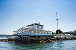 | Newport (Lime Rock) | 41°28′40″N 71°19′35″W / 41.4778°N 71.3264°W / 41.4778; -71.3264 (Ida Lewis Light) | 1854 | 1927 | 1963 | None | Unknown |
| Musselbed Shoals Light |  | Narragansett Bay (Open water) | 41°38′11″N 71°15′36″W / 41.6363°N 71.2599°W / 41.6363; -71.2599 (Musselbed Shoals Light) | 1873[11] | 1939 (skeleton tower) | Active (Original tower destroyed) | 035 35 ft (11 m)[11] | |
| Nayatt Point Light |  | Barrington | 41°43′30″N 71°20′23″W / 41.7250°N 71.3397°W / 41.7250; -71.3397 (Nayatt Point Light) | 1828 (Former) 1856 (Current) | Unknown | 1868 | None | Unknown |
| Newport Harbor Light (Goat Island Light) |  | Newport (Goat Island) | 41°29′36″N 71°19′37″W / 41.4933°N 71.3270°W / 41.4933; -71.3270 (Newport Harbor Light) | 1823 (Former) 1865 (Current) | 1923 | Active | 250mm | 033 33 ft (10 m) |
| Plum Beach Light |  | North Kingstown | 41°31′48″N 71°24′20″W / 41.5300°N 71.4056°W / 41.5300; -71.4056 (Plum Beach Light) | 1897 | 2003 (Relit) | Active (Inactive: 1941–2003) | Unknown | Unknown |
| Point Judith Light |  | Narragansett | 41°21′39″N 71°28′55″W / 41.3608°N 71.4819°W / 41.3608; -71.4819 (Point Judith Light) | 1810 (Former) 1857 (Current) | 1954 | Active | Fourth-order Fresnel | 051 51 ft (16 m) |
| Pomham Rocks Light |  | East Providence | 41°46′39″N 71°22′11″W / 41.7775°N 71.3696°W / 41.7775; -71.3696 (Pomham Rocks Light) | 1871 | 2006 (Relit) | Active (on skeleton tower 1974–2006) | Marine LED Beacon VLB-44 | 067 67 ft (20 m) |
| Poplar Point Light |  | North Kingstown | 41°34′15″N 71°26′23″W / 41.5708°N 71.4397°W / 41.5708; -71.4397 (Poplar Point Light) | 1831 | Never | 1882 (Now a private house) | None | Unknown |
| Prudence Island Light |  | Portsmouth (Prudence Island) | 41°36′20″N 71°18′11″W / 41.6056°N 71.3031°W / 41.6056; -71.3031 (Prudence Island Light) | 1852 | 1961 | Active | 250mm | 028 28 ft (8.5 m) |
| Rose Island Light |  | Newport (Rose island | 41°29′44″N 71°20′35″W / 41.4956°N 71.3431°W / 41.4956; -71.3431 (Rose Island Light) | 1870 | 1992 (Relit) | Active (Inactive: 1971–1992) | Sixth-order Fresnel[12] | 048 48 ft (15 m) |
| Sabin Point Light |  | Providence River | 41°45′43″N 71°22′27″W / 41.7619°N 71.3742°W / 41.7619; -71.3742 (Sabin Point Light) | 1872 | 1956 | 1968 (Razed) | None | 036 36 ft (11 m) |
| Sakonnet Light |  | Little Compton (Sakonnet River) | 41°27′11″N 71°12′11″W / 41.4531°N 71.2031°W / 41.4531; -71.2031 (Sakonnet Light) | 1884[13] | 1997 (Relit) | Active (Inactive: 1955–1997) | Unknown | 058 58 ft (18 m) |
| Sassafras Point Light |  | Providence River | 41°48′00″N 71°23′31″W / 41.800°N 71.392°W / 41.800; -71.392 (Sassafras Point Light)[14] | 1872[15] | Never | 1912[15] (Demolished) | None | 025 25 ft (7.6 m)[15] |
| Warwick Light |  | Warwick | 41°40′01″N 71°22′43″W / 41.6669°N 71.3786°W / 41.6669; -71.3786 (Warwick Light) | 1827 (Former) 1932 (Current) | 1985 | Active | 250mm | 066 66 ft (20 m) |
| Watch Hill Light |  | Westerly (Watch Hill) | 41°18′14″N 71°51′30″W / 41.3039°N 71.8584°W / 41.3039; -71.8584 (Watch Hill Light) | 1808 (Former) 1857 (Current) | 1986 | Active | VRB-25 | 061 61 ft (19 m) |
| Whale Rock Light |  | Narragansett (Whale Rock) | 41°26′37″N 71°25′25″W / 41.4436°N 71.4236°W / 41.4436; -71.4236 (Whale Rock Light) | 1882 | 1939 | 1938 (Destroyed)
(Replaced with skeleton tower) | None | 073 73 ft (22 m)[17] |
| Wickford Harbor Light |  | North Kingstown Wickford | 41°34′24″N 71°26′10″W / 41.5734°N 71.4362°W / 41.5734; -71.4362 (Wickford Harbor Light) | 1882 (Former) 1930 (Current) | 1930 (skeleton tower) | Active (skeleton tower) | 250mm | 042 42 ft (13 m) |
See also
References
- ^ R. Holmes. "Beavertail Light". Rhode Island Lighthouse History.
- ^ Light List, Volume I, Atlantic Coast, St. Croix River, Maine to Shrewsbury River, New Jersey (PDF). Light List. United States Coast Guard. 2010.
- ^ "Historic Light Station Information and Photography: Rhode Island". United States Coast Guard Historian's Office. Archived from the original on 2017-05-01.
- ^ a b "Brenton Reef Offshore Light station". R. Holmes.
- ^ a b "Bristol Ferry Light". Jeremy D'Entremont.
- ^ D'Entremont, Jeremy. "Conanicut Lighthouse". New England Lighthouses. Archived from the original on 2014-09-04. Retrieved 2014-08-26.
- ^ D'Entremont, Jeremy. "Dutch Island Lighthouse". New England Lighthouses. Archived from the original on 2014-09-04. Retrieved 2014-08-26.
- ^ a b c d "Fuller Rock Lighthouse History". New England Lighthouses. Retrieved 2011-01-06.
- ^ a b c d e "Gould Island Light". Jeremy D'Entremont.
- ^ "Hog Island Shoal Lighthouse - Rhode Island". rhodeislandlighthousehistory.info. Retrieved 2019-09-15.
- ^ a b "Musselbed Shoals Lighthouse: History". Jeremy D'Entremont. Retrieved 2010-08-26.
- ^ R. Holmes. "Rose Island Lighthouse". rhodeislandlighthousehistory.info. Retrieved 2019-09-15.
- ^ "Sakonnet, RI". LighthouseFriends.
- ^ Church, Earl (1920). Triangulation in Rhode Island. Government Printing Office. p. 40. Retrieved 2014-01-14.
- ^ a b c Jeremy D'Entremont. "Sassafras Point Lighthouse". New England Lighthouses. Archived from the original on 2014-01-01. Retrieved 2014-01-14.
- ^ R., Holmes. "Whale Rock Lighthouse". Rhode Island Lighthouse History Retrieved 9/30/2019.
- ^ D'Entremont, Jeremy. "Whale Rock Lighthouse". New England Lighthouses. Archived from the original on 2014-09-04. Retrieved 2014-08-26.
- v
- t
- e
- Alabama
- Alaska
- California
- Connecticut
- Delaware
- Florida
- Georgia
- Hawaii
- Illinois and Indiana
- Louisiana
- Maine
- Maryland
- Massachusetts
- Michigan
- Minnesota
- Mississippi
- Nebraska
- New Hampshire
- New Jersey
- New York
- North Carolina
- Ohio
- Oregon
- Pennsylvania
- Rhode Island
- South Carolina
- Texas
- Vermont
- Virginia
- Washington
- Wisconsin


