Knoxville, Georgia
| Knoxville | |
| CDP | |
 Domstolsbyggnaden | |
| Land |  USA USA |
|---|---|
| Delstat | Georgia |
| County | Crawford County |
| Höjdläge | 151 m ö.h. |
| Koordinater | 32°43′27″N 83°59′51″V / 32.72417°N 83.99750°V / 32.72417; -83.99750 |
| Yta | 0,8 km² (2010) |
| - land | 0,8 km² |
| - vatten | 0,0 km² |
| Folkmängd | 69 (2010) |
| Befolkningstäthet | 86 invånare/km² |
| Tidszon | EST (UTC-5) |
| - sommartid | EDT (UTC-4) |
| ZIP-kod | 31050 |
| FIPS | 1344060 |
| Geonames | 4204196 |
  Ortens läge i Georgia | |
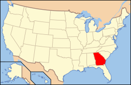 Georgias läge i USA | |
Knoxville är administrativ huvudort i Crawford County i Georgia.[1][2] Orten fick sitt namn efter Henry Knox.[3] År 1825 fick Knoxville status som kommun[4] som fråntogs år 1995 på grund av bristen av kommunala tjänster.[5]
Kända personer från Knoxville
- John Pemberton, apotekare
Källor
- ^ Georgia County Map with County Seat Cities. Geology.com Geoscience News and Information. Läst 10 juni 2016.
- ^ Profile for Knoxville, Georgia Arkiverad 10 augusti 2016 hämtat från the Wayback Machine.. ePodunk. Läst 10 juni 2016.
- ^ Crawford County. Georgia.gov Läst 10 juni 2016.
- ^ Welcome to Crawford County, Georgia. Crawford County, Georgia. Läst 10 juni 2016.
- ^ Knoxville. Explore Georgia. Läst 10 juni 2016.
Bilder & media


