Hrabstwo Washington (Vermont)
| hrabstwo | |||
 | |||
| Państwo |
| ||
|---|---|---|---|
| Stan |
| ||
| Siedziba | Montpelier | ||
| Kod statystyczny | FIPS 6-4: 50 023 | ||
| Powierzchnia | 1801,16 km²[1] | ||
| Populacja (2009) • liczba ludności |
| ||
Położenie na mapie Vermont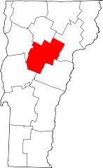 | |||
| 44°16′12″N 72°37′12″W/44,270000 -72,620000 | |||
| |||


Hrabstwo Washington (ang. Washington County) – hrabstwo w stanie Vermont w Stanach Zjednoczonych. Obszar całkowity hrabstwa obejmuje powierzchnię 695,43 mil² (1801,16 km²). Według szacunków United States Census Bureau w roku 2009 miało 59 534 mieszkańców[2].
Hrabstwo powstało w 1810 roku[3].
Miasta (city)
- Barre
- Montpelier
Gminy (town)
- Barre
- Berlin
- Cabot
- Calais
- Duxbury
- East Montpelier
- Fayston
- Marshfield
- Middlesex
- Moretown
- Northfield
- Plainfield
- Roxbury
- Waitsfield
- Warren
- Waterbury
- Woodbury
- Worcester[4]
Wsie (village)
- Cabot
- Marshfield
- Northfield
- Waterbury[4]
CDP
- East Barre
- East Montpelier
- Graniteville
- Plainfield
- South Barre
- Waitsfield
- Websterville
- Worcester[4]
| Populacja hrabstwa w poprzednich latach[3] | |
|---|---|
| Rok | Liczba ludności |
| 1980 | 52 391 |
| 1990 | 54 928 |
| 2000 | 58 039 |
| 2005 | 59 478 |
Przypisy
- ↑ US Census Bureau: Population, Housing Units, Area, and Density: 2000. [dostęp 2012-05-26]. [zarchiwizowane z tego adresu (2016-03-09)]. (ang.).
- ↑ a b US Census Bureau: Washington County. Quickfacts. [dostęp 2011-07-16]. (ang.).
- ↑ a b National Association of Counties: Washington County, VT. [dostęp 2011-07-16]. (ang.).
- ↑ a b c National Association of Counties: Places in Washington County, VT. [dostęp 2011-07-16]. (ang.).
- p
- d
- e
|

Kontrola autorytatywna (hrabstwo w stanie Vermont):
- Britannica: place/Washington-county-Vermont


