North Warwickshire
Niet-metropolitaans district in Engeland  | |||
|---|---|---|---|
  | |||
| Situering | |||
| Land | Engeland | ||
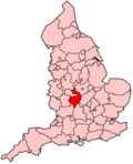
| County | Warwickshire | ||
| Regio | West Midlands | ||
| Coördinaten | 52°34'34"NB, 1°32'43"WL | ||
| Algemeen | |||
| Oppervlakte | 284,2635[1] km² | ||
| Inwoners (2018[2]) | 64.850 (228 inw./km²) | ||
| ONS-code | E07000218 | ||
| Website | Officiële website | ||
| Detailkaart | |||
 | |||
| |||

North Warwickshire is een Engels district in het shire-graafschap (non-metropolitan county OF county) Warwickshire en telt 65.000 inwoners. De oppervlakte bedraagt 284 km².
Van de bevolking is 15,0% ouder dan 65 jaar. De werkloosheid bedraagt 2,6% van de beroepsbevolking (cijfers volkstelling 2001).
Plaatsen in district North Warwickshire
- Blythe End
- Gilson
- Heath Whitacre
- Moxhull
- Warton
- Whitacre Heath
- Wiggins Hill
Civil parishes in district North Warwickshire
Ansley, Arley, Astley, Atherstone, Austrey, Baddesley Ensor, Baxterley, Bentley, Caldecote, Coleshill, Corley, Curdworth, Dordon, Fillongley, Great Packington, Grendon, Hartshill, Kingsbury, Lea Marston, Little Packington, Mancetter, Maxstoke, Merevale, Middleton, Nether Whitacre, Newton Regis, Over Whitacre, Polesworth, Seckington, Shustoke, Shuttington, Water Orton, Wishaw.
Geboren
- Michael Drayton (1563-1631), dichter
Bronnen, noten en/of referenties
- ↑ Office for National Statistics → Download → SAM_for_Administrative_Areas_(2018).zip → SAM_LAD_DEC_2018_UK.xlsx.
- ↑ https://www.ons.gov.uk/file?uri=/peoplepopulationandcommunity/populationandmigration/populationestimates/datasets/populationestimatesforukenglandandwalesscotlandandnorthernireland/mid20182019laboundaries/ukmidyearestimates20182019ladcodes.xls Schatting Office for National Statistics: knop MYE5 → kolom Estimated Population mid-2018]
- Volkstelling 2001, Office for National Statistics


