Sutherland Shire
| Sutherland Shire New South Wales | |||||||||||||||
|---|---|---|---|---|---|---|---|---|---|---|---|---|---|---|---|
 Letak di Sydney | |||||||||||||||
| Jumlah penduduk | 215,084 | ||||||||||||||
| • Kepadatan | 642,0/km2 (16.600/sq mi) | ||||||||||||||
| Luas | 335 km2 (129,3 sq mi) | ||||||||||||||
| Walikota | Clr Lorraine Kelly | ||||||||||||||
| Ibu kota dewan | Sutherland | ||||||||||||||
| Daerah | Metropolitan Sydney | ||||||||||||||
| Daerah pemilihan negara bagian | Cronulla, Heathcote, Menai, Miranda | ||||||||||||||
| Divisi Federal | Cook, Hughes | ||||||||||||||
| Situs web | Sutherland Shire | ||||||||||||||
| |||||||||||||||
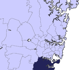
Sutherland Shire adalah sebuah Local Government Area di wilayah Southern Sydney, Sydney, Australia. Secara geografis, Sutherland Shire adalah daerah di selatan Botany Bay dan Georges River. Pusat administratif pemerintah daerah terletak di kota pinggiran Sutherland, dengan gedung dewan terletak di Eton Street. Sutherland Shire juga dikenal dengan sebutan "The Shire".[1]
Kota pinggiran
Kota pinggiran di Sutherland Shire adalah:
|
|
|
|
Pemukiman yang dikelola oleh Sutherland Shire adalah:
|
|
|

Lihat pula
- Bangor Bypass
- Botany Bay
- Puberty Blues
- Royal National Park
- Bukit pasir Wanda
Catatan kaki
- ^ http://www.theshire.com.au/
Pranala luar
- Sutherland Shire Environment Centre Diarsipkan 2020-09-19 di Wayback Machine.
- Sutherland Shire Guide - Get On Up
- Sutherland Shire Online Diarsipkan 2010-01-05 di Wayback Machine.
- Children's Book Council of Australia (CBCA), Sutherland Sub branch - literacy in children and young adults of the Sutherland Shire Diarsipkan 2010-07-02 di Wayback Machine.
- l
- b
- s
Suburban dan permukiman di Sutherland Shire, Southern Sydney, Sydney
- Alfords Point
- Bangor
- Barden Ridge
- Bundeena
- Bonnet Bay
- Burraneer
- Caringbah
- Caringbah South
- Como
- Cronulla
- Dolans Bay
- Engadine
- Grays Point
- Greenhills Beach
- Gymea
- Gymea Bay
- Heathcote
- Illawong
- Jannali
- Kangaroo Point
- Kareela
- Kirrawee
- Kurnell
- Lilli Pilli
- Loftus
- Lucas Heights
- Maianbar
- Menai
- Miranda
- Oyster Bay
- Port Hacking
- Sandy Point
- Sutherland
- Sylvania
- Sylvania Waters
- Taren Point
- Waterfall
- Woolooware
- Woronora
- Woronora Heights
- Yarrawarrah
- Yowie Bay
- Audley
- Bate Bay
- Caravan Head (nature reserve)
- Como West
- Cronulla Beach
- Bukit pasir Cronulla
- Elouera Beach
- Garie Beach
- Gundamaian
- Gunnamatta Bay
- North Cronulla Beach
- North Engadine
- Royal National Park
- Shelly Beach
- Sylvania Heights
- Towra Point
- Wanda Beach
- Warumbul
- Wattamolla
34°02′S 151°03′E / 34.033°S 151.050°E / -34.033; 151.050
 | Artikel bertopik geografi atau tempat Australia ini adalah sebuah rintisan. Anda dapat membantu Wikipedia dengan mengembangkannya. |
- l
- b
- s


