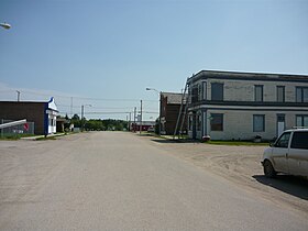
Dundurn

Cet article est une ébauche concernant une localité canadienne et la Saskatchewan.

Vous pouvez partager vos connaissances en l’améliorant (comment ?) selon les recommandations des projets correspondants.

Dundurn
Dundurn
Administration
Pays Drapeau du Canada Canada
Province Drapeau de la Saskatchewan Saskatchewan
Région centre-sud de Saskatchewan
Statut municipal Village
Constitution
Démographie
Population 647 hab. (2016)
Densité 735 hab./km2
Géographie
Coordonnées 51° 48′ 35″ nord, 106° 30′ 29″ ouest
Superficie 88 ha = 0,88 km2
Divers
Fuseau horaire -6
Code géographique 4711063
Localisation
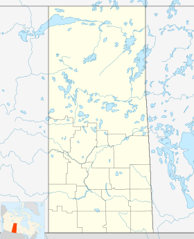
Géolocalisation sur la carte : Saskatchewan
Voir sur la carte administrative de Saskatchewan
Dundurn
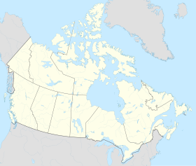
Géolocalisation sur la carte : Canada
Voir sur la carte administrative du Canada
Dundurn
Liens
Site web www.townofdundurn.ca
modifier 

Dundurn est une communauté située dans la province de la Saskatchewan, dans le centre-sud.

Histoire

Cette section est vide, insuffisamment détaillée ou incomplète. Votre aide est la bienvenue ! Comment faire ?

Économie

Cette section est vide, insuffisamment détaillée ou incomplète. Votre aide est la bienvenue ! Comment faire ?

Géographie

Cette section est vide, insuffisamment détaillée ou incomplète. Votre aide est la bienvenue ! Comment faire ?

Démographie

Cette section est vide, insuffisamment détaillée ou incomplète. Votre aide est la bienvenue ! Comment faire ?

Notes et références

v · m
Cités
Villes
  • Aberdeen
  • Alameda
  • Allan
  • Arborfield
  • Arcola
  • Asquith
  • Assiniboia
  • Balcarres
  • Balgonie
  • Battleford
  • Bengough
  • Bienfait
  • Big River
  • Biggar
  • Birch Hills
  • Blaine Lake
  • Bredenbury
  • Broadview
  • Bruno
  • Burstall
  • Cabri
  • Canora
  • Carlyle
  • Carnduff
  • Carrot River
  • Central Butte
  • Choiceland
  • Churchbridge
  • Colonsay
  • Coronach
  • Craik
  • Creighton
  • Cudworth
  • Cupar
  • Cut Knife
  • Dalmeny
  • Davidson
  • Delisle
  • Duck Lake
  • Dundurn
  • Eastend
  • Eatonia
  • Elrose
  • Esterhazy
  • Eston
  • Fleming
  • Foam Lake
  • Fort Qu'Appelle
  • Francis
  • Govan
  • Grand Coulee
  • Gravelbourg
  • Grenfell
  • Gull Lake
  • Hafford
  • Hague
  • Hanley
  • Hepburn
  • Herbert
  • Hudson Bay
  • Imperial
  • Indian Head
  • Ituna
  • Kamsack
  • Kelvington
  • Kerrobert
  • Kindersley
  • Kinistino
  • Kipling
  • Kyle
  • La Ronge
  • Lafleche
  • Lampman
  • Langenburg
  • Langham
  • Lanigan
  • Lashburn
  • Leader
  • Lemberg
  • LeRoy
  • Lumsden
  • Luseland
  • Macklin
  • Maidstone
  • Maple Creek
  • Marshall
  • Midale
  • Milestone
  • Moosomin
  • Morse
  • Mossbank
  • Naicam
  • Nipawin
  • Nokomis
  • Norquay
  • Ogema
  • Osler
  • Outlook
  • Oxbow
  • Pense
  • Pilot Butte
  • Ponteix
  • Porcupine Plain
  • Preeceville
  • Qu'Appelle
  • Radisson
  • Radville
  • Raymore
  • Redvers
  • Regina Beach
  • Rocanville
  • Rockglen
  • Rose Valley
  • Rosetown
  • Rosthern
  • Rouleau
  • Saint Brieux
  • St. Walburg
  • Saltcoats
  • Scott
  • Shaunavon
  • Shellbrook
  • Sintaluta
  • Southey
  • Spiritwood
  • Springside
  • Star City
  • Stoughton
  • Strasbourg
  • Sturgis
  • Tisdale
  • Turtleford
  • Unity
  • Vonda
  • Wadena
  • Wakaw
  • Waldheim
  • Wapella
  • Watrous
  • Watson
  • Wawota
  • White City
  • Whitewood
  • Wilkie
  • Willow Bunch
  • Wolseley
  • Wynyard
  • Yellow Grass
  • Zealandia
Subdivisions de :
  • CB
  • AB
  • SK
  • MB
  • ON
  • QC
  • NB
  • N.-É.
  • Î.-P.-É.
  • TNL
  • YK
  • TNO
  • NU
  • icône décorative Portail de la Saskatchewan