Veľká Lesná
Municipality of Slovakia
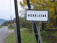
Veľká Lesná, formerly Richvald (German: Reichwald; Goral: Ryvold; Hungarian: Kristályfalu, Rusyn: Велика Лїсна) a village and municipality in Stará Ľubovňa District in the Prešov Region of northern Slovakia.
History
In historical records the village was first mentioned in 1338. Before the dissolution of Austria-Hungary, the town was listed as Richvald. Before the establishment of independent Czechoslovakia in 1918, Veľká Lesná was part of Szepes County within the Kingdom of Hungary. From 1939 to 1945, it was part of the Slovak Republic. On 27 January 1945, the Red Army dislodged the Wehrmacht from Veľká Lesná and it was once again part of Czechoslovakia.
Geography
The municipality lies at an altitude of 620 metres and covers an area of 24.256 km². It has a population of about 494 people.
External links
- https://web.archive.org/web/20080111223415/http://www.statistics.sk/mosmis/eng/run.html
- https://www.youtube.com/watch?v=byFDw_nqdas Video that captures Velka Lesna's relationship to East Douglas, USA
- v
- t
- e
Municipalities of Stará Ľubovňa District
- Čirč
- Ďurková
- Forbasy
- Hajtovka
- Haligovce
- Hniezdne
- Hraničné
- Hromoš
- Chmeľnica
- Jakubany
- Jarabina
- Kamienka
- Kolačkov
- Kremná
- Kyjov
- Lacková
- Legnava
- Lesnica
- Litmanová
- Lomnička
- Ľubotín
- Malý Lipník
- Matysová
- Mníšek nad Popradom
- Nižné Ružbachy
- Nová Ľubovňa
- Obručné
- Orlov
- Plaveč
- Plavnica
- Pusté Pole
- Ruská Voľa nad Popradom
- Starina
- Stráňany
- Sulín
- Šambron
- Šarišské Jastrabie
- Údol
- Veľká Lesná
- Veľký Lipník
- Vislanka
- Vyšné Ružbachy

49°20′N 20°27′E / 49.333°N 20.450°E / 49.333; 20.450
 | This Prešov Region geography article is a stub. You can help Wikipedia by expanding it. |
- v
- t
- e


