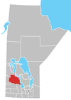
Rural Municipality of Ethelbert
The Rural Municipality of Ethelbert is a former rural municipality (RM) in the Canadian province of Manitoba. It was originally incorporated as a rural municipality on March 1, 1905.[1] It ceased on January 1, 2015 as a result of its provincially mandated amalgamation with the Town of Ethelbert to form the Municipality of Ethelbert.[2]
The westernmost approximately one-quarter of the former RM lay within Duck Mountain Provincial Forest. It was the largest area of the forest that lay within any single rural municipality.
Communities
- Garland
- Mink Creek
References
- ^ "Manitoba's Municipal History: Rural Municipalities and Local Government Districts". The Manitoba Historical Society. September 21, 2014. Retrieved January 2, 2015.
- ^ "Manitoba's Municipal History: Municipal Amalgamations (2015)". The Manitoba Historical Society. December 1, 2014. Retrieved January 2, 2015.
- Manitoba Municipalities: Rural Municipality of Ethelbert
- Map of Ethelbert R.M. at Statcan
- v
- t
- e
Division No. 17, Manitoba (Dauphin Area)
- Dauphin
| Former towns |
|
|---|
| Former villages |
|
|---|
| Former RMs |
|
|---|
- Ebb and Flow
- Keeseekoowenin (Partly)
- Alonsa
- Amaranth
- Ashville
- Bacon Ridge
- Bluff Creek
- Cayer
- East Bay
- Eddystone
- Fork River
- Freedale
- Garland
- Glencairn
- Halicz
- Harcus
- Keld
- Kinosota
- Laurier
- Lonely Lake
- Magnet
- Makinak
- Manitoba House
- Meharry
- Million
- Mink Creek
- Moore Dale
- Moose Bay
- Norgate
- North Junction
- Oak Brae
- Ochre River
- Paulson
- Portia
- Reedy Creek
- Reeve
- Reykjavik
- Rorketon
- Ste. Amélie
- Shergrove
- Sifton
- Silver Ridge
- Toutes Aides
- Trembowla
- Valley River
- Valpoy
- Venlaw
- Volga
- Weiden
- Zoria

 | This Manitoba location article is a stub. You can help Wikipedia by expanding it. |
- v
- t
- e
51°32′11″N 100°29′53″W / 51.53639°N 100.49806°W / 51.53639; -100.49806


