Rohrbach District
District in Upper Austria, Austria
Rohrbach District Bezirk Rohrbach | |
|---|---|
District | |
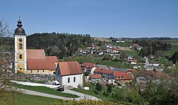 View of Niederwaldkirchen | |
 | |
| Country |  Austria Austria |
| State |  Upper Austria Upper Austria |
| Number of municipalities | 40 |
| Area | |
| • Total | 828.0 km2 (319.7 sq mi) |
| Population (01.01.2021) | |
| • Total | 62,461[1] |
| Time zone | UTC+01:00 (CET) |
| • Summer (DST) | UTC+02:00 (CEST) |
Bezirk Rohrbach is a district in the state of Upper Austria in Austria.
Municipalities
Towns (Städte) are indicated in boldface; market towns (Marktgemeinden) in italics; suburbs, hamlets and other subdivisions of a municipality are indicated in small characters.[2]
- Afiesl
- Ahorn
- Aigen-Schlägl
- Altenfelden
- Arnreit
- Atzesberg
- Auberg
- Haslach an der Mühl
- Helfenberg
- Hofkirchen im Mühlkreis
- Hörbich
- Julbach
- Kirchberg ob der Donau
- Klaffer am Hochficht
- Kleinzell im Mühlkreis
- Kollerschlag
- Lembach im Mühlkreis
- Lichtenau im Mühlkreis
- Nebelberg
- Neufelden
- Neustift im Mühlkreis
- Niederkappel
- Niederwaldkirchen
- Oberkappel
- Oepping
- Peilstein im Mühlviertel
- Pfarrkirchen im Mühlkreis
- Putzleinsdorf
- Rohrbach-Berg
- Sankt Johann am Wimberg
- Sankt Martin im Mühlkreis
- Sankt Oswald bei Haslach
- Sankt Peter am Wimberg
- Sankt Stefan am Walde
- Sankt Ulrich im Mühlkreis
- Sankt Veit im Mühlkreis
- Sarleinsbach
- Schwarzenberg am Böhmerwald
- Ulrichsberg
References
- v
- t
- e
Cities and districts (Bezirke) of Upper Austria- Altheim
- Ansfelden
- Attnang-Puchheim
- Bad Hall
- Bad Ischl
- Bad Leonfelden
- Braunau am Inn
- Eferding
- Enns
- Freistadt
- Gallneukirchen
- Gmunden
- Grein
- Grieskirchen
- Kirchdorf an der Krems
- Laakirchen
- Leonding
- Linz
- Marchtrenk
- Mattighofen
- Perg
- Peuerbach
- Pregarten
- Ried im Innkreis
- Rohrbach-Berg
- Schärding
- Schwanenstadt
- Stadl-Paura
- Steyr
- Steyregg
- Traun
- Vöcklabruck
- Wels

48°32′38″N 13°58′23″E / 48.544°N 13.973°E / 48.544; 13.973
Authority control databases | |
|---|---|
| International |
|
| National |
|


