Qingta Subdistrict
Subdistrict in Beijing, China
Qingta Subdistrict 青塔街道 | |
|---|---|
Subdistrict | |
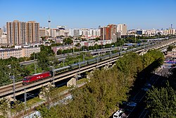 Aerial view of railway north of Qingta, 2021 | |
39°53′32″N 116°15′16″E / 39.89222°N 116.25444°E / 39.89222; 116.25444 | |
| Country | China |
| Municipality | Beijing |
| District | Fengtai |
| Village-level Divisions | 14 communities 2 village |
| Time zone | UTC+8 (China Standard) |
| Postal code | 100141 |
| Area code | 010 |
Qingta Subdistrict (Chinese: 青塔街道; pinyin: Qīngtǎ Jiēdào) is a subdistrict situated in the northern side of Fengtai District, Beijing, China. It shares border with Wanshou Road Subdistrict to the north, Liuliqiao Subdistrict to the east, and Lugouqiao Subdistrict to the south and west.
The subdistrict was established from portions of Lugouqiao and Liuliqiao Subdistricts in 2021.[1]
Administrative divisions
As of 2023, Qingta Subdistrict consists of 16 subdivisions, of which 14 are communities and 2 villages:[2]
| Administrative Division Code | Community Names | Name Transliteration | Type |
|---|---|---|---|
| 110106025001 | 岳各庄 | Yuegezhuang | Community |
| 110106025002 | 青塔东里 | Qingta Dongli | |
| 110106025003 | 青塔西里 | Qingta Xili | |
| 110106025004 | 蔚园 | Weiyuan | |
| 110106025005 | 秀园 | Xiuyuan | |
| 110106025006 | 芳园 | Fangyuan | |
| 110106025007 | 春园 | Chunyuan | |
| 110106025008 | 长安新城第一 | Chang'an Xincheng Diyi | |
| 110106025009 | 民岳家园 | Minyue Jiayuan | |
| 110106025010 | 长安新城第二 | Chang'an Xincheng Di'er | |
| 110106025011 | 汇锦苑 | Huijinyuan | |
| 110106025012 | 珠江紫台 | Zhujiang Zitai | |
| 110106025013 | 阅园 | Yueyuan | |
| 110106025014 | 西府景园 | Xifujingyuan | |
| 110106025200 | 郑常庄 | Zhengchang | Village |
| 110106025201 | 岳各庄 | Yuegezhuang |
Gallery
-
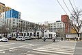
 Xiaotun Road, which makes up the western border of Qingta, 2010
 -
 Nanshawo Bridge, 2019
 -


See also
References
 | This Beijing location article is a stub. You can help Wikipedia by expanding it. |
- v
- t
- e


