Nueva Concepción
You can help expand this article with text translated from the corresponding article in Spanish. (June 2023) Click [show] for important translation instructions.
- Machine translation, like DeepL or Google Translate, is a useful starting point for translations, but translators must revise errors as necessary and confirm that the translation is accurate, rather than simply copy-pasting machine-translated text into the English Wikipedia.
- Do not translate text that appears unreliable or low-quality. If possible, verify the text with references provided in the foreign-language article.
- You must provide copyright attribution in the edit summary accompanying your translation by providing an interlanguage link to the source of your translation. A model attribution edit summary is
Content in this edit is translated from the existing Spanish Wikipedia article at [[:es:Nueva Concepción]]; see its history for attribution. - You may also add the template
{{Translated|es|Nueva Concepción}}to the talk page. - For more guidance, see Wikipedia:Translation.
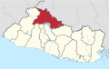
Municipality in Chalatenango Department, El Salvador
14°8′N 89°18′W / 14.133°N 89.300°W / 14.133; -89.300 El Salvador
 (2020)
Nueva Concepción is a municipality in the Chalatenango department of El Salvador.
Geography
The city of Nueva Concepción is located in the department of Chalatenango in the North region of the country. In Nueva Concepción notable rivers are the Rio Lempa, Rio Jayuca, Rio Moja Flores, Rio San Nicolás and other rivers. Nueva Concepción is also known for its water park, "Splash".
The main way to get to Nueva Concepción (coming from San Salvador) is the northern troncal del norte (CA4) road going towards Chalatenango and then the CA3 W.
Climate
| Climate data for Nueva Concepción (1991–2020) | |||||||||||||
|---|---|---|---|---|---|---|---|---|---|---|---|---|---|
| Month | Jan | Feb | Mar | Apr | May | Jun | Jul | Aug | Sep | Oct | Nov | Dec | Year |
| Mean daily maximum °C (°F) | 34.4 (93.9) | 35.9 (96.6) | 37.1 (98.8) | 37.4 (99.3) | 34.9 (94.8) | 33.2 (91.8) | 33.7 (92.7) | 33.6 (92.5) | 32.7 (90.9) | 32.6 (90.7) | 33.1 (91.6) | 33.8 (92.8) | 34.4 (93.9) |
| Daily mean °C (°F) | 25.7 (78.3) | 27.0 (80.6) | 28.1 (82.6) | 28.8 (83.8) | 27.7 (81.9) | 26.4 (79.5) | 26.2 (79.2) | 26.0 (78.8) | 25.7 (78.3) | 25.6 (78.1) | 25.4 (77.7) | 25.3 (77.5) | 26.5 (79.7) |
| Mean daily minimum °C (°F) | 18.5 (65.3) | 19.6 (67.3) | 21.0 (69.8) | 22.6 (72.7) | 22.8 (73.0) | 22.3 (72.1) | 21.4 (70.5) | 21.6 (70.9) | 21.9 (71.4) | 21.3 (70.3) | 19.6 (67.3) | 18.3 (64.9) | 20.9 (69.6) |
| Average precipitation mm (inches) | 1.9 (0.07) | 4.3 (0.17) | 15.0 (0.59) | 58.9 (2.32) | 195.3 (7.69) | 306.0 (12.05) | 259.2 (10.20) | 296.2 (11.66) | 315.8 (12.43) | 199.0 (7.83) | 49.8 (1.96) | 7.8 (0.31) | 1,709.1 (67.29) |
| Average relative humidity (%) | 60 | 58 | 57 | 61 | 72 | 81 | 79 | 81 | 83 | 80 | 71 | 65 | 70.7 |
| Source: Ministerio de Medio Ambiente y Recursos Naturales[1] | |||||||||||||
Population
As of June 2020, the population to Nueva Concepción is at least 32,000 people. Men represent nearly 54% of the population whereas women make up the remaining 46%. Roughly two thirds of the residents live in rural area whereas one third reside in urban area.[2]
References
- ^ "Normales Climatológicas 1991-2020" (in Spanish). Ministerio de Medio Ambiente y Recursos Naturales. Archived from the original on May 13, 2024. Retrieved May 13, 2024.
- ^ "Nueva Concepción (Municipality, El Salvador) - Population Statistics, Charts, Map and Location". www.citypopulation.de. Retrieved 2021-02-22.
- v
- t
- e
 Chalatenango Department
Capital: Chalatenango
- Agua Caliente
- Arcatao
- Azacualpa
- Chalatenango
- Citalá
- Comalapa
- Concepción Quezaltepeque
- Dulce Nombre de María
- El Carrizal
- El Paraíso
- La Laguna
- La Palma
- La Reina
- Las Flores
- Las Vueltas
- Nombre de Jesús
- Nueva Concepción
- Nueva Trinidad
- Ojos de Agua
- Potonico
- San Antonio de la Cruz
- San Antonio Los Ranchos
- San Fernando
- San Francisco Lempa
- San Francisco Morazán
- San Ignacio
- San Isidro Labrador
- San José Cancasque
- San Luis del Carmen
- San Miguel de Mercedes
- San Rafael
- Santa Rita
- Tejutla
- Cayahuanca Stone
- Cerrón Grande Dam
- Estadio José Gregorio Martínez
- St. John the Baptist Cathedral
Authority control databases | |
|---|---|
| International |
|
| National |
|
 | This El Salvador location article is a stub. You can help Wikipedia by expanding it. |
- v
- t
- e


