Nga Sơn district
You can help expand this article with text translated from the corresponding article in Vietnamese. (March 2009) Click [show] for important translation instructions.
- View a machine-translated version of the Vietnamese article.
- Machine translation, like DeepL or Google Translate, is a useful starting point for translations, but translators must revise errors as necessary and confirm that the translation is accurate, rather than simply copy-pasting machine-translated text into the English Wikipedia.
- Do not translate text that appears unreliable or low-quality. If possible, verify the text with references provided in the foreign-language article.
- You must provide copyright attribution in the edit summary accompanying your translation by providing an interlanguage link to the source of your translation. A model attribution edit summary is
Content in this edit is translated from the existing Vietnamese Wikipedia article at [[:vi:Nga Sơn]]; see its history for attribution. - You may also add the template
{{Translated|vi|Nga Sơn}}to the talk page. - For more guidance, see Wikipedia:Translation.
District in North Central Coast, Vietnam
Nga Sơn district Huyện Nga Sơn | |
|---|---|
| 19°59′N 105°58′E / 19.983°N 105.967°E / 19.983; 105.967 | |
| Country |  Vietnam Vietnam |
| Region | North Central Coast |
| Province | Thanh Hóa |
| Capital | Nga Sơn |
| Area | |
| • Total | 58 sq mi (151 km2) |
| Population (2018) | |
| • Total | 155,200 |
| Time zone | UTC+7 (UTC + 7) |
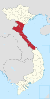
Nga Sơn is a district (huyện) of Thanh Hóa province in the North Central Coast region of Vietnam. The district capital is Nga Sơn.[1]
The district features many historical vestiges. These include Từ Thức grotto, Tien Pagoda (Chùa Tiên), and legends referring to Mai An Tiêm who, the story goes, was exiled to the then uninhabited islands, now known as Nga Son and Thanh Hoa.
Nga Sơn villagers were known for planting sedge -a grass-like plant with triangular stems, and weaving mats.
Demographics
In 2018, the population of Nga Sơn was estimated to be about 155,200.[1]
Geography
The district is located northeast of the Thanh Hóa province. It is approximately 42 kilometers (26 mi) from Thanh Hóa. The district shares a border to the north and east with the Ninh Bình province, to the west with the Hà Trung district, and to the south with the Hậu Lộc district.
The district terrain consists mainly of plains and includes the Len River, which flows through the southern district of Nga Sơn.
With a coastline about 20 kilometers (12 mi) long, Nga Sơn annually encroaches into the sea some 80–100 kilometers (50–62 mi) per year due to alluvium deposits from the Red and Day Rivers.
Economy
Nga Son hosts multiple district schools.[citation needed]
Climate
| Province | District | Jan | Feb | Mar | Apr | May | Jun | Jul | Aug | Sep | Oct | Nov | Dec | Year |
|---|---|---|---|---|---|---|---|---|---|---|---|---|---|---|
| Thanh Hóa | Nga Sơn | 22°/16° | 25°/20° | 25°/20° | 30°/24° | 31°/25° | 34°/26° | 32°/26° | 31°/25° | 31°/25° | 29°/23° | 27°/20° | 22°/18° | 28°/22° |
[2]
Things to Do
References
- ^ a b "Districts of Vietnam". Statoids. Retrieved March 19, 2009.
- ^ "weather".
- v
- t
- e
- Đồng Hới city※
- Ba Đồn town
- Bố Trạch
- Lệ Thủy
- Minh Hóa
- Quảng Ninh
- Quảng Trạch
- Tuyên Hóa
- Huế city※
- Hương Thủy town
- Hương Trà town
- A Lưới
- Nam Đông
- Phong Điền
- Phú Lộc
- Phú Vang
- Quảng Điền
※ denotes provincial seat.
 | This article about a location in Thanh Hóa Province, Vietnam is a stub. You can help Wikipedia by expanding it. |
- v
- t
- e


