Nevado de Santa Isabel
Shield volcano in Tolima, Colombia


Nevado de Santa Isabel
Location of Nevado de Santa Isabel in Colombia
 Colombia
Andean Volcanic Belt
Nevado de Santa Isabel (English: "The Snowy of Saint Isabel") is a shield volcano straddling the boundaries of the Colombian departments of Tolima, Caldas, and Risaralda, being the highest point of the latter. The volcano lies approximately 10 kilometers southwest of the larger Nevado del Ruiz volcano. Santa Isabel is the third highest peak in Los Nevados National Natural Park. It is a relatively flat volcano with three domes of nearly equal elevation.
Geology
The volcano is located over the Palestina Fault, that crosscuts the underlying El Bosque Batholith of Eocene age, dated at 49.1 ± 1.7 Ma.[2][3]
Gallery
-
 Panorama of Nevado del Ruiz (left), Nevado de Santa Isabel (centre) and Paramillo de Santa Rosa (right)
 -
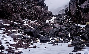 Basalt blocks of Santa Isabel volcano
 -
 Aerial view of the summit of Nevado de Santa Isabel


See also
References
Wikimedia Commons has media related to Nevado de Santa Isabel.
- ^ a b "Santa Isabel". Global Volcanism Program. Smithsonian Institution. Retrieved 2021-03-09.
- ^ Plancha 225, 1998
- ^ González, 2001, p. 50
Bibliography
- González, Humberto (2001). Geología de las planchas 206 Manizales y 225 Nevado del Ruiz - 1:100,000 - Memoria explicativa (PDF) (Report). INGEOMINAS. pp. 1–93. Retrieved 2017-06-09.[dead link]
- Mosquera, Darío; Martín, Pedro; Vesga, Carlos; González, Humberto (1998). Plancha 225 - Nevado del Ruiz - 1:100,000 (Map). INGEOMINAS. p. 1. Retrieved 2017-06-06.
- v
- t
- e


- Alto Mellizos
- Las Ánimas
- Bordoncillo
- Cerro Bravo
- Cerro Machín
- Doña Juana
- El Escondido
- Galeras
- Morasurco
- Nevado El Cisne
- Nevado del Huila
- Nevado del Quindío
- Nevado del Ruiz
- Nevado de Santa Isabel
- Nevado del Tolima
- Patascoy
- Petacas
- Puracé
- Romeral
- San Diego
- Sotará
- • "Observatorios Vulcanológicos". Servicio Geológico de Colombia.
 Category • Images
Authority control databases | |
|---|---|
| International |
|
| Geographic |
|
 | This Colombian location article is a stub. You can help Wikipedia by expanding it. |
- v
- t
- e


