National Register of Historic Places listings in Coconino County, Arizona

This is a list of the National Register of Historic Places listings in Coconino County, Arizona.
It is intended to be a complete list of the properties and districts on the National Register of Historic Places in Coconino County, Arizona, United States. The locations of National Register properties and districts for which the latitude and longitude coordinates are included below, may be seen in a map.[1]
There are 155 properties and districts listed on the National Register in the county, including 11 that are also National Historic Landmarks. There are also two former listings.
This National Park Service list is complete through NPS recent listings posted August 30, 2024.[2]
Map all coordinates using OpenStreetMap
Download coordinates as:
- KML
- GPX (all coordinates)
- GPX (primary coordinates)
- GPX (secondary coordinates)
Current listings
| [3] | Name on the Register | Image | Date listed[4] | Location | City or town | Description |
|---|---|---|---|---|---|---|
| 1 | 1956 Grand Canyon TWA – United Airlines Aviation Accident Site |  | April 22, 2014 (#14000280) | Near the confluence of the Colorado River and Little Colorado River 36°10′30″N 111°50′00″W / 36.175°N 111.833333°W / 36.175; -111.833333 (1956 Grand Canyon TWA – United Airlines Aviation Accident Site) | Grand Canyon National Park | |
| 2 | Abandoned Route 66, Ash Fork Hill | Upload image | May 19, 1989 (#89000380) | North of Interstate 40 between Ash Fork and Williams 35°13′10″N 112°21′39″W / 35.219444°N 112.360833°W / 35.219444; -112.360833 (Abandoned Route 66, Ash Fork Hill) | Ash Fork | |
| 3 | Abandoned Route 66, Parks (1921) |  | May 19, 1989 (#89000377) | West of Parks, several feet north of current road alignment 35°15′36″N 111°57′19″W / 35.26°N 111.955278°W / 35.26; -111.955278 (Abandoned Route 66, Parks (1921)) | Parks | |
| 4 | Abandoned Route 66, Parks (1931) |  | May 19, 1989 (#89000378) | East of Parks, following straight course through woods north of current, curved/bypass alignment 35°15′35″N 111°56′43″W / 35.259722°N 111.945278°W / 35.259722; -111.945278 (Abandoned Route 66, Parks (1931)) | Parks | |
| 5 | Horace M. Albright Training Center |  | September 13, 2013 (#13000784) | Albright Ave. & Center Rd. 35°58′41″N 111°59′26″W / 35.978006°N 111.990509°W / 35.978006; -111.990509 (Horace M. Albright Training Center) | Grand Canyon National Park | |
| 6 | Anderson Mesa Incline | Upload image | February 24, 1995 (#95000154) | Address Restricted | Flagstaff | |
| 7 | Archeological Site No. AR-03-04-03-810 | Upload image | February 24, 1995 (#95000149) | Address Restricted | Flagstaff | |
| 8 | Archeological Site No. AR-03-04-03-811 | Upload image | February 24, 1995 (#95000150) | Address Restricted | Flagstaff | |
| 9 | Archeological Site No. AR-03-04-03-812 | Upload image | February 24, 1995 (#95000151) | Address Restricted | Flagstaff | |
| 10 | Archeological Site No. AR-03-04-05-414 | Upload image | February 24, 1995 (#95000152) | Address Restricted | Flagstaff | |
| 11 | Archeological Site. No. AR-03-04-05-440 | Upload image | February 24, 1995 (#95000153) | Address Restricted | Flagstaff | |
| 12 | Arizona Lumber and Timber Company Office | 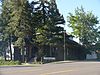 | April 30, 1986 (#86000900) | 1 Riordan Rd. 35°11′29″N 111°40′00″W / 35.191389°N 111.666667°W / 35.191389; -111.666667 (Arizona Lumber and Timber Company Office) | Flagstaff | |
| 13 | Ash Fork Steel Dam |  | July 30, 1976 (#76000373) | East of Ash Fork off Old U.S. Route 66 35°13′31″N 112°24′54″W / 35.225278°N 112.415°W / 35.225278; -112.415 (Ash Fork Steel Dam) | Ash Fork | |
| 14 | Ashurst House |  | November 29, 1984 (#84000529) | 417-421 W. Aspen Ave. 35°11′59″N 111°39′12″W / 35.199722°N 111.653333°W / 35.199722; -111.653333 (Ashurst House) | Flagstaff | |
| 15 | Bank Hotel |  | December 7, 1977 (#77000232) | Route 66 and Leroux St. 35°11′52″N 111°38′57″W / 35.19773°N 111.64924°W / 35.19773; -111.64924 (Bank Hotel) | Flagstaff | Also known as McMillan Building[5] |
| 16 | Barney Flat Historic Railroad Logging Landscape |  | February 24, 1995 (#95000155) | Perkinsville Rd., south of Williams in the Kaibab National Forest 35°09′26″N 112°08′52″W / 35.157222°N 112.147778°W / 35.157222; -112.147778 (Barney Flat Historic Railroad Logging Landscape) | Williams | Only stump field in the NRHP |
| 17 | Big Springs Lookout Tower |  | January 28, 1988 (#87002478) | Kaibab National Forest 36°35′36″N 112°20′03″W / 36.593333°N 112.334167°W / 36.593333; -112.334167 (Big Springs Lookout Tower) | Big Springs | |
| 18 | Big Springs Ranger Station | 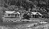 | June 10, 1993 (#93000519) | Along Ryan Rd. in the Kaibab National Forest 36°36′12″N 112°20′59″W / 36.603333°N 112.349722°W / 36.603333; -112.349722 (Big Springs Ranger Station) | Big Springs | |
| 19 | Brannen-Devine House |  | April 30, 1986 (#86000912) | 209 E. Cottage 35°11′41″N 111°38′51″W / 35.19462°N 111.64744°W / 35.19462; -111.64744 (Brannen-Devine House) | Flagstaff | |
| 20 | Brow Monument |  | July 13, 1987 (#87001159) | N. Kaibab Ranger District in the Kaibab National Forest 36°35′27″N 112°23′54″W / 36.590833°N 112.398333°W / 36.590833; -112.398333 (Brow Monument) | Big Springs | |
| 21 | Buck Mountain Lookout Tower | Upload image | January 28, 1988 (#87002460) | Coconino National Forest 34°40′01″N 111°24′53″W / 34.666944°N 111.414722°W / 34.666944; -111.414722 (Buck Mountain Lookout Tower) | Buck Mountain | |
| 22 | Bullethead | Upload image | November 21, 1992 (#92001544) | Address Restricted | Fredonia | |
| 23 | C&M Garage | 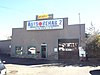 | April 30, 1986 (#86000908) | 204 S. Mikes Pike St. 35°11′44″N 111°39′15″W / 35.195554°N 111.654186°W / 35.195554; -111.654186 (C&M Garage) | Flagstaff | |
| 24 | Cameron Suspension Bridge |  | June 5, 1986 (#86001206) | Carries U.S. Route 89 over the Little Colorado River 35°52′38″N 111°24′40″W / 35.877222°N 111.411111°W / 35.877222; -111.411111 (Cameron Suspension Bridge) | Cameron | |
| 25 | Camp Clover Ranger Station |  | July 16, 1993 (#93000520) | Off U.S. Route 89 southwest of Williams in the Kaibab National Forest 35°14′13″N 112°13′08″W / 35.236944°N 112.218889°W / 35.236944; -112.218889 (Camp Clover Ranger Station) | Williams | |
| 26 | H.E. Campbell House |  | April 30, 1986 (#86000910) | 215 N. Leroux[6] 35°12′00″N 111°38′54″W / 35.20004°N 111.64833°W / 35.20004; -111.64833 (H.E. Campbell House) | Flagstaff | |
| 27 | Canyon Diablo Bridge |  | September 30, 1988 (#88001664) | Abandoned grade of Old U.S. Route 66 over Diablo Canyon at Two Guns 35°06′56″N 111°05′41″W / 35.115556°N 111.094722°W / 35.115556; -111.094722 (Canyon Diablo Bridge) | Two Guns | |
| 28 | Canyon Padre Bridge |  | September 30, 1988 (#88001666) | Abandoned grade of Old U.S. Route 66 over Padre Canyon 35°09′44″N 111°17′12″W / 35.162222°N 111.286667°W / 35.162222; -111.286667 (Canyon Padre Bridge) | Flagstaff | |
| 29 | Chapel of the Holy Cross |  | October 6, 2011 (#10000947) | 780 Chapel Rd. 34°49′55″N 111°46′00″W / 34.831944°N 111.766667°W / 34.831944; -111.766667 (Chapel of the Holy Cross) | Sedona | |
| 30 | Charles H. Spencer Hulk |  | October 15, 1989 (#89001593) | Address Restricted | Lee's Ferry | |
| 31 | Checkered Men | Upload image | November 21, 1992 (#92001546) | Address Restricted | Fredonia | |
| 32 | J.M. Clark House |  | December 5, 1984 (#84000446) | 503 N. Humphreys St. 35°12′11″N 111°38′58″W / 35.20311°N 111.64932°W / 35.20311; -111.64932 (J.M. Clark House) | Flagstaff | |
| 33 | Cliffs Ranger Station |  | March 31, 1975 (#75000220) | 2 miles (3.2 km) east of Flagstaff in Walnut Canyon National Monument 35°10′30″N 111°31′02″W / 35.175°N 111.517222°W / 35.175; -111.517222 (Cliffs Ranger Station) | Flagstaff | Renamed and boundary increased, August 28, 2019 |
| 34 | Coconino County Hospital Complex |  | April 30, 1986 (#86000905) | Ft. Valley Rd. 35°13′30″N 111°39′17″W / 35.225°N 111.654722°W / 35.225; -111.654722 (Coconino County Hospital Complex) | Flagstaff | Now the Pioneer Museum |
| 35 | Cooper Ridge Lookout Tree | Upload image | January 13, 1992 (#91001962) | North of the junction of Alternate U.S. Route 89 and State Route 67 in the Kaibab National Forest 36°44′48″N 112°13′05″W / 36.746667°N 112.218056°W / 36.746667; -112.218056 (Cooper Ridge Lookout Tree) | Fredonia | |
| 36 | Corral Lake Lookout Tree | Upload image | January 13, 1992 (#91001954) | Roughly 30 miles (48 km) southeast of Fredonia in the Kaibab National Forest 36°36′18″N 112°15′58″W / 36.605°N 112.266111°W / 36.605; -112.266111 (Corral Lake Lookout Tree) | Fredonia | |
| 37 | Coyote Range | Upload image | May 14, 1984 (#84000641) | North of Flagstaff on U.S. Route 180 35°13′52″N 111°39′20″W / 35.231111°N 111.655556°W / 35.231111; -111.655556 (Coyote Range) | Flagstaff | Perhaps better known as Colton House. Former home of Mary-Russell Ferrell Colton, part of the Museum of Northern Arizona |
| 38 | Dead Indian Canyon Bridge |  | September 30, 1988 (#88001603) | Abandoned grade of US 64 [sic; actually State Route 64] over Dead Indian Canyon 35°55′58″N 111°38′29″W / 35.93266°N 111.64136°W / 35.93266; -111.64136 (Dead Indian Canyon Bridge) | Desert View | Longest and last Warren truss bridge built in Arizona, in 1933, as part of opening the south rim of the Grand Canyon to the public. |
| 39 | DelSue Motor Inn |  | May 4, 1998 (#98000356) | 234 E. Old U.S. Route 66 35°15′03″N 112°11′03″W / 35.250833°N 112.184167°W / 35.250833; -112.184167 (DelSue Motor Inn) | Williams | Now the "Grand Motel" |
| 40 | Desert View Watchtower Historic District |  | January 3, 1995 (#94001503) | East Rim Drive, about 17 miles (27 km) east of Grand Canyon Village, Desert View 36°02′42″N 111°49′34″W / 36.045°N 111.826111°W / 36.045; -111.826111 (Desert View Watchtower Historic District) | Grand Canyon National Park | |
| 41 | Dry Park Lookout Cabin and Storage Sheds |  | January 28, 1988 (#87002479) | Kaibab National Forest 36°27′09″N 112°14′15″W / 36.4525°N 112.2375°W / 36.4525; -112.2375 (Dry Park Lookout Cabin and Storage Sheds) | Big Springs | |
| 42 | El Tovar Hotel |  | September 6, 1974 (#74000334) | Grand Canyon National Park, Route 8A 36°03′27″N 112°08′13″W / 36.0575°N 112.136944°W / 36.0575; -112.136944 (El Tovar Hotel) | Grand Canyon National Park | |
| 43 | El Tovar Stables |  | September 6, 1974 (#74000336) | Off Grand Canyon National Park Route 8A 36°03′20″N 112°08′28″W / 36.055556°N 112.141111°W / 36.055556; -112.141111 (El Tovar Stables) | Grand Canyon National Park | |
| 44 | Elden Pueblo |  | October 24, 1986 (#86002853) | U.S. Route 89, north of Flagstaff[7] 35°14′33″N 111°34′05″W / 35.242500°N 111.568056°W / 35.242500; -111.568056 (Elden Pueblo) | Flagstaff | |
| 45 | Dean Eldredge Museum |  | May 3, 1994 (#94000396) | 3404 E. Route 66 35°12′51″N 111°35′56″W / 35.214167°N 111.598889°W / 35.214167; -111.598889 (Dean Eldredge Museum) | Flagstaff | Now the Museum Club, a roadhouse and dance club |
| 46 | Fern Mountain Ranch |  | March 29, 1978 (#78000542) | North of Flagstaff 35°21′08″N 111°44′09″W / 35.352222°N 111.735833°W / 35.352222; -111.735833 (Fern Mountain Ranch) | Flagstaff | |
| 47 | First Baptist Church | 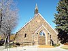 | December 23, 1991 (#91001576) | 123 S. Beaver St. 35°11′43″N 111°39′06″W / 35.19533°N 111.65154°W / 35.19533; -111.65154 (First Baptist Church) | Flagstaff | |
| 48 | First Methodist Episcopal Church and Parsonage |  | November 29, 1984 (#84000403) | 127 W. Sherman St. 35°19′47″N 112°11′17″W / 35.329722°N 112.188056°W / 35.329722; -112.188056 (First Methodist Episcopal Church and Parsonage) | Williams | |
| 49 | Flagstaff Armory |  | April 30, 1986 (#86000903) | 503 W. Clay Ave.[8] 35°11′44″N 111°39′23″W / 35.19546°N 111.65644°W / 35.19546; -111.65644 (Flagstaff Armory) | Flagstaff | Now the site of a Natural Grocers store |
| 50 | Flagstaff Southside Historic District | 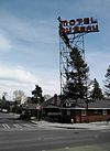 | March 31, 2010 (#10000107) | South of downtown bordered by Route 66 and Santa Fe Railroad, Rio de Flag, and Northern Arizona University 35°11′40″N 111°38′58″W / 35.1945°N 111.6494°W / 35.1945; -111.6494 (Flagstaff Southside Historic District) | Flagstaff | |
| 51 | Flagstaff Townsite Historic Residential District |  | April 30, 1986 (#86000897) | Roughly bounded by Cherry, Humphreys and Sitgreaves Sts., Railroad Ave., and Toltec and Aztec Sts. 35°12′04″N 111°39′13″W / 35.201111°N 111.653611°W / 35.201111; -111.653611 (Flagstaff Townsite Historic Residential District) | Flagstaff | |
| 52 | Fort Tuthill Historic District | Upload image | April 6, 2004 (#04000257) | State Route 89A and Interstate 17 35°08′31″N 111°41′25″W / 35.141944°N 111.690278°W / 35.141944; -111.690278 (Fort Tuthill Historic District) | Flagstaff | |
| 53 | Fracas Lookout Tree | Upload image | January 13, 1992 (#91001955) | Roughly 30 miles (48 km) southeast of Fredonia in the Kaibab National Forest 36°39′39″N 112°16′16″W / 36.660833°N 112.271111°W / 36.660833; -112.271111 (Fracas Lookout Tree) | Fredonia | |
| 54 | D.M. Francis House | Upload image | April 30, 1986 (#86000902) | 1456 Meade Ln. 35°13′06″N 111°39′32″W / 35.218333°N 111.658889°W / 35.218333; -111.658889 (D.M. Francis House) | Flagstaff | |
| 55 | Grand Canyon Airport Historic District |  | August 28, 2007 (#07000278) | Approximately 2.6 miles (4.2 km) east of the junction of State Route 64 and Forest Rd. 305 35°50′54″N 112°05′24″W / 35.848236°N 112.090038°W / 35.848236; -112.090038 (Grand Canyon Airport Historic District) | Tusayan | |
| 56 | Grand Canyon Inn and Campground |  | September 2, 1982 (#82001872) | North Rim 36°12′34″N 112°03′35″W / 36.209444°N 112.059722°W / 36.209444; -112.059722 (Grand Canyon Inn and Campground) | Grand Canyon National Park | |
| 57 | Grand Canyon Lodge |  | September 2, 1982 (#82001721) | North Rim on Bright Angel Point 36°11′57″N 112°03′07″W / 36.199167°N 112.051944°W / 36.199167; -112.051944 (Grand Canyon Lodge) | Grand Canyon National Park | |
| 58 | Grand Canyon North Rim Headquarters | 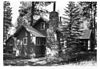 | September 2, 1982 (#82001722) | North Rim 36°12′53″N 112°03′42″W / 36.214722°N 112.061667°W / 36.214722; -112.061667 (Grand Canyon North Rim Headquarters) | Grand Canyon National Park | |
| 59 | Grand Canyon Park Operations Building |  | May 28, 1987 (#87001412) | Off West Rim Dr. 36°03′18″N 112°08′13″W / 36.055°N 112.136944°W / 36.055; -112.136944 (Grand Canyon Park Operations Building) | Grand Canyon National Park | |
| 60 | Grand Canyon Power House |  | May 28, 1987 (#87001411) | Off West Rim Dr. 36°03′31″N 112°08′26″W / 36.05854°N 112.14065°W / 36.05854; -112.14065 (Grand Canyon Power House) | Grand Canyon National Park | |
| 61 | Grand Canyon Railroad Station |  | September 6, 1974 (#74000337) | Grand Canyon National Park Route 8A 36°03′22″N 112°08′11″W / 36.056111°N 112.136389°W / 36.056111; -112.136389 (Grand Canyon Railroad Station) | Grand Canyon National Park | |
| 62 | Grand Canyon Railway |  | August 23, 2000 (#00000319) | From Williams to Grand Canyon National Park 35°35′59″N 112°12′44″W / 35.599722°N 112.212222°W / 35.599722; -112.212222 (Grand Canyon Railway) | Williams | |
| 63 | Grand Canyon Village Historic District |  | November 20, 1975 (#75000343) | State Route 64 36°03′22″N 112°08′21″W / 36.056111°N 112.139167°W / 36.056111; -112.139167 (Grand Canyon Village Historic District) | Grand Canyon National Park | |
| 64 | Grandview Lookout Tower and Cabin |  | January 28, 1988 (#87002482) | Off Coconino Rim Rd. 35°57′28″N 111°57′15″W / 35.957778°N 111.954167°W / 35.957778; -111.954167 (Grandview Lookout Tower and Cabin) | Twin Lakes | |
| 65 | Grandview Lookout Tree | Upload image | January 13, 1992 (#91001945) | South of Grandview Point, Grand Canyon National Park, in the Kaibab National Forest 35°55′58″N 111°58′44″W / 35.932778°N 111.978889°W / 35.932778; -111.978889 (Grandview Lookout Tree) | Grand Canyon National Park | |
| 66 | Grandview Mine |  | July 9, 1974 (#74000347) | Grand Canyon National Park 36°01′05″N 111°58′32″W / 36.018056°N 111.975556°W / 36.018056; -111.975556 (Grandview Mine) | Grand Canyon National Park | |
| 67 | Hart Store | 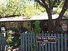 | October 25, 2007 (#07001099) | 100 Brewer Rd. 34°51′52″N 111°45′55″W / 34.86455°N 111.76518°W / 34.86455; -111.76518 (Hart Store) | Sedona | |
| 68 | Head Hunters | Upload image | November 21, 1992 (#92001548) | Address Restricted | Fredonia | |
| 69 | Hermits Rest Concession Building |  | August 7, 1974 (#74000335) | Grand Canyon National Park 36°03′40″N 112°12′40″W / 36.061111°N 112.211111°W / 36.061111; -112.211111 (Hermits Rest Concession Building) | Grand Canyon National Park | |
| 70 | The Homestead |  | May 27, 1975 (#75000341) | 3 miles (4.8 km) north of Flagstaff on U.S. Route 180 35°14′05″N 111°39′48″W / 35.234722°N 111.663333°W / 35.234722; -111.663333 (The Homestead) | Flagstaff | Oldest home in Flagstaff, home of Thomas McMillan. Part of the Museum of Northern Arizona |
| 71 | House at 310 South Beaver |  | April 30, 1986 (#86000913) | 310 S. Beaver 35°11′37″N 111°39′03″W / 35.193611°N 111.650833°W / 35.193611; -111.650833 (House at 310 South Beaver) | Flagstaff | |
| 72 | House at 720 Grand Canyon Avenue | Upload image | April 30, 1986 (#86000909) | 720 Grand Canyon Ave. 35°11′58″N 111°39′26″W / 35.199444°N 111.657222°W / 35.199444; -111.657222 (House at 720 Grand Canyon Avenue) | Flagstaff | |
| 73 | Hull Cabin Historic District |  | October 23, 1985 (#85003370) | 1.5 miles (2.4 km) south of Grand Canyon South Rim in the Kaibab National Forest 35°58′05″N 111°56′46″W / 35.96803°N 111.94618°W / 35.96803; -111.94618 (Hull Cabin Historic District) | Grand Canyon National Park | |
| 74 | Hull Tank Lookout Tree |  | January 13, 1992 (#91001947) | Southeast of Grandview Point, Grand Canyon National Park, in the Kaibab National Forest 35°56′25″N 111°57′28″W / 35.940278°N 111.957778°W / 35.940278; -111.957778 (Hull Tank Lookout Tree) | Grand Canyon National Park | |
| 75 | The Ice House |  | April 8, 2009 (#09000174) | 201 East Birch Avenue 35°11′54″N 111°38′44″W / 35.19828°N 111.64568°W / 35.19828; -111.64568 (The Ice House) | Flagstaff | |
| 76 | Jacob Lake Lookout Tower |  | January 28, 1988 (#87002477) | Grand Canyon Highway 36°41′59″N 112°12′47″W / 36.699722°N 112.213056°W / 36.699722; -112.213056 (Jacob Lake Lookout Tower) | Jacob Lake | |
| 77 | Jacob Lake Ranger Station |  | July 13, 1987 (#87001151) | N. Kaibab Ranger District off State Route 67 in the Kaibab National Forest 36°42′23″N 112°13′43″W / 36.70649°N 112.22848°W / 36.70649; -112.22848 (Jacob Lake Ranger Station) | Jacob Lake | Historic cabin and barn |
| 78 | Jordan Ranch |  | January 28, 2004 (#03001489) | 735 Jordan Rd. 34°52′42″N 111°45′40″W / 34.878333°N 111.761111°W / 34.878333; -111.761111 (Jordan Ranch) | Sedona | Jordan Farmhouse |
| 79 | Kane Ranch Headquarters | Upload image | January 2, 2008 (#07001348) | Approximately 11 miles (18 km) south of U.S. Route 89A on Forest Rd. 8910 36°34′05″N 112°00′14″W / 36.5680°N 112.0038°W / 36.5680; -112.0038 (Kane Ranch Headquarters) | House Rock Valley | |
| 80 | Kendrick Lookout Cabin |  | January 28, 1988 (#87002480) | Kaibab National Forest 35°24′30″N 111°50′46″W / 35.408333°N 111.846111°W / 35.408333; -111.846111 (Kendrick Lookout Cabin) | Pumpkin Center | Built in 1911[9] |
| 81 | I.B. Koch House | Upload image | April 30, 1986 (#86000901) | 7 Riordan Rd. 35°11′27″N 111°39′56″W / 35.190833°N 111.665556°W / 35.190833; -111.665556 (I.B. Koch House) | Flagstaff | |
| 82 | Krenz-Kerley Trading Post | Upload image | August 24, 1998 (#98001040) | 78 N. Main St. 36°07′53″N 111°14′21″W / 36.131389°N 111.239167°W / 36.131389; -111.239167 (Krenz-Kerley Trading Post) | Tuba City | Now the Tuba City Public Library |
| 83 | La Ciudad de Mexico Grocery |  | April 30, 1986 (#86000906) | 217 S. San Francisco 35°11′38″N 111°38′59″W / 35.1939°N 111.64977°W / 35.1939; -111.64977 (La Ciudad de Mexico Grocery) | Flagstaff | |
| 84 | La Iglesia Metodista Mexicana, El Divino Redentor |  | January 30, 1985 (#85000147) | 319 S. San Francisco St. 35°11′34″N 111°39′01″W / 35.19286°N 111.65031°W / 35.19286; -111.65031 (La Iglesia Metodista Mexicana, El Divino Redentor) | Flagstaff | |
| 85 | Laws Spring |  | July 5, 1984 (#84000645) | Kaibab National Forest 35°25′36″N 112°04′07″W / 35.426667°N 112.068611°W / 35.426667; -112.068611 (Laws Spring) | Williams | |
| 86 | Lee Butte Lookout Tower and Cabin | Upload image | January 28, 1988 (#87002461) | Woods Canyon 34°50′04″N 111°32′10″W / 34.834444°N 111.536111°W / 34.834444; -111.536111 (Lee Butte Lookout Tower and Cabin) | Happy Jack | |
| 87 | Lee's Ferry and Lonely Dell Ranch |  | November 4, 1997 (#97001234) | Confluence of Colorado and Paria Rivers, near the Utah-Arizona border 36°51′53″N 111°35′40″W / 36.864722°N 111.594444°W / 36.864722; -111.594444 (Lee's Ferry and Lonely Dell Ranch) | Marble Canyon | |
| 88 | Lees Ferry |  | March 15, 1976 (#76000374) | Southwest of Page at the Colorado River 36°52′02″N 111°34′53″W / 36.867222°N 111.581389°W / 36.867222; -111.581389 (Lees Ferry) | Page | |
| 89 | Little Mountain Lookout Tree | Upload image | January 13, 1992 (#91001950) | Roughly 30 miles (48 km) southeast of Fredonia in the Kaibab National Forest 36°35′22″N 112°21′30″W / 36.589444°N 112.358333°W / 36.589444; -112.358333 (Little Mountain Lookout Tree) | Fredonia | |
| 90 | Lonely Dell Ranch Historic District | 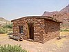 | May 19, 1978 (#78000277) | Southwest of Page in the Glen Canyon National Recreation Area 36°52′15″N 111°35′41″W / 36.870833°N 111.594722°W / 36.870833; -111.594722 (Lonely Dell Ranch Historic District) | Page | |
| 91 | Lowell Observatory |  | October 15, 1966 (#66000172) | 1 mile (1.6 km) west of Flagstaff on Mars Hill 35°12′08″N 111°39′46″W / 35.202222°N 111.662778°W / 35.202222; -111.662778 (Lowell Observatory) | Flagstaff | |
| 92 | Mary Jane Colter Buildings (Hopi House, The Lookout, Hermit's Rest, and the Desert View Watchtower) |  | May 28, 1987 (#87001436) | Several locations along the South Rim 36°03′15″N 112°03′18″W / 36.054167°N 112.055°W / 36.054167; -112.055 (Mary Jane Colter Buildings (Hopi House, The Lookout, Hermit's Rest, and the Desert View Watchtower)) | Grand Canyon National Park | The Hopi House built in 1904 |
| 93 | C. Hart Merriam Base Camp Site |  | October 15, 1966 (#66000173) | 20 miles (32 km) northwest of Flagstaff in the Coconino National Forest 35°22′30″N 111°43′30″W / 35.375°N 111.725°W / 35.375; -111.725 (C. Hart Merriam Base Camp Site) | Flagstaff | |
| 94 | W.W. Midgley Bridge |  | March 31, 1989 (#88001614) | Milepost 375.7 on Alternate U.S. Route 89 over Wilson Canyon 34°53′07″N 111°44′30″W / 34.885278°N 111.741667°W / 34.885278; -111.741667 (W.W. Midgley Bridge) | Sedona | |
| 95 | Milligan House |  | November 29, 1984 (#84000389) | 323 W. Aspen 35°11′59″N 111°39′11″W / 35.19964°N 111.65304°W / 35.19964; -111.65304 (Milligan House) | Flagstaff | |
| 96 | Moqui Lookout Cabin |  | January 28, 1988 (#87002457) | Coconino National Forest 34°33′52″N 111°09′57″W / 34.564444°N 111.165833°W / 34.564444; -111.165833 (Moqui Lookout Cabin) | Blue Ridge | |
| 97 | Moqui Ranger Station |  | June 10, 1993 (#93000521) | Off U.S. Route 180 north of Tusayan in the Kaibab National Forest 35°59′17″N 112°07′13″W / 35.988056°N 112.120278°W / 35.988056; -112.120278 (Moqui Ranger Station) | Tusayan | |
| 98 | Museum of Northern Arizona Exhibition Building |  | April 27, 1993 (#93000305) | 3001 N. Fort Valley Rd. 35°14′04″N 111°39′53″W / 35.234444°N 111.664722°W / 35.234444; -111.664722 (Museum of Northern Arizona Exhibition Building) | Flagstaff | |
| 99 | Navajo National Monument | 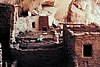 | October 15, 1966 (#66000176) | 30 miles (48 km) southwest of Kayenta 36°41′07″N 110°32′07″W / 36.685278°N 110.535278°W / 36.685278; -110.535278 (Navajo National Monument) | Kayenta | |
| 100 | Navajo Steel Arch Highway Bridge |  | August 13, 1981 (#81000134) | Southwest of Lee 36°49′05″N 111°37′52″W / 36.818056°N 111.631111°W / 36.818056; -111.631111 (Navajo Steel Arch Highway Bridge) | Lee's Ferry | |
| 101 | Negrette House |  | October 8, 2014 (#14000823) | 120 S. 6th St. 35°14′54″N 112°11′33″W / 35.2482°N 112.1926°W / 35.2482; -112.1926 (Negrette House) | Williams | |
| 102 | North End Historic Residential District | Upload image | April 30, 1986 (#86000899) | Roughly bounded by Hunt, San Francisco and Verde, Elm and Cherry, and Beaver and Humphreys Sts. 35°12′06″N 111°39′04″W / 35.201667°N 111.651111°W / 35.201667; -111.651111 (North End Historic Residential District) | Flagstaff | Flagstaff MRA |
| 103 | Northern Arizona Normal School Historic District |  | May 22, 1986 (#86001107) | Northern Arizona University campus, near Route 66 (Milton Rd.) 35°11′35″N 111°39′18″W / 35.193056°N 111.655°W / 35.193056; -111.655 (Northern Arizona Normal School Historic District) | Flagstaff | Old Main and other historic buildings |
| 104 | Nuvakwewtaqa | Upload image | August 2, 1977 (#77000233) | Address Restricted | Winslow | |
| 105 | Buckey O'Neill Cabin |  | October 29, 1975 (#75000227) | Off State Route 64 in Grand Canyon National Park 36°03′26″N 112°08′26″W / 36.057222°N 112.140556°W / 36.057222; -112.140556 (Buckey O'Neill Cabin) | Grand Canyon National Park | |
| 106 | Our Lady of Guadaloupe Church |  | April 30, 1986 (#86000907) | 302 S. Kendrick 35°11′44″N 111°39′10″W / 35.195556°N 111.652778°W / 35.195556; -111.652778 (Our Lady of Guadaloupe Church) | Flagstaff | |
| 107 | Pendley Homestead Historic District |  | December 23, 1991 (#91001857) | State Route 89A, 7 miles (11 km) north of Sedona 34°56′54″N 111°45′10″W / 34.948333°N 111.752778°W / 34.948333; -111.752778 (Pendley Homestead Historic District) | Sedona | Within Slide Rock State Park |
| 108 | Picture Canyon Archaeological Site |  | January 10, 2008 (#07001349) | Address Restricted | Flagstaff | |
| 109 | Presbyterian Church Parsonage |  | April 30, 1986 (#86000911) | 15 E. Cherry 35°12′00″N 111°38′50″W / 35.19995°N 111.64726°W / 35.19995; -111.64726 (Presbyterian Church Parsonage) | Flagstaff | |
| 110 | Prochnow House |  | April 30, 1986 (#86000898) | 304 S. Elden 35°11′32″N 111°38′42″W / 35.192222°N 111.645°W / 35.192222; -111.645 (Prochnow House) | Flagstaff | |
| 111 | Promontory Butte Lookout Complex |  | January 28, 1988 (#87002455) | Rim Rd. in the Apache-Sitgreaves National Forest 34°22′03″N 111°00′43″W / 34.3675°N 111.011944°W / 34.3675; -111.011944 (Promontory Butte Lookout Complex) | Beaver Park | |
| 112 | Pumphouse Wash Bridge |  | September 30, 1988 (#88001605) | Milepost 387.4 on U.S. Route 89 over Pumphouse Wash 35°01′30″N 111°44′06″W / 35.025°N 111.735°W / 35.025; -111.735 (Pumphouse Wash Bridge) | Flagstaff | |
| 113 | Railroad Addition Historic District |  | January 18, 1983 (#83002989) | 15 W. Aspen; also roughly bounded by Santa Fe railroad tracks, Agassiz and Beaver Sts., Birch and Aspen Aves.; also 122 E. Old U.S. Route 66 35°11′52″N 111°38′50″W / 35.197778°N 111.647222°W / 35.197778; -111.647222 (Railroad Addition Historic District) | Flagstaff | Additional addresses represent two boundary increases |
| 114 | Ranger's Dormitory |  | September 5, 1975 (#75000219) | Off State Route 64 in Grand Canyon National Park 36°03′20″N 112°08′11″W / 36.055556°N 112.136389°W / 36.055556; -112.136389 (Ranger's Dormitory) | Grand Canyon National Park | |
| 115 | Ridge Ruin Archeological District | Upload image | April 20, 1992 (#92000339) | Address Restricted | Flagstaff | |
| 116 | Riordan Estate | 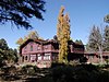 | February 28, 1979 (#79000416) | 2 Kinlichi Knoll 35°11′14″N 111°39′33″W / 35.187222°N 111.659167°W / 35.187222; -111.659167 (Riordan Estate) | Flagstaff | |
| 117 | Rock Family | Upload image | November 21, 1992 (#92001550) | Address Restricted | Fredonia | |
| 118 | Rocketeers | Upload image | November 21, 1992 (#92001547) | Address Restricted | Fredonia | |
| 119 | Rural Route 66, Brannigan Park | Upload image | May 19, 1989 (#89000375) | Forest Rd. 146 east of Parks to Brannigan Park 35°15′46″N 111°53′40″W / 35.262778°N 111.894444°W / 35.262778; -111.894444 (Rural Route 66, Brannigan Park) | Parks | |
| 120 | Rural Route 66, Parks | Upload image | May 19, 1989 (#89000374) | Forest Rd. 146 between Beacon Hill and Parks 35°15′50″N 112°02′45″W / 35.263889°N 112.045833°W / 35.263889; -112.045833 (Rural Route 66, Parks) | Parks | |
| 121 | Rural Route 66, Pine Springs | Upload image | May 19, 1989 (#89000379) | Forest Rd. 108 at Pine Springs Ranch 35°12′55″N 112°16′42″W / 35.215278°N 112.278333°W / 35.215278; -112.278333 (Rural Route 66, Pine Springs) | Williams | |
| 122 | Saginaw & Manistee Camp 2 | Upload image | February 24, 1995 (#95000148) | Address Restricted | Flagstaff | |
| 123 | Sedona Ranger Station |  | August 29, 2008 (#08000810) | Brewer Road, south of Hart Road 34°51′45″N 111°45′57″W / 34.86245°N 111.7657°W / 34.86245; -111.7657 (Sedona Ranger Station) | Sedona | |
| 124 | South Beaver School |  | August 6, 1987 (#87001342) | 506 S. Beaver St. 35°11′30″N 111°39′06″W / 35.191667°N 111.651667°W / 35.191667; -111.651667 (South Beaver School) | Flagstaff | |
| 125 | Sunset Crater-Cinder Lake Apollo Mission Testing and Training Historic District |  | November 8, 2019 (#100004595) | Roughly bounded by Sunset Crater Volcano National Monument and Sunset Crater West Quadrangle 35°22′09″N 111°31′04″W / 35.3691°N 111.5178°W / 35.3691; -111.5178 (Sunset Crater-Cinder Lake Apollo Mission Testing and Training Historic District) | Flagstaff | |
| 126 | Summit Mountain Lookout Tree | Upload image | January 13, 1992 (#91001948) | Off Perkinsville Rd. southeast of Williams in the Kaibab National Forest 35°07′51″N 112°07′56″W / 35.130833°N 112.132222°W / 35.130833; -112.132222 (Summit Mountain Lookout Tree) | Williams | |
| 127 | Superintendent's Residence |  | September 6, 1974 (#74000450) | Off Route 8A in Grand Canyon National Park 36°03′22″N 112°08′05″W / 36.056111°N 112.134722°W / 36.056111; -112.134722 (Superintendent's Residence) | Grand Canyon National Park | |
| 128 | Tater Point Lookout Tree | Upload image | January 13, 1992 (#91001946) | Forest Rd. 240 east of State Route 67 and south of U.S. Route 89A in the Kaibab National Forest 36°32′22″N 112°06′05″W / 36.539444°N 112.101389°W / 36.539444; -112.101389 (Tater Point Lookout Tree) | Fredonia | |
| 129 | Taylor Cabin Line Camp | Upload image | July 16, 1985 (#85001580) | Sycamore Canyon Wilderness Area 34°59′18″N 111°59′19″W / 34.988333°N 111.988611°W / 34.988333; -111.988611 (Taylor Cabin Line Camp) | Sedona | |
| 130 | Telephone Hill Lookout Tree | Upload image | January 13, 1992 (#91001952) | Off State Route 67 south of its junction with U.S. Route 89A in the Kaibab National Forest 36°32′50″N 112°10′33″W / 36.547222°N 112.175833°W / 36.547222; -112.175833 (Telephone Hill Lookout Tree) | Fredonia | |
| 131 | Tipover Lookout Tree | Upload image | January 13, 1992 (#91001953) | Northwest of North Rim Entrance Station, Grand Canyon National Park, in the Kaibab National Forest 36°21′56″N 112°08′19″W / 36.365556°N 112.138611°W / 36.365556; -112.138611 (Tipover Lookout Tree) | Fredonia | |
| 132 | Trans-Canyon Telephone Line, Grand Canyon National Park |  | May 13, 1986 (#86001102) | Grand Canyon along the Bright Angel and North Kaibab Trails from the South Rim to Roaring Springs and the South Kaibab Trail to Tipoff 36°06′36″N 112°05′34″W / 36.11°N 112.092778°W / 36.11; -112.092778 (Trans-Canyon Telephone Line, Grand Canyon National Park) | Grand Canyon National Park | |
| 133 | Tuba Trading Post |  | November 29, 1996 (#96001362) | 10 N. Main St. 36°07′49″N 111°14′25″W / 36.130217°N 111.240202°W / 36.130217; -111.240202 (Tuba Trading Post) | Tuba City | Native limestone trading post building complex, built in 1891, 1905, and later. |
| 134 | Tusayan Lookout Tree |  | January 13, 1992 (#91001951) | West of U.S. Route 180, southwest of Tusayan in the Kaibab National Forest 35°58′16″N 112°08′11″W / 35.971111°N 112.136389°W / 35.971111; -112.136389 (Tusayan Lookout Tree) | Tusayan | |
| 135 | Tusayan Ruins |  | July 10, 1974 (#74000285) | Grand Canyon National Park 36°00′49″N 111°51′56″W / 36.013611°N 111.865556°W / 36.013611; -111.865556 (Tusayan Ruins) | Grand Canyon National Park | |
| 136 | Tutuveni | Upload image | December 3, 1986 (#86003283) | Address Restricted | Cameron | |
| 137 | Twins | Upload image | November 21, 1992 (#92001545) | Address Restricted | Fredonia | |
| 138 | Two Spot Logging Train |  | September 14, 1999 (#99001066) | Junction of San Francisco St. and BNSF Railroad 35°11′48″N 111°38′46″W / 35.196667°N 111.646111°W / 35.196667; -111.646111 (Two Spot Logging Train) | Flagstaff | |
| 139 | Urban Route 66, Williams |  | May 19, 1989 (#89000376) | Bill Williams Ave. between 6th St. and Pine St. 35°14′56″N 112°11′31″W / 35.248889°N 112.191944°W / 35.248889; -112.191944 (Urban Route 66, Williams) | Williams | |
| 140 | USFS Fort Valley Experimental Forest Station Historic District | Upload image | July 25, 2001 (#01000002) | 1⁄3 mile (0.54 km) west of the junction of U.S. Route 180 and Bader Rd. 35°16′04″N 111°44′34″W / 35.267778°N 111.742778°W / 35.267778; -111.742778 (USFS Fort Valley Experimental Forest Station Historic District) | Flagstaff | |
| 141 | Volunteer Lookout Cabin | Upload image | January 28, 1988 (#87002481) | Kaibab National Forest 35°13′05″N 111°53′41″W / 35.218056°N 111.894722°W / 35.218056; -111.894722 (Volunteer Lookout Cabin) | Bellemont | |
| 142 | Walnut Canyon Bridge |  | September 30, 1988 (#88001660) | Townsend-Winona Highway 35°12′42″N 111°25′14″W / 35.211667°N 111.420556°W / 35.211667; -111.420556 (Walnut Canyon Bridge) | Winona | |
| 143 | Walnut Canyon Dam |  | January 18, 1979 (#79000417) | Southeast of Flagstaff 35°09′59″N 111°28′30″W / 35.166389°N 111.475°W / 35.166389; -111.475 (Walnut Canyon Dam) | Flagstaff | |
| 144 | Walnut Canyon National Monument |  | October 15, 1966 (#66000174) | 8 miles (13 km) east of Flagstaff off Old U.S. Route 66 35°09′51″N 111°30′03″W / 35.164167°N 111.500833°W / 35.164167; -111.500833 (Walnut Canyon National Monument) | Flagstaff | |
| 145 | Water Reclamation Plant |  | September 6, 1974 (#74000348) | South of Grand Canyon National Park, Route 8A 36°02′54″N 112°09′19″W / 36.048333°N 112.155278°W / 36.048333; -112.155278 (Water Reclamation Plant) | Grand Canyon National Park | |
| 146 | Weatherford Hotel |  | March 30, 1978 (#78000543) | 23 N. Leroux St. 35°11′54″N 111°38′53″W / 35.198333°N 111.648056°W / 35.198333; -111.648056 (Weatherford Hotel) | Flagstaff | |
| 147 | White Man Cave | Upload image | November 21, 1992 (#92001543) | Address Restricted | Fredonia | |
| 148 | Williams Historic Business District |  | December 20, 1984 (#84000436) | Roughly bounded by Grant and Railroad Aves. and 1st and 4th Sts. 35°15′03″N 112°11′20″W / 35.250833°N 112.188889°W / 35.250833; -112.188889 (Williams Historic Business District) | Williams | |
| 149 | Williams Residential Historic District |  | January 8, 1998 (#97001603) | Roughly bounded by Grant and Fairview Aves. and Taber and 6th Sts. 35°14′47″N 112°11′12″W / 35.246389°N 112.186667°W / 35.246389; -112.186667 (Williams Residential Historic District) | Williams | |
| 150 | Willow Springs | Upload image | December 3, 1986 (#86003285) | Address Restricted | Cameron | |
| 151 | Charles Wilson, Jr. House |  | April 30, 1986 (#86000904) | 100 Wilson Dr. 35°12′01″N 111°39′41″W / 35.20034°N 111.66135°W / 35.20034; -111.66135 (Charles Wilson, Jr. House) | Flagstaff | |
| 152 | Winona | Upload image | October 15, 1966 (#66000177) | Address Restricted | Winona | Archaeological site. |
| 153 | Wise Men | Upload image | November 21, 1992 (#92001549) | Address Restricted | Fredonia | |
| 154 | Woody Mountain Lookout Tower | 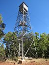 | January 28, 1988 (#87002458) | Rogers Lake 35°08′32″N 111°44′57″W / 35.142222°N 111.749167°W / 35.142222; -111.749167 (Woody Mountain Lookout Tower) | Flagstaff | |
| 155 | Wupatki National Monument | 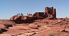 | October 15, 1966 (#66000175) | 30 miles (48 km) north of Flagstaff off U.S. Route 89 35°33′01″N 111°23′02″W / 35.550278°N 111.383889°W / 35.550278; -111.383889 (Wupatki National Monument) | Flagstaff |
Former listings
| [3] | Name on the Register | Image | Date listed | Date removed | Location | City or town | Description |
|---|---|---|---|---|---|---|---|
| 1 | Mayhew's Lodge | Upload image | February 13, 1975 (#75000346) | October 31, 1980 | 10.5 mi. N of Sedona on U.S. 89A | Flagstaff | Destroyed by fire March 26, 1980[10][11] |
| 2 | Mormon Lake Lookout Cabin | Upload image | January 28, 1988 (#87002459) | July 8, 2019 | Coconino National Forest 34°53′12″N 111°25′42″W / 34.886667°N 111.428333°W / 34.886667; -111.428333 (Mormon Lake Lookout Cabin) | Mormon Lake |
See also
Wikimedia Commons has media related to National Register of Historic Places in Coconino County, Arizona.
- List of National Historic Landmarks in Arizona
- National Register of Historic Places listings in Arizona
References
- ^ The latitude and longitude information provided in this table was derived originally from the National Register Information System, which has been found to be fairly accurate for about 99% of listings. Some locations in this table may have been corrected to current GPS standards.
- ^ National Park Service, United States Department of the Interior, "National Register of Historic Places: Weekly List Actions", retrieved August 30, 2024.
- ^ a b Numbers represent an alphabetical ordering by significant words. Various colorings, defined here, differentiate National Historic Landmarks and historic districts from other NRHP buildings, structures, sites or objects.
- ^ The eight-digit number below each date is the number assigned to each location in the National Register Information System database, which can be viewed by clicking the number.
- ^ "McMillan Building - 1887". Historical Marker Database. Retrieved 2012-08-24.
- ^ Woodward, Jim. "National Register of Historic Places Inventory-Nomination Form: Historic Resources of Flagstaff, Arizona". Retrieved 2012-08-19.
- ^ Location derived from its GNIS feature record; the NRIS lists the site as "Address Restricted".
- ^ "Natural Grocers Expands Into Arizona With The Opening Of Flagstaff Store". Natural Grocers website. Retrieved 2012-08-23.
- ^ "National Register Information System". National Register of Historic Places. National Park Service. March 13, 2009.
- ^ "Historical log cabin near Sedona destroyed by fire". The Arizona Republic. March 27, 1980. p. A5. Retrieved April 18, 2022 – via Newspapers.com.
- ^ National Archives and Records Administration. "Mayhew's Cabin". archives.gov.
- v
- t
- e

Municipalities and communities of Coconino County, Arizona, United States | ||
|---|---|---|
County seat: Flagstaff | ||
| Cities |  | |
| Towns | ||
| CDPs |
| |
| Populated places | ||
| Indian reservations | ||
| Ghost towns | ||
| Footnotes | ‡This populated place also has portions in an adjacent county or counties | |
| ||


