Namti
‹ The template Infobox settlement is being considered for merging. ›
Place in Kachin State, Burma
24°34′N 97°7′E / 24.567°N 97.117°E / 24.567; 97.117 Burma
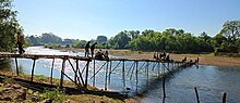
BurmaNamti "နမ္မတီး" (also spelled "Nammati" and "Nanmati"[citation needed]) is a town in Mogaung Township in Mohnyin District in the Kachin State of north-eastern Burma.[1][full citation needed] Namti is 6 miles from Mogaung and 25 miles from Myitkyina.
The main ethnic groups living in the town are Kachin, Shan, Khamti, Burmese and Gurkhas(Gorkha). There are also a few Chinese and Indian residents.[citation needed]
References
- ^ Maplandia world gazetteer
External links
- Satellite map at Maplandia.com
- v
- t
- e
Kachin State
Capital: Myitkyina
- Bhamo Township
- Mansi Township
- Momauk Township
- Shwegu Township


  | This Kachin State location article is a stub. You can help Wikipedia by expanding it. |
- v
- t
- e


