Mizni Dol
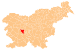
Place in Inner Carniola, Slovenia
45°58′50.06″N 14°13′39.2″E / 45.9805722°N 14.227556°E / 45.9805722; 14.227556 Slovenia
 (2010)
Mizni Dol (pronounced [ˈmiːzni ˈdoːu̯]; sometimes also Mizendol[2]) is a small settlement in the hills west of Vrhnika in the Inner Carniola region of Slovenia.[3]
History
The independent settlement of Mizni Dol was created in 2002, when the territory was separated from the settlement of Zaplana.[4] Prior to this, Mizni Dol was a hamlet of Zaplana.[2]
References
External links
- Mizni Dol on Geopedia
- v
- t
- e
Municipality of Vrhnika
Administrative seat: Vrhnika
- Bevke
- Bistra
- Blatna Brezovica
- Drenov Grič
- Jamnik
- Jerinov Grič
- Lesno Brdo
- Mala Ligojna
- Marinčev Grič
- Mirke
- Mizni Dol
- Padež
- Podlipa
- Pokojišče
- Prezid
- Sinja Gorica
- Smrečje
- Stara Vrhnika
- Strmica
- Trčkov Grič
- Velika Ligojna
- Verd
- Zaplana
- Zavrh pri Borovnici
- Ivan Cankar
- Karel Grabeljšek
- Simon Ogrin
- Jožef Petkovšek
- Matej Sternen


