Mansfeld-Südharz
District in Saxony-Anhalt, Germany

Flag
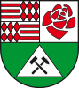
Coat of arms

(31 December 2022)[1]
Mansfeld-Südharz is a district in Saxony-Anhalt, Germany. Its area is 1,449.1 km2 (559.5 sq mi).[2]
History
The district was established by merging the former districts of Sangerhausen and Mansfelder Land as part of the reform of 2007. In the German parliament, the Bundestag, the area forms part of the Mansfeld electoral district.
Towns and municipalities

The district Mansfeld-Südharz consists of the following subdivisions:[3]
| Free towns | Free municipalities |
|---|---|
|
| Verbandsgemeinden | ||
|---|---|---|
| ||
| 1seat of the Verbandsgemeinde; 2town; | ||
References
Wikimedia Commons has media related to Landkreis Mansfeld-Südharz.
- ^ "Bevölkerung der Gemeinden – Stand: 31. Dezember 2022" (PDF) (in German). Statistisches Landesamt Sachsen-Anhalt. June 2023.
- ^ "Tabellen Bodenfläche". Statistisches Landesamt Sachsen-Anhalt. Retrieved 20 November 2022.
- ^ "Statistisches Landesamt Sachsen-Anhalt". Archived from the original on 2017-05-15. Retrieved 2009-08-06.
- v
- t
- e


- Dessau-Roßlau
- Halle (Saale)
- Magdeburg
- Altmarkkreis Salzwedel
- Anhalt-Bitterfeld
- Börde
- Burgenlandkreis
- Harz
- Jerichower Land
- Mansfeld-Südharz
- Saalekreis
- Salzlandkreis
- Stendal
- Wittenberg
- Anhalt-Zerbst
- Aschersleben-Staßfurt
- Bernburg
- Bitterfeld
- Bördekreis
- Burgenlandkreis
- Halberstadt
- Köthen
- Mansfelder Land
- Merseburg-Querfurt
- Ohrekreis
- Quedlinburg
- Saalkreis
- Sangerhausen
- Schönebeck
- Weißenfels
- Wernigerode
51°32′N 11°22′E / 51.533°N 11.367°E / 51.533; 11.367
Authority control databases | |
|---|---|
| International |
|
| National |
|
 | This Mansfeld-Südharz location article is a stub. You can help Wikipedia by expanding it. |
- v
- t
- e


