Log, Rogatec
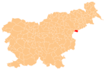
Place in Styria, Slovenia
46°13′47.22″N 15°46′19.35″E / 46.2297833°N 15.7720417°E / 46.2297833; 15.7720417 Slovenia
 (2002)
Log (pronounced [ˈloːk]) is a settlement in the Municipality of Rogatec in eastern Slovenia. It lies in the wooded hills above the right bank of the Sotla River, close to its source. Part of the surrounding area has been declared a forest reserve as a typical Subpannonian beech and oak forest preserved in its natural state. It is known as the Forest Reserve at Log on the Sotla River (Slovene: Gozdni rezervat Log ob Sotli). The entire Rogatec are area traditionally belonged to the Styria region. It is now included in the Savinja Statistical Region.[2]
References
External links
- Log on Geopedia
- v
- t
- e
Municipality of Rogatec
Administrative seat: Rogatec
| Current |
|
|---|---|
| Former |
|
- Strmol Mansion
- Rogatec Castle
- Rogatec Open-Air Museum
- Church of Saint Bartholomew
- Church of Saint Hyacinthe
- Boč Natural Reserve


