List of the highest major summits of Colorado

The following sortable table comprises the 117 highest mountain peaks of the U.S. State of Colorado with at least 3000 meters (9843 feet) of elevation and at least 500 meters (1640 feet) of topographic prominence.
Topographic elevation is the vertical distance above the reference geoid, a mathematical model of the Earth's sea level as an equipotential gravitational surface. The topographic prominence of a summit is the elevation difference between that summit and the highest or key col to a higher summit. The topographic isolation of a summit is the minimum great-circle distance to a point of equal elevation.
This article defines a significant summit as a summit with at least 100 meters (328.1 feet) of topographic prominence, and a major summit as a summit with at least 500 meters (1640 feet) of topographic prominence. An ultra-prominent summit is a summit with at least 1500 meters (4921 feet) of topographic prominence. There are three ultra-prominent summits in Colorado.
All elevations in this article include an elevation adjustment from the National Geodetic Vertical Datum of 1929 (NGVD 29) to the North American Vertical Datum of 1988 (NAVD 88). For further information, please see this United States National Geodetic Survey note.
If an elevation or prominence is calculated as a range of values, the arithmetic mean is shown.
Highest major summits
Map this section's coordinates using OpenStreetMap
Download coordinates as:
- KML
- GPX (all coordinates)
- GPX (primary coordinates)
- GPX (secondary coordinates)
| Rank | Mountain Peak | Mountain Range | Elevation | Prominence | Isolation | Location |
|---|---|---|---|---|---|---|
| 1 | Mount Elbert[1][2][3][4][a] | Sawatch Range | 14,440 ft 4401.2 m | 9,093 ft 2772 m | 671 mi 1,079 km | 39°07′04″N 106°26′43″W / 39.1178°N 106.4454°W / 39.1178; -106.4454 (Mount Elbert) |
| 2 | Mount Massive[5][6][7][8][b][c] | Sawatch Range | 14,428 ft 4398 m | 1,961 ft 598 m | 5.06 mi 8.14 km | 39°11′15″N 106°28′33″W / 39.1875°N 106.4757°W / 39.1875; -106.4757 (Mount Massive) |
| 3 | Mount Harvard[9][10][11][12][d][e] | Sawatch Range | 14,421 ft 4395.6 m | 2,360 ft 719 m | 14.92 mi 24 km | 38°55′28″N 106°19′15″W / 38.9244°N 106.3207°W / 38.9244; -106.3207 (Mount Harvard) |
| 4 | Blanca Peak[13][14][15][f][g][h] | Sangre de Cristo Mountains | 14,351 ft 4374 m | 5,326 ft 1623 m | 103.4 mi 166.4 km | 37°34′39″N 105°29′08″W / 37.5775°N 105.4856°W / 37.5775; -105.4856 (Blanca Peak) |
| 5 | La Plata Peak[16][17][18][i] | Sawatch Range | 14,343 ft 4372 m | 1,836 ft 560 m | 6.28 mi 10.11 km | 39°01′46″N 106°28′22″W / 39.0294°N 106.4729°W / 39.0294; -106.4729 (La Plata Peak) |
| 6 | Uncompahgre Peak[19][20][21][22][j][k] | San Juan Mountains | 14,321 ft 4365 m | 4,277 ft 1304 m | 85 mi 136.8 km | 38°04′18″N 107°27′44″W / 38.0717°N 107.4621°W / 38.0717; -107.4621 (Uncompahgre Peak) |
| 7 | Crestone Peak[23][24][25][l][m] | Sangre de Cristo Range | 14,300 ft 4359 m | 4,554 ft 1388 m | 27.4 mi 44 km | 37°58′01″N 105°35′08″W / 37.9669°N 105.5855°W / 37.9669; -105.5855 (Crestone Peak) |
| 8 | Mount Lincoln[26][27][28][29][n][o] | Mosquito Range | 14,293 ft 4356.5 m | 3,862 ft 1177 m | 22.5 mi 36.2 km | 39°21′05″N 106°06′42″W / 39.3515°N 106.1116°W / 39.3515; -106.1116 (Mount Lincoln) |
| 9 | Castle Peak[30][31][32][33][p] | Elk Mountains | 14,279 ft 4352.2 m | 2,365 ft 721 m | 20.9 mi 33.6 km | 39°00′35″N 106°51′41″W / 39.0097°N 106.8614°W / 39.0097; -106.8614 (Castle Peak) |
| 10 | Grays Peak[34][35][36][37][q][r] | Front Range | 14,278 ft 4352 m | 2,770 ft 844 m | 25 mi 40.2 km | 39°38′02″N 105°49′03″W / 39.6339°N 105.8176°W / 39.6339; -105.8176 (Grays Peak) |
| 11 | Mount Antero[38][39][40][41][s] | Sawatch Range | 14,276 ft 4351.4 m | 2,503 ft 763 m | 17.67 mi 28.4 km | 38°40′27″N 106°14′46″W / 38.6741°N 106.2462°W / 38.6741; -106.2462 (Mount Antero) |
| 12 | Mount Blue Sky[42][43][44][45][t] | Front Range | 14,271 ft 4350 m | 2,770 ft 844 m | 9.79 mi 15.76 km | 39°35′18″N 105°38′38″W / 39.5883°N 105.6438°W / 39.5883; -105.6438 (Mount Evans) |
| 13 | Longs Peak[46][47][48][49][u][v] | Front Range | 14,259 ft 4346 m | 2,940 ft 896 m | 43.6 mi 70.2 km | 40°15′18″N 105°36′54″W / 40.2550°N 105.6151°W / 40.2550; -105.6151 (Longs Peak) |
| 14 | Mount Wilson[50][51][52][w][x][y] | San Miguel Mountains | 14,252 ft 4344 m | 4,024 ft 1227 m | 33 mi 53.1 km | 37°50′21″N 107°59′30″W / 37.8391°N 107.9916°W / 37.8391; -107.9916 (Mount Wilson) |
| 15 | Mount Princeton[53][54][55][56] | Sawatch Range | 14,204 ft 4329.3 m | 2,177 ft 664 m | 5.19 mi 8.36 km | 38°44′57″N 106°14′33″W / 38.7492°N 106.2424°W / 38.7492; -106.2424 (Mount Princeton) |
| 16 | Mount Yale[57][58][59][60] | Sawatch Range | 14,200 ft 4328.2 m | 1,896 ft 578 m | 5.55 mi 8.93 km | 38°50′39″N 106°18′50″W / 38.8442°N 106.3138°W / 38.8442; -106.3138 (Mount Yale) |
| 17 | Maroon Peak[61][62][63][64] | Elk Mountains | 14,163 ft 4317 m | 2,336 ft 712 m | 8.06 mi 12.97 km | 39°04′15″N 106°59′20″W / 39.0708°N 106.9890°W / 39.0708; -106.9890 (Maroon Peak) |
| 18 | Mount Sneffels[65][66][67][68][z] | Sneffels Range | 14,158 ft 4315.4 m | 3,050 ft 930 m | 15.71 mi 25.3 km | 38°00′14″N 107°47′32″W / 38.0038°N 107.7923°W / 38.0038; -107.7923 (Mount Sneffels) |
| 19 | Capitol Peak[69][70][71][72][aa] | Elk Mountains | 14,137 ft 4309 m | 1,750 ft 533 m | 7.44 mi 11.98 km | 39°09′01″N 107°04′58″W / 39.1503°N 107.0829°W / 39.1503; -107.0829 (Capitol Peak) |
| 20 | Pikes Peak[73][74][75][76] | Front Range | 14,115 ft 4302.31 m | 5,530 ft 1686 m | 60.6 mi 97.6 km | 38°50′26″N 105°02′39″W / 38.8405°N 105.0442°W / 38.8405; -105.0442 (Pikes Peak) |
| 21 | Windom Peak[77][78][79][ab][ac][ad] | Needle Mountains | 14,093 ft 4296 m | 2,187 ft 667 m | 26.3 mi 42.4 km | 37°37′16″N 107°35′31″W / 37.6212°N 107.5919°W / 37.6212; -107.5919 (Windom Peak) |
| 22 | Handies Peak[80][81][82][83] | San Juan Mountains | 14,058 ft 4284.8 m | 1,908 ft 582 m | 11.18 mi 18 km | 37°54′47″N 107°30′16″W / 37.9130°N 107.5044°W / 37.9130; -107.5044 (Handies Peak) |
| 23 | Culebra Peak[84][85][86][ae][af][ag] | Culebra Range | 14,053 ft 4283 m | 4,827 ft 1471 m | 35.4 mi 56.9 km | 37°07′21″N 105°11′09″W / 37.1224°N 105.1858°W / 37.1224; -105.1858 (Culebra Peak) |
| 24 | San Luis Peak[87][88][89][90][ah] | La Garita Mountains | 14,022 ft 4273.8 m | 3,113 ft 949 m | 26.9 mi 43.4 km | 37°59′12″N 106°55′53″W / 37.9868°N 106.9313°W / 37.9868; -106.9313 (San Luis Peak) |
| 25 | Mount of the Holy Cross[91][92][93][94][ai][aj] | Sawatch Range | 14,011 ft 4270.5 m | 2,113 ft 644 m | 18.41 mi 29.6 km | 39°28′00″N 106°28′54″W / 39.4668°N 106.4817°W / 39.4668; -106.4817 (Mount of the Holy Cross) |
| 26 | Grizzly Peak[95][96][97][98][ak] | Sawatch Range | 13,995 ft 4265.6 m | 1,928 ft 588 m | 6.77 mi 10.89 km | 39°02′33″N 106°35′51″W / 39.0425°N 106.5976°W / 39.0425; -106.5976 (Grizzly Peak) |
| 27 | Mount Ouray[99][100][101][102][al] | Sawatch Range | 13,961 ft 4255.4 m | 2,659 ft 810 m | 13.58 mi 21.9 km | 38°25′22″N 106°13′29″W / 38.4227°N 106.2247°W / 38.4227; -106.2247 (Mount Ouray) |
| 28 | Vermilion Peak[103][104][105][am] | San Juan Mountains | 13,900 ft 4237 m | 2,105 ft 642 m | 9.07 mi 14.6 km | 37°47′57″N 107°49′43″W / 37.7993°N 107.8285°W / 37.7993; -107.8285 (Vermilion Peak) |
| 29 | Mount Silverheels[106][107][108][109] | Front Range | 13,829 ft 4215 m | 2,283 ft 696 m | 5.48 mi 8.82 km | 39°20′22″N 106°00′19″W / 39.3394°N 106.0054°W / 39.3394; -106.0054 (Mount Silverheels) |
| 30 | Rio Grande Pyramid[110][111][112][113] | San Juan Mountains | 13,827 ft 4214.4 m | 1,881 ft 573 m | 10.76 mi 17.31 km | 37°40′47″N 107°23′33″W / 37.6797°N 107.3924°W / 37.6797; -107.3924 (Rio Grande Pyramid) |
| 31 | Bald Mountain[114][115][116][an] | Front Range | 13,690 ft 4173 m | 2,099 ft 640 m | 7.51 mi 12.09 km | 39°26′41″N 105°58′14″W / 39.4448°N 105.9705°W / 39.4448; -105.9705 (Bald Mountain) |
| 32 | Mount Oso[117][118][119][ao] | San Juan Mountains | 13,690 ft 4173 m | 1,664 ft 507 m | 5.41 mi 8.71 km | 37°36′25″N 107°29′37″W / 37.6070°N 107.4936°W / 37.6070; -107.4936 (Mount Oso) |
| 33 | Mount Jackson[120][121][122][123] | Sawatch Range | 13,676 ft 4168.5 m | 1,810 ft 552 m | 3.21 mi 5.16 km | 39°29′07″N 106°32′12″W / 39.4853°N 106.5367°W / 39.4853; -106.5367 (Mount Jackson) |
| 34 | Bard Peak[124][125][126][ap] | Front Range | 13,647 ft 4159 m | 1,701 ft 518 m | 5.43 mi 8.74 km | 39°43′13″N 105°48′16″W / 39.7204°N 105.8044°W / 39.7204; -105.8044 (Bard Peak) |
| 35 | West Spanish Peak[127][128][129][aq] | Spanish Peaks | 13,631 ft 4155 m | 3,686 ft 1123 m | 19.87 mi 32 km | 37°22′32″N 104°59′36″W / 37.3756°N 104.9934°W / 37.3756; -104.9934 (West Spanish Peak) |
| 36 | Mount Powell[130][131][132][ar][as] | Gore Range | 13,586 ft 4141 m | 3,000 ft 914 m | 21.5 mi 34.6 km | 39°45′36″N 106°20′27″W / 39.7601°N 106.3407°W / 39.7601; -106.3407 (Mount Powell) |
| 37 | Hagues Peak[133][134][135][136][at] | Mummy Range | 13,573 ft 4137 m | 2,420 ft 738 m | 15.7 mi 25.3 km | 40°29′04″N 105°38′47″W / 40.4845°N 105.6464°W / 40.4845; -105.6464 (Hagues Peak) |
| 38 | Tower Mountain[137][138][139][au] | San Juan Mountains | 13,558 ft 4132 m | 1,652 ft 504 m | 4.88 mi 7.86 km | 37°51′26″N 107°37′23″W / 37.8573°N 107.6230°W / 37.8573; -107.6230 (Tower Mountain) |
| 39 | Treasure Mountain[140][141][142][av] | Elk Mountains | 13,535 ft 4125 m | 2,828 ft 862 m | 6.92 mi 11.13 km | 39°01′28″N 107°07′22″W / 39.0244°N 107.1228°W / 39.0244; -107.1228 (Treasure Mountain) |
| 40 | North Arapaho Peak[143][144][145][146][aw][ax] | Front Range | 13,508 ft 4117 m | 1,665 ft 507 m | 15.38 mi 24.8 km | 40°01′35″N 105°39′01″W / 40.0265°N 105.6504°W / 40.0265; -105.6504 (North Arapaho Peak) |
| 41 | Parry Peak[147][148][149][ay] | Front Range | 13,397 ft 4083 m | 1,720 ft 524 m | 9.46 mi 15.22 km | 39°50′17″N 105°42′48″W / 39.8381°N 105.7132°W / 39.8381; -105.7132 (Parry Peak) |
| 42 | Bill Williams Peak[150][151][az][ba] | Williams Mountains | 13,389 ft 4081 m | 1,682 ft 513 m | 3.72 mi 5.98 km | 39°10′50″N 106°36′37″W / 39.1806°N 106.6102°W / 39.1806; -106.6102 (Bill Williams Peak) |
| 43 | Sultan Mountain[152][153][154][bb] | San Juan Mountains | 13,373 ft 4076 m | 1,868 ft 569 m | 4.59 mi 7.39 km | 37°47′09″N 107°42′14″W / 37.7859°N 107.7038°W / 37.7859; -107.7038 (Sultan Mountain) |
| 44 | Mount Herard[155][156][157][bc] | Sangre de Cristo Mountains | 13,345 ft 4068 m | 2,040 ft 622 m | 4.63 mi 7.45 km | 37°50′57″N 105°29′42″W / 37.8492°N 105.4949°W / 37.8492; -105.4949 (Mount Herard) |
| 45 | West Buffalo Peak[158][159][160][161][bd] | Mosquito Range | 13,332 ft 4064 m | 1,986 ft 605 m | 9.61 mi 15.46 km | 38°59′30″N 106°07′30″W / 38.9917°N 106.1249°W / 38.9917; -106.1249 (West Buffalo Peak) |
| 46 | Summit Peak[162][163][164][165][be] | San Juan Mountains | 13,308 ft 4056.2 m | 2,760 ft 841 m | 39.6 mi 63.7 km | 37°21′02″N 106°41′48″W / 37.3506°N 106.6968°W / 37.3506; -106.6968 (Summit Peak) |
| 47 | Middle Peak[166][167][168][bf][bg] | San Miguel Mountains | 13,306 ft 4056 m | 1,960 ft 597 m | 4.78 mi 7.69 km | 37°51′13″N 108°06′30″W / 37.8536°N 108.1082°W / 37.8536; -108.1082 (Middle Peak) |
| 48 | Antora Peak[169][170][171][bh] | Sawatch Range | 13,275 ft 4046 m | 2,409 ft 734 m | 6.75 mi 10.86 km | 38°19′30″N 106°13′05″W / 38.3250°N 106.2180°W / 38.3250; -106.2180 (Antora Peak) |
| 49 | Henry Mountain[172][173][174][bi] | Sawatch Range | 13,261 ft 4042 m | 1,674 ft 510 m | 10.94 mi 17.61 km | 38°41′08″N 106°37′16″W / 38.6856°N 106.6211°W / 38.6856; -106.6211 (Henry Mountain) |
| 50 | Hesperus Mountain[175][176][177][bj][bk] | La Plata Mountains | 13,237 ft 4035 m | 2,852 ft 869 m | 24.5 mi 39.5 km | 37°26′42″N 108°05′20″W / 37.4451°N 108.0890°W / 37.4451; -108.0890 (Hesperus Mountain) |
| 51 | Jacque Peak[178][179][180][bl] | Gore Range | 13,211 ft 4027 m | 2,065 ft 629 m | 4.52 mi 7.28 km | 39°27′18″N 106°11′49″W / 39.4549°N 106.1970°W / 39.4549; -106.1970 (Jacque Peak) |
| 52 | Bennett Peak[181][182][183][bm] | San Juan Mountains | 13,209 ft 4026 m | 1,743 ft 531 m | 17.08 mi 27.5 km | 37°29′00″N 106°26′03″W / 37.4833°N 106.4343°W / 37.4833; -106.4343 (Bennett Peak) |
| 53 | Conejos Peak[184][185][186][187] | San Juan Mountains | 13,179 ft 4017 m | 1,912 ft 583 m | 8.15 mi 13.12 km | 37°17′19″N 106°34′15″W / 37.2887°N 106.5709°W / 37.2887; -106.5709 (Conejos Peak) |
| 54 | Twilight Peak[188][189][190][bn][bo] | Needle Mountains | 13,163 ft 4012 m | 2,338 ft 713 m | 4.88 mi 7.86 km | 37°39′47″N 107°43′37″W / 37.6630°N 107.7270°W / 37.6630; -107.7270 (Twilight Peak) |
| 55 | South River Peak[191][192][193][194] | San Juan Mountains | 13,154 ft 4009.4 m | 2,448 ft 746 m | 21.1 mi 34 km | 37°34′27″N 106°58′53″W / 37.5741°N 106.9815°W / 37.5741; -106.9815 (South River Peak) |
| 56 | Bushnell Peak[195][196][197][198] | Sangre de Cristo Mountains | 13,110 ft 3995.8 m | 2,405 ft 733 m | 11.07 mi 17.82 km | 38°20′28″N 105°53′21″W / 38.3412°N 105.8892°W / 38.3412; -105.8892 (Bushnell Peak) |
| 57 | West Elk Peak[199][200][201][202][bp] | West Elk Mountains | 13,042 ft 3975.2 m | 3,095 ft 943 m | 13.78 mi 22.2 km | 38°43′04″N 107°11′58″W / 38.7179°N 107.1994°W / 38.7179; -107.1994 (West Elk Peak) |
| 58 | Mount Centennial[203][204][bq] (Peak 13010) | San Juan Mountains | 13,016 ft 3967 m | 1,790 ft 546 m | 2.86 mi 4.61 km | 37°36′22″N 107°14′41″W / 37.6062°N 107.2446°W / 37.6062; -107.2446 (Mount Centennial) |
| 59 | Clark Peak[205][206][207][208][br] | Medicine Bow Mountains | 12,954 ft 3948.4 m | 2,771 ft 845 m | 16.4 mi 26.4 km | 40°36′24″N 105°55′48″W / 40.6068°N 105.9300°W / 40.6068; -105.9300 (Clark Peak) |
| 60 | Mount Richthofen[209][210][211][bs][bt] | Never Summer Mountains | 12,945 ft 3946 m | 2,680 ft 817 m | 9.66 mi 15.54 km | 40°28′10″N 105°53′40″W / 40.4695°N 105.8945°W / 40.4695; -105.8945 (Mount Richthofen) |
| 61 | Chair Mountain[212][213][214][215] | Elk Mountains | 12,727 ft 3879.1 m | 2,461 ft 750 m | 8.89 mi 14.3 km | 39°03′29″N 107°16′56″W / 39.0581°N 107.2822°W / 39.0581; -107.2822 (Chair Mountain) |
| 62 | Mount Gunnison[216][217][218][219] | West Elk Mountains | 12,725 ft 3878.7 m | 3,539 ft 1079 m | 11.84 mi 19.05 km | 38°48′44″N 107°22′57″W / 38.8121°N 107.3826°W / 38.8121; -107.3826 (Mount Gunnison) |
| 63 | East Spanish Peak[220][221][222][223][bu] | Spanish Peaks | 12,688 ft 3867 m | 2,383 ft 726 m | 4.21 mi 6.78 km | 37°23′36″N 104°55′12″W / 37.3934°N 104.9201°W / 37.3934; -104.9201 (East Spanish Peak) |
| 64 | Gothic Mountain[224][225][226][bv] | Elk Mountains | 12,631 ft 3850 m | 1,645 ft 501 m | 2.73 mi 4.39 km | 38°57′22″N 107°00′39″W / 38.9562°N 107.0107°W / 38.9562; -107.0107 (Gothic Mountain) |
| 65 | Lone Cone[227][228][229][230] | San Miguel Mountains | 12,618 ft 3846.1 m | 2,273 ft 693 m | 8.4 mi 13.52 km | 37°53′17″N 108°15′20″W / 37.8880°N 108.2556°W / 37.8880; -108.2556 (Lone Cone) |
| 66 | Graham Peak[231][232][233][234] | San Juan Mountains | 12,536 ft 3821.1 m | 2,551 ft 778 m | 8.64 mi 13.9 km | 37°29′50″N 107°22′34″W / 37.4972°N 107.3761°W / 37.4972; -107.3761 (Graham Peak) |
| 67 | Whetstone Mountain[235][236][237][238] | West Elk Mountains | 12,527 ft 3818.1 m | 2,456 ft 749 m | 9.39 mi 15.11 km | 38°49′20″N 106°58′48″W / 38.8223°N 106.9799°W / 38.8223; -106.9799 (Whetstone Mountain) |
| 68 | Specimen Mountain[239][240][241][bw] | Front Range | 12,494 ft 3808 m | 1,731 ft 528 m | 4.7 mi 7.56 km | 40°26′42″N 105°48′29″W / 40.4449°N 105.8081°W / 40.4449; -105.8081 (Specimen Mountain) |
| 69 | East Beckwith Mountain[242][243][244][245] | West Elk Mountains | 12,441 ft 3792.1 m | 2,492 ft 760 m | 6.24 mi 10.05 km | 38°50′47″N 107°13′24″W / 38.8464°N 107.2233°W / 38.8464; -107.2233 (East Beckwith Mountain) |
| 70 | Knobby Crest[246][247][bx][by] | Kenosha Mountains | 12,434 ft 3790 m | 1,759 ft 536 m | 8.27 mi 13.31 km | 39°22′05″N 105°36′18″W / 39.3681°N 105.6050°W / 39.3681; -105.6050 (Knobby Crest) |
| 71 | Bison Mountain[248][249][250][251][bz] (Bison Peak) | Tarryall Mountains | 12,432 ft 3789.4 m | 2,451 ft 747 m | 18.23 mi 29.3 km | 39°14′18″N 105°29′52″W / 39.2384°N 105.4978°W / 39.2384; -105.4978 (Bison Mountain) |
| 72 | Anthracite Range High Point[252][253][254] | West Elk Mountains | 12,394 ft 3777.8 m | 2,125 ft 648 m | 4.77 mi 7.68 km | 38°48′52″N 107°08′40″W / 38.8145°N 107.1445°W / 38.8145; -107.1445 (Anthracite Range) |
| 73 | Matchless Mountain[255][256][257][ca] | Elk Mountains | 12,389 ft 3776 m | 1,763 ft 537 m | 7.87 mi 12.67 km | 38°50′02″N 106°38′42″W / 38.8340°N 106.6451°W / 38.8340; -106.6451 (Matchless Mountain) |
| 74 | Flat Top Mountain[258][259][260][261][cb] | Flat Tops | 12,361 ft 3767.7 m | 4,054 ft 1236 m | 40.8 mi 65.6 km | 40°00′53″N 107°05′00″W / 40.0147°N 107.0833°W / 40.0147; -107.0833 (Flat Top Mountain) |
| 75 | Greenhorn Mountain[262][263][264][265][cc] | Wet Mountains | 12,352 ft 3765 m | 3,777 ft 1151 m | 25.2 mi 40.6 km | 37°52′53″N 105°00′48″W / 37.8815°N 105.0133°W / 37.8815; -105.0133 (Greenhorn Mountain) |
| 76 | Elliott Mountain[266][267][268][cd] | San Miguel Mountains | 12,346 ft 3763 m | 2,240 ft 683 m | 5.13 mi 8.26 km | 37°44′04″N 108°03′29″W / 37.7344°N 108.0580°W / 37.7344; -108.0580 (Elliott Mountain) |
| 77 | Parkview Mountain[269][270][271][272][ce] | Rabbit Ears Range | 12,301 ft 3749.4 m | 2,676 ft 816 m | 9.36 mi 15.07 km | 40°19′49″N 106°08′11″W / 40.3303°N 106.1363°W / 40.3303; -106.1363 (Parkview Mountain) |
| 78 | Cornwall Mountain[273][274][275][cf] | San Juan Mountains | 12,291 ft 3746 m | 1,744 ft 532 m | 5.2 mi 8.37 km | 37°22′52″N 106°29′31″W / 37.3811°N 106.4920°W / 37.3811; -106.4920 (Cornwall Mountain) |
| 79 | Mount Zirkel[276][277][278][cg][ch] | Park Range | 12,185 ft 3714 m | 3,470 ft 1058 m | 37.7 mi 60.6 km | 40°49′53″N 106°39′47″W / 40.8313°N 106.6631°W / 40.8313; -106.6631 (Mount Zirkel) |
| 80 | Crested Butte[279][280][281][ci] | Elk Mountains | 12,168 ft 3709 m | 2,582 ft 787 m | 4.65 mi 7.49 km | 38°53′01″N 106°56′37″W / 38.8835°N 106.9436°W / 38.8835; -106.9436 (Crested Butte) |
| 81 | Sawtooth Mountain[282][283][284][285] | La Garita Mountains | 12,153 ft 3704.2 m | 1,927 ft 587 m | 16.73 mi 26.9 km | 38°16′26″N 106°52′01″W / 38.2740°N 106.8670°W / 38.2740; -106.8670 (Sawtooth Mountain) |
| 82 | Park Cone[286][287][288][cj] | Sawatch Range | 12,106 ft 3690 m | 2,040 ft 622 m | 3.44 mi 5.53 km | 38°47′48″N 106°36′10″W / 38.7967°N 106.6028°W / 38.7967; -106.6028 (Park Cone) |
| 83 | Carbon Peak[289][290][291][292] | West Elk Mountains | 12,088 ft 3684.3 m | 2,179 ft 664 m | 3.92 mi 6.31 km | 38°47′39″N 107°02′35″W / 38.7943°N 107.0431°W / 38.7943; -107.0431 (Carbon Peak) |
| 84 | Mount Guero[293][294][295][296] | West Elk Mountains | 12,058 ft 3675.4 m | 2,432 ft 741 m | 6.38 mi 10.27 km | 38°43′11″N 107°23′10″W / 38.7196°N 107.3861°W / 38.7196; -107.3861 (Mount Guero) |
| 85 | Red Table Mountain[297][298][299][300] | Sawatch Range | 12,043 ft 3670.7 m | 2,017 ft 615 m | 7.88 mi 12.68 km | 39°25′05″N 106°46′16″W / 39.4181°N 106.7712°W / 39.4181; -106.7712 (Red Table Mountain) |
| 86 | Chalk Benchmark[301][302][303] | San Juan Mountains | 12,038 ft 3669.3 m | 1,971 ft 601 m | 7.26 mi 11.68 km | 37°08′30″N 106°45′00″W / 37.1418°N 106.7500°W / 37.1418; -106.7500 (Chalk Benchmark) |
| 87 | Mount Zwischen[304][305][306][ck] | Sangre de Cristo Mountains | 12,011 ft 3661 m | 2,266 ft 691 m | 4.44 mi 7.14 km | 37°47′29″N 105°27′19″W / 37.7913°N 105.4554°W / 37.7913; -105.4554 (Mount Zwischen) |
| 88 | Little Cone[307][308][309][310] | San Miguel Mountains | 11,988 ft 3654 m | 1,840 ft 561 m | 5.19 mi 8.35 km | 37°55′39″N 108°05′27″W / 37.9275°N 108.0908°W / 37.9275; -108.0908 (Little Cone) |
| 89 | Huntsman Ridge Peak[311][312][cl] (Dutch Peak) | Elk Mountains | 11,858 ft 3614 m | 3,072 ft 936 m | 10.3 mi 16.58 km | 39°11′31″N 107°22′00″W / 39.1920°N 107.3668°W / 39.1920; -107.3668 (Huntsman Ridge Peak) |
| 90 | Sheep Mountain[313][314][315][316] | Rabbit Ears Range | 11,825 ft 3604.2 m | 1,792 ft 546 m | 7.16 mi 11.53 km | 40°21′40″N 106°15′57″W / 40.3610°N 106.2658°W / 40.3610; -106.2658 (Sheep Mountain) |
| 91 | Waugh Mountain[317][318][319][cm][cn] | South Park Hills | 11,716 ft 3571 m | 2,330 ft 710 m | 18.86 mi 30.4 km | 38°36′08″N 105°41′44″W / 38.6022°N 105.6955°W / 38.6022; -105.6955 (Waugh Mountain) |
| 92 | Coal Mountain[320][321][322][co] | West Elk Mountains | 11,710 ft 3569 m | 1,715 ft 523 m | 5.73 mi 9.22 km | 38°47′13″N 107°29′01″W / 38.7870°N 107.4837°W / 38.7870; -107.4837 (Coal Mountain) |
| 93 | Black Mountain[323][324][325][cp] | South Park Hills | 11,659 ft 3554 m | 2,234 ft 681 m | 8.03 mi 12.92 km | 38°43′07″N 105°41′15″W / 38.7185°N 105.6874°W / 38.7185; -105.6874 (Black Mountain) |
| 94 | Williams Peak[326][327][328][329] | Front Range | 11,620 ft 3541.8 m | 2,049 ft 625 m | 8.66 mi 13.93 km | 39°51′19″N 106°11′07″W / 39.8552°N 106.1854°W / 39.8552; -106.1854 (Williams Peak) |
| 95 | Puma Peak[330][331][cq] | South Park Hills | 11,575 ft 3528 m | 2,260 ft 689 m | 7.11 mi 11.44 km | 39°09′26″N 105°34′53″W / 39.1572°N 105.5815°W / 39.1572; -105.5815 (Puma Peak) |
| 96 | Mount Mestas[332][333][334][cr] | Sangre de Cristo Mountains | 11,574 ft 3528 m | 2,229 ft 679 m | 14.47 mi 23.3 km | 37°34′59″N 105°08′51″W / 37.5830°N 105.1474°W / 37.5830; -105.1474 (Mount Mestas) |
| 97 | Thirtynine Mile Mountain[335][336][337][cs] | South Park Hills | 11,553 ft 3521 m | 2,088 ft 636 m | 10.61 mi 17.08 km | 38°49′57″N 105°33′19″W / 38.8324°N 105.5553°W / 38.8324; -105.5553 (Thirtynine Mile Mountain) |
| 98 | Tomichi Dome[338][339][340][ct] | Sawatch Range | 11,471 ft 3496 m | 2,325 ft 709 m | 9.35 mi 15.04 km | 38°29′06″N 106°31′45″W / 38.4849°N 106.5291°W / 38.4849; -106.5291 (Tomichi Dome) |
| 99 | Blair Mountain[341][342][343][cu][cv] | White River Plateau | 11,465 ft 3495 m | 1,736 ft 529 m | 11.5 mi 18.5 km | 39°47′39″N 107°25′03″W / 39.7943°N 107.4176°W / 39.7943; -107.4176 (Blair Mountain) |
| 100 | Twin Sisters Peaks[344][345][346][cw] | Front Range | 11,433 ft 3485 m | 2,298 ft 700 m | 4.03 mi 6.48 km | 40°17′19″N 105°31′03″W / 40.2886°N 105.5175°W / 40.2886; -105.5175 (Twin Sisters Peaks) |
| 101 | Elk Mountain[347][348][349][350] | Rabbit Ears Range | 11,424 ft 3482.1 m | 2,159 ft 658 m | 10.52 mi 16.93 km | 40°09′43″N 106°07′43″W / 40.1619°N 106.1285°W / 40.1619; -106.1285 (Elk Mountain) |
| 102 | Iron Mountain[351][352][353][cx] | Sangre de Cristo Range | 11,416 ft 3480 m | 1,951 ft 595 m | 6.95 mi 11.18 km | 37°38′15″N 105°15′14″W / 37.6375°N 105.2538°W / 37.6375; -105.2538 (Iron Mountain) |
| 103 | Marcellina Mountain[354][355][356][cy] | West Elk Mountains | 11,353 ft 3461 m | 2,728 ft 831 m | 5.08 mi 8.18 km | 38°55′48″N 107°14′38″W / 38.9299°N 107.2438°W / 38.9299; -107.2438 (Marcellina Mountain) |
| 104 | Crater Peak[357][358][359][360][cz] | Front Range | 11,333 ft 3454.2 m | 2,307 ft 703 m | 17.98 mi 28.9 km | 39°02′23″N 107°39′46″W / 39.0396°N 107.6628°W / 39.0396; -107.6628 (Crater Peak) |
| 105 | Castle Peak[361][362][363][da] | Sawatch Range | 11,305 ft 3446 m | 3,040 ft 927 m | 16.51 mi 26.6 km | 39°46′20″N 106°49′49″W / 39.7723°N 106.8304°W / 39.7723; -106.8304 (Castle Peak) |
| 106 | Hardscrabble Mountain[364][365][366][db] | Sawatch Range | 11,171 ft 3405 m | 1,706 ft 520 m | 7.03 mi 11.31 km | 39°31′02″N 106°48′08″W / 39.5171°N 106.8021°W / 39.5171; -106.8021 (Hardscrabble Mountain) |
| 107 | Cochetopa Dome[367][368][369][dc] | La Garita Mountains | 11,138 ft 3395 m | 1,762 ft 537 m | 6.15 mi 9.9 km | 38°13′36″N 106°42′53″W / 38.2267°N 106.7147°W / 38.2267; -106.7147 (Cochetopa Dome) |
| 108 | North Mamm Peak[370][371][372][373] | Front Range | 11,126 ft 3391.3 m | 3,103 ft 946 m | 21.2 mi 34.1 km | 39°23′11″N 107°51′58″W / 39.3865°N 107.8660°W / 39.3865; -107.8660 (North Mamm Peak) |
| 109 | Laramie Mountains HP[374][375][dd] | Laramie Mountains | 11,025 ft 3360 m | 1,880 ft 573 m | 8.54 mi 13.74 km | 40°46′13″N 105°42′58″W / 40.7704°N 105.7162°W / 40.7704; -105.7162 (Laramie Mountains high point) |
| 110 | Sand Mountain North[376][377][de][df] | Elkhead Mountains | 10,884 ft 3317 m | 2,179 ft 664 m | 17.7 mi 28.5 km | 40°45′49″N 107°03′27″W / 40.7636°N 107.0575°W / 40.7636; -107.0575 (Sand Mountain North) |
| 111 | Black Mountain[378][379][380][dg] | Elkhead Mountains | 10,865 ft 3312 m | 2,440 ft 744 m | 16.4 mi 26.4 km | 40°47′01″N 107°22′09″W / 40.7835°N 107.3691°W / 40.7835; -107.3691 (Black Mountain) |
| 112 | Sleepy Cat Peak[381][382][383][dh] | Flat Tops | 10,853 ft 3308 m | 2,348 ft 716 m | 10.64 mi 17.13 km | 40°07′39″N 107°32′02″W / 40.1275°N 107.5338°W / 40.1275; -107.5338 (Sleepy Cat Peak) |
| 113 | Spruce Mountain[384][385][386][387] | Grand Mesa | 10,838 ft 3303.5 m | 1,813 ft 553 m | 8.33 mi 13.41 km | 39°11′50″N 107°31′19″W / 39.1973°N 107.5220°W / 39.1973; -107.5220 (Spruce Mountain) |
| 114 | Green Mountain[388][389][390][391] | Kenosha Mountains | 10,427 ft 3178.3 m | 1,859 ft 567 m | 4.18 mi 6.72 km | 39°18′19″N 105°18′00″W / 39.3053°N 105.3001°W / 39.3053; -105.3001 (Green Mountain) |
| 115 | Columbus Mountain[392][393][394][di] | Elkhead Mountains | 10,258 ft 3126 m | 1,913 ft 583 m | 7.68 mi 12.36 km | 40°52′48″N 107°11′32″W / 40.8799°N 107.1921°W / 40.8799; -107.1921 (Columbus Mountain) |
| 116 | Ute Peak[395][396][397][398][dj] | Ute Mountain | 9,984 ft 3043 m | 4,039 ft 1231 m | 34.3 mi 55.2 km | 37°17′03″N 108°46′43″W / 37.2841°N 108.7787°W / 37.2841; -108.7787 (Ute Peak) |
| 117 | Horse Mountain[399][400][401][dk] | San Juan Mountains | 9,952 ft 3033 m | 1,887 ft 575 m | 13.06 mi 21 km | 37°18′29″N 107°17′11″W / 37.3080°N 107.2864°W / 37.3080; -107.2864 (Horse Mountain) |
Gallery
-

-

-
 3. Mount Harvard is the highest of the Collegiate Peaks and the third-highest peak of the Rocky Mountains.
 -
 4. Blanca Peak is the highest peak of the Sangre de Cristo Mountains and the second-most topographically isolated peak of Colorado.
 -

-
 6. Uncompahgre Peak is the highest peak of the San Juan Mountains and the sixth-highest peak of the Rocky Mountains.
 -
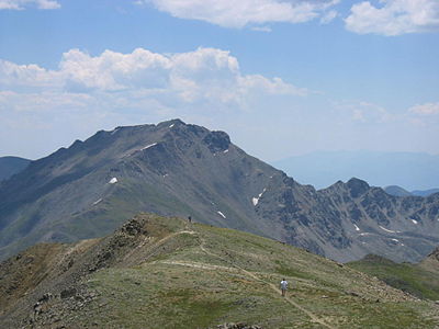
 7. Crestone Peak is the highest peak of the Crestones and the seventh-highest peak of the Rocky Mountains.
 -
 8. Mount Lincoln is the highest peak of the Mosquito Range and the eighth-highest peak of the Rocky Mountains.
 -
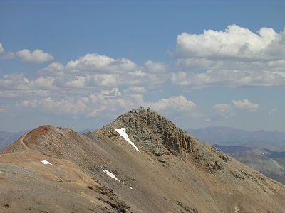
 9. Castle Peak is the highest peak of the Elk Mountains and the ninth-highest peak of the Rocky Mountains.
 -
 10. Grays Peak is the highest peak of the Front Range and the tenth-highest peak of the Rocky Mountains.
 -

-
 25. This photograph of the legendary Mount of the Holy Cross was taken by William Henry Jackson in 1874.


See also
 Geography portal
 North America portal
 United States portal
 Colorado portal
 Mountains portal


- List of mountain peaks of North America
- List of mountain peaks of Greenland
- List of mountain peaks of Canada
- List of mountain peaks of the Rocky Mountains
- List of mountain peaks of the United States
- List of mountain peaks of México
- List of mountain peaks of Central America
- List of mountain peaks of the Caribbean
- Colorado
- Geography of Colorado
- Category:Mountains of Colorado
- commons:Category:Mountains of Colorado
- Category:Mountains of Colorado
- Geography of Colorado
- Physical geography
Notes
- ^ The summit of Mount Elbert is the highest point of the U.S. State of Colorado, the Rocky Mountains of North America, and the entire Mississippi River drainage basin.
- ^ Mount Massive is the second-highest summit of the Rocky Mountains.
- ^ The elevation of Mount Massive includes an adjustment of +2.087 m (6.85 ft) from NGVD 29 to NAVD 88.
- ^ The summit of Mount Harvard is the highest point of the Collegiate Peaks.
- ^ Mount Harvard is the southernmost and easternmost summit of its elevation in the Rocky Mountains.
- ^ The summit of Blanca Peak is the highest point of the Sangre de Cristo Mountains and the entire Rio Grande drainage basin.
- ^ Blanca Peak is the southernmost ultra-prominent summit of the Rocky Mountains.
- ^ The elevation of Blanca Peak includes an adjustment of +1.755 m (5.76 ft) from NGVD 29 to NAVD 88.
- ^ The elevation of La Plata Peak includes an adjustment of +1.983 m (6.51 ft) from NGVD 29 to NAVD 88.
- ^ The summit of Uncompahgre Peak is the highest point of the San Juan Mountains and the entire Gulf of California drainage basin.
- ^ Uncompahgre Peak is the westernmost summit of its elevation in the Rocky Mountains.
- ^ The summit of Crestone Peak is the highest point of the Crestones.
- ^ The elevation of Crestone Peak includes an adjustment of +1.76 m (5.77 ft) from NGVD 29 to NAVD 88.
- ^ The summit of Mount Lincoln is the highest point of the Mosquito Range and the entire Missouri River drainage basin.
- ^ Mount Lincoln is the northernmost summit of its elevation in the Rocky Mountains.
- ^ The summit of Castle Peak is the highest point of the Elk Mountains.
- ^ The summit of Grays Peak is the highest point of the Front Range and the Continental Divide in North America.
- ^ Grays Peak is the northernmost summit of its elevation in the Rocky Mountains.
- ^ The summit of Mount Antero is the highest point of the southern Sawatch Range.
- ^ The summit elevation of Mount Blue Sky includes a vertical offset of +1.798 m (5.9 ft) from the station benchmark.
- ^ The summit of Longs Peak is the highest point of the northern Front Range.
- ^ Longs Peak is the northernmost 14,000-foot (4267-meter) summit of the Rocky Mountains.
- ^ The summit of Mount Wilson is the highest point of the San Miguel Mountains.
- ^ Mount Wilson is the westernmost summit of its elevation in the Rocky Mountains.
- ^ The elevation of Mount Wilson includes an adjustment of +1.899 m (6.23 ft) from NGVD 29 to NAVD 88.
- ^ The summit of Mount Sneffels is the highest point of the Sneffels Range.
- ^ The elevation of Capitol Peak includes an adjustment of +1.991 m (6.53 ft) from NGVD 29 to NAVD 88.
- ^ The summit of Windom Peak is the highest point of the Needle Mountains.
- ^ Mount Eolus may be higher than Windom Peak.
- ^ The elevation of Windom Peak includes an adjustment of +1.785 m (5.86 ft) from NGVD 29 to NAVD 88.
- ^ The summit of Culebra Peak is the highest point of the Culebra Range.
- ^ Culebra Peak is the southernmost 14,000-foot (4267-meter) summit of the Rocky Mountains.
- ^ The elevation of Culebra Peak includes an adjustment of +1.74 m (5.71 ft) from NGVD 29 to NAVD 88.
- ^ The summit of San Luis Peak is the highest point of the La Garita Mountains.
- ^ The summit of Mount of the Holy Cross is the highest point of the northern Sawatch Range.
- ^ The summit elevation of Mount of the Holy Cross includes a vertical offset of +0.61 m (2 ft) from the station benchmark.
- ^ Grizzly Peak lies on the Conteinetal Divide of the Americas.
- ^ The summit of Mount Ouray is the highest point of the far southern Sawatch Range.
- ^ The elevation of Vermilion Peak includes an adjustment of +1.827 m (5.99 ft) from NGVD 29 to NAVD 88.
- ^ The elevation of Bald Mountain includes an adjustment of +1.922 m (6.31 ft) from NGVD 29 to NAVD 88.
- ^ The elevation of Mount Oso includes an adjustment of +1.776 m (5.83 ft) from NGVD 29 to NAVD 88.
- ^ The elevation of Bard Peak includes an adjustment of +1.707 m (5.6 ft) from NGVD 29 to NAVD 88.
- ^ The elevation of West Spanish Peak includes an adjustment of +1.468 m (4.82 ft) from NGVD 29 to NAVD 88.
- ^ The summit of Mount Powell is the highest point of the Gore Range.
- ^ The elevation of Mount Powell includes an adjustment of +1.771 m (5.81 ft) from NGVD 29 to NAVD 88.
- ^ The summit of Hagues Peak is the highest point of the Mummy Range.
- ^ The elevation of Tower Mountain includes an adjustment of +1.796 m (5.89 ft) from NGVD 29 to NAVD 88.
- ^ The elevation of Treasure Mountain includes an adjustment of +2.008 m (6.59 ft) from NGVD 29 to NAVD 88.
- ^ The summit of North Arapaho Peak is the highest point of the Indian Peaks.
- ^ The elevation of North Arapaho Peak includes an adjustment of +1.763 m (5.78 ft) from NGVD 29 to NAVD 88.
- ^ The elevation of Parry Peak includes an adjustment of +1.763 m (5.78 ft) from NGVD 29 to NAVD 88.
- ^ The summit of Bill Williams Peak is the highest point of the Williams Mountains.
- ^ The elevation of Bill Williams Peak includes an adjustment of +2.044 m (6.71 ft) from NGVD 29 to NAVD 88.
- ^ The elevation of Sultan Mountain includes an adjustment of +1.649 m (5.41 ft) from NGVD 29 to NAVD 88.
- ^ The elevation of Mount Herard includes an adjustment of +1.64 m (5.38 ft) from NGVD 29 to NAVD 88.
- ^ The elevation of West Buffalo Peak includes an adjustment of +1.834 m (6.02 ft) from NGVD 29 to NAVD 88.
- ^ The summit of Summit Peak is the highest point of the southern San Juan Mountains.
- ^ Dolores Peak may be higher than Middle Peak.
- ^ The elevation of Middle Peak includes an adjustment of +1.809 m (5.94 ft) from NGVD 29 to NAVD 88.
- ^ The elevation of Antora Peak includes an adjustment of +1.883 m (6.18 ft) from NGVD 29 to NAVD 88.
- ^ The elevation of Henry Mountain includes an adjustment of +2.037 m (6.68 ft) from NGVD 29 to NAVD 88.
- ^ The summit of Hesperus Mountain is the highest point of the La Plata Mountains.
- ^ The elevation of Hesperus Mountain includes an adjustment of +1.65 m (5.41 ft) from NGVD 29 to NAVD 88.
- ^ The elevation of Jacque Peak includes an adjustment of +1.866 m (6.12 ft) from NGVD 29 to NAVD 88.
- ^ The elevation of Bennett Peak includes an adjustment of +1.782 m (5.85 ft) from NGVD 29 to NAVD 88.
- ^ The summit of Twilight Peak is the highest point of the West Needle Mountains.
- ^ The elevation of Twilight Peak includes an adjustment of +1.537 m (5.04 ft) from NGVD 29 to NAVD 88.
- ^ The summit of West Elk Peak is the highest point of the West Elk Mountains.
- ^ The elevation of Mount Centennial includes an adjustment of +1.814 m (5.95 ft) from NGVD 29 to NAVD 88.
- ^ The summit of Clark Peak is the highest point of the Medicine Bow Mountains.
- ^ The summit of Mount Richthofen is the highest point of the Never Summer Mountains.
- ^ The elevation of Mount Richthofen includes an adjustment of +1.658 m (5.44 ft) from NGVD 29 to NAVD 88.
- ^ The elevation of East Spanish Peak includes an adjustment of +1.372 m (4.5 ft) from NGVD 29 to NAVD 88.
- ^ The elevation of Gothic Mountain includes an adjustment of +1.936 m (6.35 ft) from NGVD 29 to NAVD 88.
- ^ The elevation of Specimen Mountain includes an adjustment of +1.614 m (5.3 ft) from NGVD 29 to NAVD 88.
- ^ The summit of Knobby Crest is the highest point of the Kenosha Mountains.
- ^ The elevation of Knobby Crest includes an adjustment of +1.595 m (5.23 ft) from NGVD 29 to NAVD 88.
- ^ The summit of Bison Mountain is the highest point of the Tarryall Mountains.
- ^ The elevation of Matchless Mountain includes an adjustment of +1.941 m (6.37 ft) from NGVD 29 to NAVD 88.
- ^ The summit of Flat Top Mountain is the highest point of the Flat Tops.
- ^ The summit of Greenhorn Mountain is the highest point of the Wet Mountains.
- ^ The elevation of Elliott Mountain includes an adjustment of +1.709 m (5.61 ft) from NGVD 29 to NAVD 88.
- ^ The summit of Parkview Mountain is the highest point of the Rabbit Ears Range.
- ^ The elevation of Cornwall Mountain includes an adjustment of +1.715 m (5.63 ft) from NGVD 29 to NAVD 88.
- ^ The summit of Mount Zirkel is the highest point of the Park Range.
- ^ The elevation of Mount Zirkel includes an adjustment of +1.632 m (5.35 ft) from NGVD 29 to NAVD 88.
- ^ The elevation of Crested Butte includes an adjustment of +1.94 m (6.36 ft) from NGVD 29 to NAVD 88.
- ^ The elevation of Park Cone includes an adjustment of +1.873 m (6.15 ft) from NGVD 29 to NAVD 88.
- ^ The elevation of Mount Zwischen includes an adjustment of +1.481 m (4.86 ft) from NGVD 29 to NAVD 88.
- ^ The elevation of Huntsman Ridge Peak includes an adjustment of +1.711 m (5.61 ft) from NGVD 29 to NAVD 88.
- ^ The summit of Waugh Mountain is the highest point of the South Park Hills.
- ^ The elevation of Waugh Mountain includes an adjustment of +1.702 m (5.58 ft) from NGVD 29 to NAVD 88.
- ^ The elevation of Coal Mountain includes an adjustment of +1.625 m (5.33 ft) from NGVD 29 to NAVD 88.
- ^ The elevation of Black Mountain includes an adjustment of +1.631 m (5.35 ft) from NGVD 29 to NAVD 88.
- ^ The elevation of Puma Peak includes an adjustment of +1.513 m (4.96 ft) from NGVD 29 to NAVD 88.
- ^ The elevation of Mount Mestas includes an adjustment of +1.372 m (4.5 ft) from NGVD 29 to NAVD 88.
- ^ The elevation of Thirtynine Mile Mountain includes an adjustment of +1.584 m (5.2 ft) from NGVD 29 to NAVD 88.
- ^ The elevation of Tomichi Dome includes an adjustment of +1.693 m (5.55 ft) from NGVD 29 to NAVD 88.
- ^ The summit of Blair Mountain is the highest point of the White River Plateau.
- ^ The elevation of Blair Mountain includes an adjustment of +1.565 m (5.13 ft) from NGVD 29 to NAVD 88.
- ^ The elevation of Twin Sisters Peaks includes an adjustment of +1.388 m (4.55 ft) from NGVD 29 to NAVD 88.
- ^ The elevation of Iron Mountain includes an adjustment of +1.436 m (4.71 ft) from NGVD 29 to NAVD 88.
- ^ The elevation of Marcellina Mountain includes an adjustment of +1.658 m (5.44 ft) from NGVD 29 to NAVD 88.
- ^ The summit of Crater Peak is the highest point of Grand Mesa.
- ^ The elevation of Castle Peak includes an adjustment of +1.575 m (5.17 ft) from NGVD 29 to NAVD 88.
- ^ The elevation of Hardscrabble Mountain includes an adjustment of +1.612 m (5.29 ft) from NGVD 29 to NAVD 88.
- ^ The elevation of Cochetopa Dome includes an adjustment of +1.804 m (5.92 ft) from NGVD 29 to NAVD 88.
- ^ The elevation of Laramie Mountains HP includes an adjustment of +1.415 m (4.64 ft) from NGVD 29 to NAVD 88.
- ^ The summit of Sand Mountain North is the highest point of the Elkhead Mountains.
- ^ The elevation of Sand Mountain North includes an adjustment of +1.502 m (4.93 ft) from NGVD 29 to NAVD 88.
- ^ The elevation of Black Mountain includes an adjustment of +1.537 m (5.04 ft) from NGVD 29 to NAVD 88.
- ^ The elevation of Sleepy Cat Peak includes an adjustment of +1.471 m (4.83 ft) from NGVD 29 to NAVD 88.
- ^ The elevation of Columbus Mountain includes an adjustment of +1.378 m (4.52 ft) from NGVD 29 to NAVD 88.
- ^ The summit of Ute Peak is the highest point of Ute Mountain.
- ^ The elevation of Horse Mountain includes an adjustment of +1.461 m (4.79 ft) from NGVD 29 to NAVD 88.
References
- ^ "MOUNT ELBERT". Datasheet for NGS Station KL0637. U.S. National Geodetic Survey. Retrieved 18 May 2016.
- ^ "Mount Elbert". Geographic Names Information System. United States Geological Survey, United States Department of the Interior.
- ^ "Mount Elbert". Peakbagger.com. Retrieved 18 May 2016.
- ^ "Mount Elbert". Bivouac.com. Retrieved 18 May 2016.
- ^ "MOUNT MASSIVE CAIRN". Datasheet for NGS Station KL0640. U.S. National Geodetic Survey. Retrieved 18 May 2016.
- ^ "Mount Massive". Geographic Names Information System. United States Geological Survey, United States Department of the Interior.
- ^ "Mount Massive". Peakbagger.com. Retrieved 18 May 2016.
- ^ "Mount Massive". Bivouac.com. Retrieved 18 May 2016.
- ^ "HARVARD". Datasheet for NGS Station JL0879. U.S. National Geodetic Survey. Retrieved 18 May 2016.
- ^ "Mount Harvard". Geographic Names Information System. United States Geological Survey, United States Department of the Interior.
- ^ "Mount Harvard". Peakbagger.com. Retrieved 18 May 2016.
- ^ "Mount Harvard". Bivouac.com. Retrieved 18 May 2016.
- ^ "Blanca Peak". Geographic Names Information System. United States Geological Survey, United States Department of the Interior.
- ^ "Blanca Peak". Peakbagger.com. Retrieved 18 May 2016.
- ^ "Blanca Peak". Bivouac.com. Retrieved 18 May 2016.
- ^ "La Plata Peak". Geographic Names Information System. United States Geological Survey, United States Department of the Interior.
- ^ "La Plata Peak". Peakbagger.com. Retrieved 18 May 2016.
- ^ "La Plata Peak". Bivouac.com. Retrieved 18 May 2016.
- ^ "UNCOMPAHGRE". Datasheet for NGS Station JL0798. U.S. National Geodetic Survey. Retrieved 18 May 2016.
- ^ "Uncompahgre Peak". Geographic Names Information System. United States Geological Survey, United States Department of the Interior.
- ^ "Uncompahgre Peak". Peakbagger.com. Retrieved 18 May 2016.
- ^ "Uncompahgre Peak". Bivouac.com. Retrieved 18 May 2016.
- ^ "Crestone Peak". Geographic Names Information System. United States Geological Survey, United States Department of the Interior.
- ^ "Crestone Peak". Peakbagger.com. Retrieved 18 May 2016.
- ^ "Crestone Peak". Bivouac.com. Retrieved 18 May 2016.
- ^ "MT LINCOLN". Datasheet for NGS Station KL0627. U.S. National Geodetic Survey. Retrieved 18 May 2016.
- ^ "Mount Lincoln". Geographic Names Information System. United States Geological Survey, United States Department of the Interior.
- ^ "Mount Lincoln". Peakbagger.com. Retrieved 18 May 2016.
- ^ "Mount Lincoln". Bivouac.com. Retrieved 18 May 2016.
- ^ "CASTLE PK". Datasheet for NGS Station KL0659. U.S. National Geodetic Survey. Retrieved 18 May 2016.
- ^ "Castle Peak". Geographic Names Information System. United States Geological Survey, United States Department of the Interior.
- ^ "Castle Peak". Peakbagger.com. Retrieved 18 May 2016.
- ^ "Castle Peak". Bivouac.com. Retrieved 18 May 2016.
- ^ "GRAYS PEAK". Datasheet for NGS Station KK2036. U.S. National Geodetic Survey. Retrieved 18 May 2016.
- ^ "Grays Peak". Geographic Names Information System. United States Geological Survey, United States Department of the Interior.
- ^ "Grays Peak". Peakbagger.com. Retrieved 18 May 2016.
- ^ "Grays Peak". Bivouac.com. Retrieved 18 May 2016.
- ^ "MT ANTERO". Datasheet for NGS Station JL0883. U.S. National Geodetic Survey. Retrieved 18 May 2016.
- ^ "Mount Antero". Geographic Names Information System. United States Geological Survey, United States Department of the Interior.
- ^ "Mount Antero". Peakbagger.com. Retrieved 18 May 2016.
- ^ "Mount Antero". Bivouac.com. Retrieved 18 May 2016.
- ^ "EVANS". Datasheet for NGS Station KK2030. U.S. National Geodetic Survey. Retrieved 18 May 2016.
- ^ "Mount Blue Sky". Geographic Names Information System. United States Geological Survey, United States Department of the Interior.
- ^ "Mount Blue Sky". Peakbagger.com. Retrieved 18 May 2016.
- ^ "Mount Blue Sky". Bivouac.com. Retrieved 18 May 2016.
- ^ "LONGS PEAK". Datasheet for NGS Station LL1346. U.S. National Geodetic Survey. Retrieved 18 May 2016.
- ^ "Longs Peak". Geographic Names Information System. United States Geological Survey, United States Department of the Interior.
- ^ "Longs Peak". Peakbagger.com. Retrieved 18 May 2016.
- ^ "Longs Peak". Bivouac.com. Retrieved 18 May 2016.
- ^ "Mount Wilson". Geographic Names Information System. United States Geological Survey, United States Department of the Interior.
- ^ "Mount Wilson". Peakbagger.com. Retrieved 18 May 2016.
- ^ "Mount Wilson". Bivouac.com. Retrieved 18 May 2016.
- ^ "PRINCETON". Datasheet for NGS Station JL0886. U.S. National Geodetic Survey. Retrieved 18 May 2016.
- ^ "Mount Princeton". Geographic Names Information System. United States Geological Survey, United States Department of the Interior.
- ^ "Mount Princeton". Peakbagger.com. Retrieved 18 May 2016.
- ^ "Mount Princeton". Bivouac.com. Retrieved 18 May 2016.
- ^ "YALE". Datasheet for NGS Station JL0889. U.S. National Geodetic Survey. Retrieved 18 May 2016.
- ^ "Mount Yale". Geographic Names Information System. United States Geological Survey, United States Department of the Interior.
- ^ "Mount Yale". Peakbagger.com. Retrieved 18 May 2016.
- ^ "Mount Yale". Bivouac.com. Retrieved 18 May 2016.
- ^ "MAROON PEAK". Datasheet for NGS Station KL0805. U.S. National Geodetic Survey. Retrieved 18 May 2016.
- ^ "Maroon Peak". Geographic Names Information System. United States Geological Survey, United States Department of the Interior.
- ^ "Maroon Peak". Peakbagger.com. Retrieved 18 May 2016.
- ^ "Maroon Peak". Bivouac.com. Retrieved 18 May 2016.
- ^ "SNEFFLES". Datasheet for NGS Station JL0826. U.S. National Geodetic Survey. Retrieved 18 May 2016.
- ^ "Mount Sneffels". Geographic Names Information System. United States Geological Survey, United States Department of the Interior.
- ^ "Mount Sneffels". Peakbagger.com. Retrieved 18 May 2016.
- ^ "Mount Sneffels". Bivouac.com. Retrieved 18 May 2016.
- ^ "CAPITOL PK". Datasheet for NGS Station KL0688. U.S. National Geodetic Survey. Retrieved 18 May 2016.
- ^ "Capitol Peak". Geographic Names Information System. United States Geological Survey, United States Department of the Interior.
- ^ "Capitol Peak". Peakbagger.com. Retrieved 18 May 2016.
- ^ "Capitol Peak". Bivouac.com. Retrieved 18 May 2016.
- ^ "PIKES PEAK". Datasheet for NGS Station JK1242. U.S. National Geodetic Survey. Retrieved 18 May 2016.
- ^ "Pikes Peak". Geographic Names Information System. United States Geological Survey, United States Department of the Interior.
- ^ "Pikes Peak". Peakbagger.com. Retrieved 18 May 2016.
- ^ "Pikes Peak". Bivouac.com. Retrieved 18 May 2016.
- ^ "Windom Peak". Geographic Names Information System. United States Geological Survey, United States Department of the Interior.
- ^ "Windom Peak". Peakbagger.com. Retrieved 18 May 2016.
- ^ "Windom Peak". Bivouac.com. Retrieved 18 May 2016.
- ^ "HANDIES". Datasheet for NGS Station HL0635. U.S. National Geodetic Survey. Retrieved 18 May 2016.
- ^ "Handies Peak". Geographic Names Information System. United States Geological Survey, United States Department of the Interior.
- ^ "Handies Peak". Peakbagger.com. Retrieved 18 May 2016.
- ^ "Handies Peak". Bivouac.com. Retrieved 18 May 2016.
- ^ "Culebra Peak". Geographic Names Information System. United States Geological Survey, United States Department of the Interior.
- ^ "Culebra Peak". Peakbagger.com. Retrieved 18 May 2016.
- ^ "Culebra Peak". Bivouac.com. Retrieved 18 May 2016.
- ^ "SAN LUIS PEAK CAIRN". Datasheet for NGS Station HL0570. U.S. National Geodetic Survey. Retrieved 18 May 2016.
- ^ "San Luis Peak". Geographic Names Information System. United States Geological Survey, United States Department of the Interior.
- ^ "San Luis Peak". Peakbagger.com. Retrieved 18 May 2016.
- ^ "San Luis Peak". Bivouac.com. Retrieved 18 May 2016.
- ^ "MT HOLY CROSS ET". Datasheet for NGS Station KL0649. U.S. National Geodetic Survey. Retrieved 18 May 2016.
- ^ "Mount of the Holy Cross". Geographic Names Information System. United States Geological Survey, United States Department of the Interior.
- ^ "Mount of the Holy Cross". Peakbagger.com. Retrieved 18 May 2016.
- ^ "Mount of the Holy Cross". Bivouac.com. Retrieved 18 May 2016.
- ^ "GRIZZLY". Datasheet for NGS Station KL0800. U.S. National Geodetic Survey. Retrieved 18 May 2016.
- ^ "Grizzly Peak". Geographic Names Information System. United States Geological Survey, United States Department of the Interior.
- ^ "Grizzly Peak". Peakbagger.com. Retrieved 18 May 2016.
- ^ "Grizzly Peak". Bivouac.com. Retrieved 18 May 2016.
- ^ "MOUNT OURAY RESET". Datasheet for NGS Station JL0672. U.S. National Geodetic Survey. Retrieved 18 May 2016.
- ^ "Mount Ouray". Geographic Names Information System. United States Geological Survey, United States Department of the Interior.
- ^ "Mount Ouray". Peakbagger.com. Retrieved 18 May 2016.
- ^ "Mount Ouray". Bivouac.com. Retrieved 18 May 2016.
- ^ "Vermilion Peak". Geographic Names Information System. United States Geological Survey, United States Department of the Interior.
- ^ "Vermilion Peak". Peakbagger.com. Retrieved 18 May 2016.
- ^ "Vermilion Peak". Bivouac.com. Retrieved 18 May 2016.
- ^ "SILVERHEELS ET". Datasheet for NGS Station KL0629. U.S. National Geodetic Survey. Retrieved 18 May 2016.
- ^ "Mount Silverheels". Geographic Names Information System. United States Geological Survey, United States Department of the Interior.
- ^ "Mount Silverheels". Peakbagger.com. Retrieved 18 May 2016.
- ^ "Mount Silverheels". Bivouac.com. Retrieved 18 May 2016.
- ^ "PYRAMID". Datasheet for NGS Station HL0589. U.S. National Geodetic Survey. Retrieved 18 May 2016.
- ^ "Rio Grande Pyramid". Geographic Names Information System. United States Geological Survey, United States Department of the Interior.
- ^ "Rio Grande Pyramid". Peakbagger.com. Retrieved 18 May 2016.
- ^ "Rio Grande Pyramid". Bivouac.com. Retrieved 18 May 2016.
- ^ "Bald Mountain". Geographic Names Information System. United States Geological Survey, United States Department of the Interior.
- ^ "Bald Mountain". Peakbagger.com. Retrieved 18 May 2016.
- ^ "Bald Mountain". Bivouac.com. Retrieved 18 May 2016.
- ^ "Mount Oso". Geographic Names Information System. United States Geological Survey, United States Department of the Interior.
- ^ "Mount Oso". Peakbagger.com. Retrieved 18 May 2016.
- ^ "Mount Oso". Bivouac.com. Retrieved 18 May 2016.
- ^ "MT JACKSON ET". Datasheet for NGS Station KL0650. U.S. National Geodetic Survey. Retrieved 18 May 2016.
- ^ "Mount Jackson". Geographic Names Information System. United States Geological Survey, United States Department of the Interior.
- ^ "Mount Jackson". Peakbagger.com. Retrieved 18 May 2016.
- ^ "Mount Jackson". Bivouac.com. Retrieved 18 May 2016.
- ^ "Bard Peak". Geographic Names Information System. United States Geological Survey, United States Department of the Interior.
- ^ "Bard Peak". Peakbagger.com. Retrieved 18 May 2016.
- ^ "Bard Peak". Bivouac.com. Retrieved 18 May 2016.
- ^ "West Spanish Peak". Geographic Names Information System. United States Geological Survey, United States Department of the Interior.
- ^ "West Spanish Peak". Peakbagger.com. Retrieved 18 May 2016.
- ^ "West Spanish Peak". Bivouac.com. Retrieved 18 May 2016.
- ^ "Mount Powell". Geographic Names Information System. United States Geological Survey, United States Department of the Interior.
- ^ "Mount Powell". Peakbagger.com. Retrieved 18 May 2016.
- ^ "Mount Powell". Bivouac.com. Retrieved 18 May 2016.
- ^ "HAGUE RM". Datasheet for NGS Station LL1350. U.S. National Geodetic Survey. Retrieved 18 May 2016.
- ^ "Hagues Peak". Geographic Names Information System. United States Geological Survey, United States Department of the Interior.
- ^ "Hagues Peak". Peakbagger.com. Retrieved 18 May 2016.
- ^ "Hagues Peak". Bivouac.com. Retrieved 18 May 2016.
- ^ "Tower Mountain". Geographic Names Information System. United States Geological Survey, United States Department of the Interior.
- ^ "Tower Mountain". Peakbagger.com. Retrieved 18 May 2016.
- ^ "Tower Mountain". Bivouac.com. Retrieved 18 May 2016.
- ^ "Treasure Mountain". Geographic Names Information System. United States Geological Survey, United States Department of the Interior.
- ^ "Treasure Mountain". Peakbagger.com. Retrieved 18 May 2016.
- ^ "Treasure Mountain". Bivouac.com. Retrieved 18 May 2016.
- ^ "NORTH ARAPAHOE PEAK CAIRN". Datasheet for NGS Station LL1357. U.S. National Geodetic Survey. Retrieved 18 May 2016.
- ^ "North Arapaho Peak". Geographic Names Information System. United States Geological Survey, United States Department of the Interior.
- ^ "North Arapaho Peak". Peakbagger.com. Retrieved 18 May 2016.
- ^ "North Arapaho Peak". Bivouac.com. Retrieved 18 May 2016.
- ^ "Parry Peak". Geographic Names Information System. United States Geological Survey, United States Department of the Interior.
- ^ "Parry Peak". Peakbagger.com. Retrieved 18 May 2016.
- ^ "Parry Peak". Bivouac.com. Retrieved 18 May 2016.
- ^ "Bill Williams Peak". Peakbagger.com. Retrieved December 13, 2023.
- ^ "Bill Williams Peak". Bivouac.com. Retrieved December 13, 2023.
- ^ "Sultan Mountain". Geographic Names Information System. United States Geological Survey, United States Department of the Interior.
- ^ "Sultan Mountain". Peakbagger.com. Retrieved 18 May 2016.
- ^ "Sultan Mountain". Bivouac.com. Retrieved 18 May 2016.
- ^ "Mount Herard". Geographic Names Information System. United States Geological Survey, United States Department of the Interior.
- ^ "Mount Herard". Peakbagger.com. Retrieved 18 May 2016.
- ^ "Mount Herard". Bivouac.com. Retrieved 18 May 2016.
- ^ "BUFFALO WEST PEAK CAIRN". Datasheet for NGS Station JL0653. U.S. National Geodetic Survey. Retrieved 18 May 2016.
- ^ "West Buffalo Peak". Geographic Names Information System. United States Geological Survey, United States Department of the Interior.
- ^ "West Buffalo Peak". Peakbagger.com. Retrieved 18 May 2016.
- ^ "West Buffalo Peak". Bivouac.com. Retrieved 18 May 2016.
- ^ "SUMMIT". Datasheet for NGS Station HL0503. U.S. National Geodetic Survey. Retrieved 18 May 2016.
- ^ "Summit Peak". Geographic Names Information System. United States Geological Survey, United States Department of the Interior.
- ^ "Summit Peak". Peakbagger.com. Retrieved 18 May 2016.
- ^ "Summit Peak". Bivouac.com. Retrieved 18 May 2016.
- ^ "Middle Peak". Geographic Names Information System. United States Geological Survey, United States Department of the Interior.
- ^ "Middle Peak". Peakbagger.com. Retrieved 18 May 2016.
- ^ "Middle Peak". Bivouac.com. Retrieved 18 May 2016.
- ^ "Antora Peak". Geographic Names Information System. United States Geological Survey, United States Department of the Interior.
- ^ "Antora Peak". Peakbagger.com. Retrieved 18 May 2016.
- ^ "Antora Peak". Bivouac.com. Retrieved 18 May 2016.
- ^ "Henry Mountain". Geographic Names Information System. United States Geological Survey, United States Department of the Interior.
- ^ "Henry Mountain". Peakbagger.com. Retrieved 18 May 2016.
- ^ "Henry Mountain". Bivouac.com. Retrieved 18 May 2016.
- ^ "Hesperus Mountain". Geographic Names Information System. United States Geological Survey, United States Department of the Interior.
- ^ "Hesperus Mountain". Peakbagger.com. Retrieved 18 May 2016.
- ^ "Hesperus Mountain". Bivouac.com. Retrieved 18 May 2016.
- ^ "Jacque Peak". Geographic Names Information System. United States Geological Survey, United States Department of the Interior.
- ^ "Jacque Peak". Peakbagger.com. Retrieved 18 May 2016.
- ^ "Jacque Peak". Bivouac.com. Retrieved 18 May 2016.
- ^ "Bennett Peak". Geographic Names Information System. United States Geological Survey, United States Department of the Interior.
- ^ "Bennett Peak". Peakbagger.com. Retrieved 18 May 2016.
- ^ "Bennett Peak". Bivouac.com. Retrieved 18 May 2016.
- ^ "CONEJOS". Datasheet for NGS Station HL0502. U.S. National Geodetic Survey. Retrieved 18 May 2016.
- ^ "Conejos Peak". Geographic Names Information System. United States Geological Survey, United States Department of the Interior.
- ^ "Conejos Peak". Peakbagger.com. Retrieved 18 May 2016.
- ^ "Conejos Peak". Bivouac.com. Retrieved 18 May 2016.
- ^ "Twilight Peak". Geographic Names Information System. United States Geological Survey, United States Department of the Interior.
- ^ "Twilight Peak". Peakbagger.com. Retrieved 18 May 2016.
- ^ "Twilight Peak". Bivouac.com. Retrieved 18 May 2016.
- ^ "S RIVER". Datasheet for NGS Station HL0558. U.S. National Geodetic Survey. Retrieved 18 May 2016.
- ^ "South River Peak". Geographic Names Information System. United States Geological Survey, United States Department of the Interior.
- ^ "South River Peak". Peakbagger.com. Retrieved 18 May 2016.
- ^ "South River Peak". Bivouac.com. Retrieved 18 May 2016.
- ^ "TWIN". Datasheet for NGS Station JK1305. U.S. National Geodetic Survey. Retrieved 18 May 2016.
- ^ "Bushnell Peak". Geographic Names Information System. United States Geological Survey, United States Department of the Interior.
- ^ "Bushnell Peak". Peakbagger.com. Retrieved 18 May 2016.
- ^ "Bushnell Peak". Bivouac.com. Retrieved 18 May 2016.
- ^ "WEST ELK D". Datasheet for NGS Station JL0755. U.S. National Geodetic Survey. Retrieved 18 May 2016.
- ^ "West Elk Peak". Geographic Names Information System. United States Geological Survey, United States Department of the Interior.
- ^ "West Elk Peak". Peakbagger.com. Retrieved 18 May 2016.
- ^ "West Elk Peak". Bivouac.com. Retrieved 18 May 2016.
- ^ "Mount Centennial". Peakbagger.com. Retrieved 18 May 2016.
- ^ "Mount Centennial". Bivouac.com. Retrieved 18 May 2016.
- ^ "CLARK". Datasheet for NGS Station LL1388. U.S. National Geodetic Survey. Retrieved 18 May 2016.
- ^ "Clark Peak". Geographic Names Information System. United States Geological Survey, United States Department of the Interior.
- ^ "Clark Peak". Peakbagger.com. Retrieved 18 May 2016.
- ^ "Clark Peak". Bivouac.com. Retrieved 18 May 2016.
- ^ "Mount Richthofen". Geographic Names Information System. United States Geological Survey, United States Department of the Interior.
- ^ "Mount Richthofen". Peakbagger.com. Retrieved 18 May 2016.
- ^ "Mount Richthofen". Bivouac.com. Retrieved 18 May 2016.
- ^ "CHAIR D". Datasheet for NGS Station KL0696. U.S. National Geodetic Survey. Retrieved 18 May 2016.
- ^ "Chair Mountain". Geographic Names Information System. United States Geological Survey, United States Department of the Interior.
- ^ "Chair Mountain". Peakbagger.com. Retrieved 18 May 2016.
- ^ "Chair Mountain". Bivouac.com. Retrieved 18 May 2016.
- ^ "GUNNISON D". Datasheet for NGS Station JL0762. U.S. National Geodetic Survey. Retrieved 18 May 2016.
- ^ "Mount Gunnison". Geographic Names Information System. United States Geological Survey, United States Department of the Interior.
- ^ "Mount Gunnison". Peakbagger.com. Retrieved 18 May 2016.
- ^ "Mount Gunnison". Bivouac.com. Retrieved 18 May 2016.
- ^ "EAST SPANISH PEAK CAIRN". Datasheet for NGS Station HK0488. U.S. National Geodetic Survey. Retrieved 18 May 2016.
- ^ "East Spanish Peak". Geographic Names Information System. United States Geological Survey, United States Department of the Interior.
- ^ "East Spanish Peak". Peakbagger.com. Retrieved 18 May 2016.
- ^ "East Spanish Peak". Bivouac.com. Retrieved 18 May 2016.
- ^ "Gothic Mountain". Geographic Names Information System. United States Geological Survey, United States Department of the Interior.
- ^ "Gothic Mountain". Peakbagger.com. Retrieved 18 May 2016.
- ^ "Gothic Mountain". Bivouac.com. Retrieved 18 May 2016.
- ^ "LONE CONE". Datasheet for NGS Station HM0489. U.S. National Geodetic Survey. Retrieved 18 May 2016.
- ^ "Lone Cone". Geographic Names Information System. United States Geological Survey, United States Department of the Interior.
- ^ "Lone Cone". Peakbagger.com. Retrieved 18 May 2016.
- ^ "Lone Cone". Bivouac.com. Retrieved 18 May 2016.
- ^ "GRAHAM". Datasheet for NGS Station HL0620. U.S. National Geodetic Survey. Retrieved 18 May 2016.
- ^ "Graham Peak". Geographic Names Information System. United States Geological Survey, United States Department of the Interior.
- ^ "Graham Peak". Peakbagger.com. Retrieved 18 May 2016.
- ^ "Graham Peak". Bivouac.com. Retrieved 18 May 2016.
- ^ "WHETSTONE MTN CAIRN". Datasheet for NGS Station JL0732. U.S. National Geodetic Survey. Retrieved 18 May 2016.
- ^ "Whetstone Mountain". Geographic Names Information System. United States Geological Survey, United States Department of the Interior.
- ^ "Whetstone Mountain". Peakbagger.com. Retrieved 18 May 2016.
- ^ "Whetstone Mountain". Bivouac.com. Retrieved 18 May 2016.
- ^ "Specimen Mountain". Geographic Names Information System. United States Geological Survey, United States Department of the Interior.
- ^ "Specimen Mountain". Peakbagger.com. Retrieved 18 May 2016.
- ^ "Specimen Mountain". Bivouac.com. Retrieved 18 May 2016.
- ^ "EAST BECKWITH". Datasheet for NGS Station JL0741. U.S. National Geodetic Survey. Retrieved 18 May 2016.
- ^ "East Beckwith Mountain". Geographic Names Information System. United States Geological Survey, United States Department of the Interior.
- ^ "East Beckwith Mountain". Peakbagger.com. Retrieved 18 May 2016.
- ^ "East Beckwith Mountain". Bivouac.com. Retrieved 18 May 2016.
- ^ "Knobby Crest". Peakbagger.com. Retrieved 18 May 2016.
- ^ "Knobby Crest". Bivouac.com. Retrieved 18 May 2016.
- ^ "BISON". Datasheet for NGS Station KK1966. U.S. National Geodetic Survey. Retrieved 18 May 2016.
- ^ "Bison Mountain". Geographic Names Information System. United States Geological Survey, United States Department of the Interior.
- ^ "Bison Mountain". Peakbagger.com. Retrieved 18 May 2016.
- ^ "Bison Mountain". Bivouac.com. Retrieved 18 May 2016.
- ^ "ANTHRACITE". Datasheet for NGS Station JL0739. U.S. National Geodetic Survey. Retrieved 18 May 2016.
- ^ "Anthracite Range High Point". Peakbagger.com. Retrieved 18 May 2016.
- ^ "Anthracite Range High Point". Bivouac.com. Retrieved 18 May 2016.
- ^ "Matchless Mountain". Geographic Names Information System. United States Geological Survey, United States Department of the Interior.
- ^ "Matchless Mountain". Peakbagger.com. Retrieved 18 May 2016.
- ^ "Matchless Mountain". Bivouac.com. Retrieved 18 May 2016.
- ^ "FLATTOP". Datasheet for NGS Station LM0694. U.S. National Geodetic Survey. Retrieved 18 May 2016.
- ^ "Flat Top Mountain". Geographic Names Information System. United States Geological Survey, United States Department of the Interior.
- ^ "Flat Top Mountain". Peakbagger.com. Retrieved 18 May 2016.
- ^ "Flat Top Mountain". Bivouac.com. Retrieved 18 May 2016.
- ^ "GREENHORN MTN". Datasheet for NGS Station HK0512. U.S. National Geodetic Survey. Retrieved 18 May 2016.
- ^ "Greenhorn Mountain". Geographic Names Information System. United States Geological Survey, United States Department of the Interior.
- ^ "Greenhorn Mountain". Peakbagger.com. Retrieved 18 May 2016.
- ^ "Greenhorn Mountain". Bivouac.com. Retrieved 18 May 2016.
- ^ "Elliott Mountain". Geographic Names Information System. United States Geological Survey, United States Department of the Interior.
- ^ "Elliott Mountain". Peakbagger.com. Retrieved 18 May 2016.
- ^ "Elliott Mountain". Bivouac.com. Retrieved 18 May 2016.
- ^ "PARKVIEW MOUNTAIN". Datasheet for NGS Station LM0574. U.S. National Geodetic Survey. Retrieved 18 May 2016.
- ^ "Parkview Mountain". Geographic Names Information System. United States Geological Survey, United States Department of the Interior.
- ^ "Parkview Mountain". Peakbagger.com. Retrieved 18 May 2016.
- ^ "Parkview Mountain". Bivouac.com. Retrieved 18 May 2016.
- ^ "Cornwall Mountain". Geographic Names Information System. United States Geological Survey, United States Department of the Interior.
- ^ "Cornwall Mountain". Peakbagger.com. Retrieved 18 May 2016.
- ^ "Cornwall Mountain". Bivouac.com. Retrieved 18 May 2016.
- ^ "Mount Zirkel". Geographic Names Information System. United States Geological Survey, United States Department of the Interior.
- ^ "Mount Zirkel". Peakbagger.com. Retrieved 18 May 2016.
- ^ "Mount Zirkel". Bivouac.com. Retrieved 18 May 2016.
- ^ "Crested Butte". Geographic Names Information System. United States Geological Survey, United States Department of the Interior.
- ^ "Crested Butte". Peakbagger.com. Retrieved 18 May 2016.
- ^ "Crested Butte". Bivouac.com. Retrieved 18 May 2016.
- ^ "SAWTOOTH". Datasheet for NGS Station JL0697. U.S. National Geodetic Survey. Retrieved 18 May 2016.
- ^ "Sawtooth Mountain". Geographic Names Information System. United States Geological Survey, United States Department of the Interior.
- ^ "Sawtooth Mountain". Peakbagger.com. Retrieved 18 May 2016.
- ^ "Sawtooth Mountain". Bivouac.com. Retrieved 18 May 2016.
- ^ "Park Cone". Geographic Names Information System. United States Geological Survey, United States Department of the Interior.
- ^ "Park Cone". Peakbagger.com. Retrieved 18 May 2016.
- ^ "Park Cone". Bivouac.com. Retrieved 18 May 2016.
- ^ "CARBON". Datasheet for NGS Station JL0738. U.S. National Geodetic Survey. Retrieved 18 May 2016.
- ^ "Carbon Peak". Geographic Names Information System. United States Geological Survey, United States Department of the Interior.
- ^ "Carbon Peak". Peakbagger.com. Retrieved 18 May 2016.
- ^ "Carbon Peak". Bivouac.com. Retrieved 18 May 2016.
- ^ "MT GUERO". Datasheet for NGS Station JL0894. U.S. National Geodetic Survey. Retrieved 18 May 2016.
- ^ "Mount Guero". Geographic Names Information System. United States Geological Survey, United States Department of the Interior.
- ^ "Mount Guero". Peakbagger.com. Retrieved 18 May 2016.
- ^ "Mount Guero". Bivouac.com. Retrieved 18 May 2016.
- ^ "RUEDI". Datasheet for NGS Station KL0811. U.S. National Geodetic Survey. Retrieved 18 May 2016.
- ^ "Red Table Mountain". Geographic Names Information System. United States Geological Survey, United States Department of the Interior.
- ^ "Red Table Mountain". Peakbagger.com. Retrieved 18 May 2016.
- ^ "Red Table Mountain". Bivouac.com. Retrieved 18 May 2016.
- ^ "CHALK". Datasheet for NGS Station HL0510. U.S. National Geodetic Survey. Retrieved 18 May 2016.
- ^ "Chalk Benchmark". Peakbagger.com. Retrieved 18 May 2016.
- ^ "Chalk Benchmark". Bivouac.com. Retrieved 18 May 2016.
- ^ "Mount Zwischen". Geographic Names Information System. United States Geological Survey, United States Department of the Interior.
- ^ "Mount Zwischen". Peakbagger.com. Retrieved 18 May 2016.
- ^ "Mount Zwischen". Bivouac.com. Retrieved 18 May 2016.
- ^ "LITTLE CONE". Datasheet for NGS Station HM0486. U.S. National Geodetic Survey. Retrieved 18 May 2016.
- ^ "Little Cone". Geographic Names Information System. United States Geological Survey, United States Department of the Interior.
- ^ "Little Cone". Peakbagger.com. Retrieved 18 May 2016.
- ^ "Little Cone". Bivouac.com. Retrieved 18 May 2016.
- ^ "Huntsman Ridge Peak". Peakbagger.com. Retrieved 18 May 2016.
- ^ "Huntsman Ridge Peak". Bivouac.com. Retrieved 18 May 2016.
- ^ "BUFFALO". Datasheet for NGS Station LM0590. U.S. National Geodetic Survey. Retrieved 18 May 2016.
- ^ "Sheep Mountain". Geographic Names Information System. United States Geological Survey, United States Department of the Interior.
- ^ "Sheep Mountain". Peakbagger.com. Retrieved 18 May 2016.
- ^ "Sheep Mountain". Bivouac.com. Retrieved 18 May 2016.
- ^ "Waugh Mountain". Geographic Names Information System. United States Geological Survey, United States Department of the Interior.
- ^ "Waugh Mountain". Peakbagger.com. Retrieved 18 May 2016.
- ^ "Waugh Mountain". Bivouac.com. Retrieved 18 May 2016.
- ^ "Coal Mountain". Geographic Names Information System. United States Geological Survey, United States Department of the Interior.
- ^ "Coal Mountain". Peakbagger.com. Retrieved 18 May 2016.
- ^ "Coal Mountain". Bivouac.com. Retrieved 18 May 2016.
- ^ "Black Mountain". Geographic Names Information System. United States Geological Survey, United States Department of the Interior.
- ^ "Black Mountain". Peakbagger.com. Retrieved 18 May 2016.
- ^ "Black Mountain". Bivouac.com. Retrieved 18 May 2016.
- ^ "WILLIAMS". Datasheet for NGS Station KL0783. U.S. National Geodetic Survey. Retrieved 18 May 2016.
- ^ "Williams Peak". Geographic Names Information System. United States Geological Survey, United States Department of the Interior.
- ^ "Williams Peak". Peakbagger.com. Retrieved 18 May 2016.
- ^ "Williams Peak". Bivouac.com. Retrieved 18 May 2016.
- ^ "Puma Peak". Peakbagger.com. Retrieved 18 May 2016.
- ^ "Puma Peak". Bivouac.com. Retrieved 18 May 2016.
- ^ "Mount Mestas". Geographic Names Information System. United States Geological Survey, United States Department of the Interior.
- ^ "Mount Mestas". Peakbagger.com. Retrieved 18 May 2016.
- ^ "Mount Mestas". Bivouac.com. Retrieved 18 May 2016.
- ^ "Thirtynine Mile Mountain". Geographic Names Information System. United States Geological Survey, United States Department of the Interior.
- ^ "Thirtynine Mile Mountain". Peakbagger.com. Retrieved 18 May 2016.
- ^ "Thirtynine Mile Mountain". Bivouac.com. Retrieved 18 May 2016.
- ^ "Tomichi Dome". Geographic Names Information System. United States Geological Survey, United States Department of the Interior.
- ^ "Tomichi Dome". Peakbagger.com. Retrieved 18 May 2016.
- ^ "Tomichi Dome". Bivouac.com. Retrieved 18 May 2016.
- ^ "Blair Mountain". Geographic Names Information System. United States Geological Survey, United States Department of the Interior.
- ^ "Blair Mountain". Peakbagger.com. Retrieved 18 May 2016.
- ^ "Blair Mountain". Bivouac.com. Retrieved 18 May 2016.
- ^ "Twin Sisters Peaks". Geographic Names Information System. United States Geological Survey, United States Department of the Interior.
- ^ "Twin Sisters Peaks". Peakbagger.com. Retrieved 18 May 2016.
- ^ "Twin Sisters Peaks". Bivouac.com. Retrieved 18 May 2016.
- ^ "ELK". Datasheet for NGS Station LM0582. U.S. National Geodetic Survey. Retrieved 18 May 2016.
- ^ "Elk Mountain". Geographic Names Information System. United States Geological Survey, United States Department of the Interior.
- ^ "Elk Mountain". Peakbagger.com. Retrieved 18 May 2016.
- ^ "Elk Mountain". Bivouac.com. Retrieved 18 May 2016.
- ^ "Iron Mountain". Geographic Names Information System. United States Geological Survey, United States Department of the Interior.
- ^ "Iron Mountain". Peakbagger.com. Retrieved 18 May 2016.
- ^ "Iron Mountain". Bivouac.com. Retrieved 18 May 2016.
- ^ "Marcellina Mountain". Geographic Names Information System. United States Geological Survey, United States Department of the Interior.
- ^ "Marcellina Mountain". Peakbagger.com. Retrieved 18 May 2016.
- ^ "Marcellina Mountain". Bivouac.com. Retrieved 18 May 2016.
- ^ "CRATER PK". Datasheet for NGS Station KL0706. U.S. National Geodetic Survey. Retrieved 18 May 2016.
- ^ "Crater Peak". Geographic Names Information System. United States Geological Survey, United States Department of the Interior.
- ^ "Crater Peak". Peakbagger.com. Retrieved 18 May 2016.
- ^ "Crater Peak". Bivouac.com. Retrieved 18 May 2016.
- ^ "Castle Peak". Geographic Names Information System. United States Geological Survey, United States Department of the Interior.
- ^ "Castle Peak". Peakbagger.com. Retrieved 18 May 2016.
- ^ "Castle Peak". Bivouac.com. Retrieved 18 May 2016.
- ^ "Hardscrabble Mountain". Geographic Names Information System. United States Geological Survey, United States Department of the Interior.
- ^ "Hardscrabble Mountain". Peakbagger.com. Retrieved 18 May 2016.
- ^ "Hardscrabble Mountain". Bivouac.com. Retrieved 18 May 2016.
- ^ "Cochetopa Dome". Geographic Names Information System. United States Geological Survey, United States Department of the Interior.
- ^ "Cochetopa Dome". Peakbagger.com. Retrieved 18 May 2016.
- ^ "Cochetopa Dome". Bivouac.com. Retrieved 18 May 2016.
- ^ "NORTH MAM". Datasheet for NGS Station KL0716. U.S. National Geodetic Survey. Retrieved 18 May 2016.
- ^ "North Mamm Peak". Geographic Names Information System. United States Geological Survey, United States Department of the Interior.
- ^ "North Mamm Peak". Peakbagger.com. Retrieved 18 May 2016.
- ^ "North Mamm Peak". Bivouac.com. Retrieved 18 May 2016.
- ^ "Laramie Mountains HP". Peakbagger.com. Retrieved 18 May 2016.
- ^ "Laramie Mountains HP". Bivouac.com. Retrieved 18 May 2016.
- ^ "Sand Mountain North". Peakbagger.com. Retrieved 18 May 2016.
- ^ "Sand Mountain North". Bivouac.com. Retrieved 18 May 2016.
- ^ "Black Mountain". Geographic Names Information System. United States Geological Survey, United States Department of the Interior.
- ^ "Black Mountain". Peakbagger.com. Retrieved 18 May 2016.
- ^ "Black Mountain". Bivouac.com. Retrieved 18 May 2016.
- ^ "Sleepy Cat Peak". Geographic Names Information System. United States Geological Survey, United States Department of the Interior.
- ^ "Sleepy Cat Peak". Peakbagger.com. Retrieved 18 May 2016.
- ^ "Sleepy Cat Peak". Bivouac.com. Retrieved 18 May 2016.
- ^ "SPRUCE MTN". Datasheet for NGS Station KL0703. U.S. National Geodetic Survey. Retrieved 18 May 2016.
- ^ "Spruce Mountain". Geographic Names Information System. United States Geological Survey, United States Department of the Interior.
- ^ "Spruce Mountain". Peakbagger.com. Retrieved 18 May 2016.
- ^ "Spruce Mountain". Bivouac.com. Retrieved 18 May 2016.
- ^ "GREEN". Datasheet for NGS Station KK1978. U.S. National Geodetic Survey. Retrieved 18 May 2016.
- ^ "Green Mountain". Geographic Names Information System. United States Geological Survey, United States Department of the Interior.
- ^ "Green Mountain". Peakbagger.com. Retrieved 18 May 2016.
- ^ "Green Mountain". Bivouac.com. Retrieved 18 May 2016.
- ^ "Columbus Mountain". Geographic Names Information System. United States Geological Survey, United States Department of the Interior.
- ^ "Columbus Mountain". Peakbagger.com. Retrieved 18 May 2016.
- ^ "Columbus Mountain". Bivouac.com. Retrieved 18 May 2016.
- ^ "UTE". Datasheet for NGS Station HM0511. U.S. National Geodetic Survey. Retrieved 18 May 2016.
- ^ "Ute Peak". Geographic Names Information System. United States Geological Survey, United States Department of the Interior.
- ^ "Ute Peak". Peakbagger.com. Retrieved 18 May 2016.
- ^ "Ute Peak". Bivouac.com. Retrieved 18 May 2016.
- ^ "Horse Mountain". Geographic Names Information System. United States Geological Survey, United States Department of the Interior.
- ^ "Horse Mountain". Peakbagger.com. Retrieved 18 May 2016.
- ^ "Horse Mountain". Bivouac.com. Retrieved 18 May 2016.
External links
Mountains of Colorado at Wikipedia's sister projects
 Definitions from Wiktionary
 Media from Commons
 News from Wikinews
 Quotations from Wikiquote
 Texts from Wikisource
 Textbooks from Wikibooks
 Resources from Wikiversity
- National Geodetic Survey (NGS)
- NGS Datasheets
- NGVD 29 to NAVD 88 online elevation converter @ NGS
- Geodetic Glossary @ NGS
- United States Geological Survey (USGS)
- Geographic Names Information System @ USGS
- Colorado Geological Survey
- Rocky Mountains @ peakbagger.com
- Southern Rocky Mountains @ peakbagger.com
- World Mountain Encyclopedia @ peakware.com
- peaklist.org
- summitpost.org
- v
- t
- e
Denver (capital)
- Bibliography
- Index
- Outline
- Climate change
- Colleges
- Coloradans
- Elections
- Federal lands
- Geography
- Government
- Historic places
- History
- Images
- Indian reservations
- Law
- Lists
- Military
- Mountains
- Municipalities
- Museums
- National Forests
- National Parks
- Paleontology
- Prehistoric sites
- Prehistory
- Protected areas
- Railroads
- Rivers
- Slavery
- Statistical areas
- Symbols
- Timeline
- Tourist attractions
- Towns
- Trails
- Transportation
- Wildernesses
- Alamosa
- Arvada
- Aspen
- Aurora
- Black Hawk
- Boulder
- Brighton
- Broomfield
- Brush
- Burlington
- Cañon City
- Castle Pines
- Centennial
- Central City
- Cherry Hills Village
- Colorado Springs
- Commerce City
- Cortez
- Craig
- Cripple Creek
- Dacono
- Delta
- Denver
- Durango
- Edgewater
- Englewood
- Evans
- Federal Heights
- Florence
- Fort Collins
- Fort Lupton
- Fort Morgan
- Fountain
- Fruita
- Glendale
- Glenwood Springs
- Golden
- Grand Junction
- Greeley
- Greenwood Village
- Gunnison
- Holyoke
- Idaho Springs
- La Junta
- Lafayette
- Lakewood
- Lamar
- Las Animas
- Leadville
- Littleton
- Lone Tree
- Longmont
- Louisville
- Loveland
- Manitou Springs
- Monte Vista
- Montrose
- Northglenn
- Ouray
- Pueblo
- Rifle
- Rocky Ford
- Salida
- Sheridan
- Steamboat Springs
- Sterling
- Thornton
- Trinidad
- Victor
- Walsenburg
- Westminster
- Wheat Ridge
- Woodland Park
- Wray
- Yuma
- Adams
- Alamosa
- Arapahoe
- Archuleta
- Baca
- Bent
- Boulder
- Broomfield
- Chaffee
- Cheyenne
- Clear Creek
- Conejos
- Costilla
- Crowley
- Custer
- Delta
- Denver
- Dolores
- Douglas
- Eagle
- El Paso
- Elbert
- Fremont
- Garfield
- Gilpin
- Grand
- Gunnison
- Hinsdale
- Huerfano
- Jackson
- Jefferson
- Kiowa
- Kit Carson
- La Plata
- Lake
- Larimer
- Las Animas
- Lincoln
- Logan
- Mesa
- Mineral
- Moffat
- Montezuma
- Montrose
- Morgan
- Otero
- Ouray
- Park
- Phillips
- Pitkin
- Prowers
- Pueblo
- Rio Blanco
- Rio Grande
- Routt
- Saguache
- San Juan
- San Miguel
- Sedgwick
- Summit
- Teller
- Washington
- Weld
- Yuma
- Central Colorado
- Eastern Plains
- Colorado Mineral Belt
- Colorado Piedmont
- Colorado Plateau
- Colorado Western Slope
- Denver Metropolitan Area
- Four Corners Region
- Front Range Urban Corridor
- High Plains
- North Central Colorado Urban Area
- Northwestern Colorado
- San Luis Valley
- South-Central Colorado
- South Central Colorado Urban Area
- Southern Rocky Mountains
- Southwest Colorado
 Colorado portal
| |
|---|---|
|


