List of crossings of the Zambezi River
This is a list of bridges and other crossings of the Zambezi River. Locations are listed with the left bank (moving downriver) listed first.
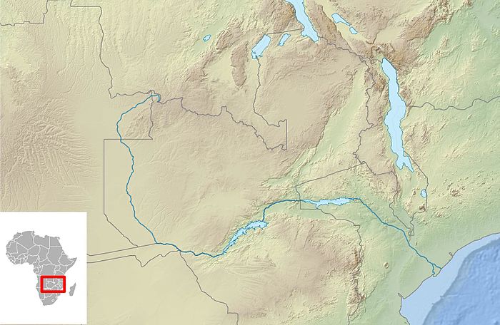
Crossings

Cazombo
Chinyingi Foot
Barotse Causeway
Sioma
Katima Mulilo
Kazungula
Victoria Falls
Kariba
Chirundu
Cahora Bassa
Samora Machel
Kassuende
Dona Ana
Armando Emilio Guebuza
class=notpageimage|
Bridges and other crossings of the Zambezi River| Crossing | Type | Location | Date Opened | State | Coordinates Lat. Long. |
|---|---|---|---|---|---|
Angola | |||||
| Cazombo Bridge | road bridge | Cazombo, Moxico Province | reopened 2008[1] | open | 11°54′22″S 22°49′52″E / 11.90611°S 22.83111°E / -11.90611; 22.83111 |
Zambia | |||||
| Chinyingi Suspension Bridge | foot bridge | Chinyingi, Western Province | 1970s | open | 13°21′08″S 23°0′47″E / 13.35222°S 23.01306°E / -13.35222; 23.01306 |
| Barotse Floodplain Causeway | road bridge | Mongu, Western Province | 2016[2] | open | 15°12′53″S 22°55′34″E / 15.21472°S 22.92611°E / -15.21472; 22.92611 |
| Sioma Bridge | road bridge | Sioma, Western Province | open since April 2016 | open | 16°40′21″S 23°37′39″E / 16.67250°S 23.62750°E / -16.67250; 23.62750 |
Zambia–Namibia | |||||
| Katima Mulilo Bridge | road bridge | Sesheke, Zambia–Katima Mulilo, Namibia | 2004[3][4] | open | 17°28′18″S 24°14′59″E / 17.47167°S 24.24972°E / -17.47167; 24.24972 |
| Kazungula Bridge | road and rail bridge | Kazungula, Zambia–Kazungula, Botswana | 2021 [5] | open | 17°47′27″S 25°15′44″E / 17.79083°S 25.26222°E / -17.79083; 25.26222 |
| Victoria Falls Bridge | road and rail bridge | Livingstone, Zambia–Victoria Falls, Zimbabwe | 1905[6] | open | 17°55′42″S 25°51′25″E / 17.92833°S 25.85694°E / -17.92833; 25.85694 |
| Kariba Dam | road over dam | Siavonga, Zambia–Kariba, Zimbabwe | 1959 | open | 16°31′23″S 28°45′41″E / 16.52306°S 28.76139°E / -16.52306; 28.76139 |
| Chirundu Bridge | two road bridges | Chirundu, Zambia–Chirundu, Zimbabwe | 1938 and 2002 | open | 16°02′18″S 28°51′08″E / 16.03833°S 28.85222°E / -16.03833; 28.85222 |
| Cahora Bassa Dam | road over dam | Tete Province | 1974 | open | 15°35′09″S 32°42′17″E / 15.58583°S 32.70472°E / -15.58583; 32.70472 |
| Samora Machel Bridge | road bridge | Tete–Moatize | 1973[7] | open | 16°10′55″S 33°35′37″E / 16.18194°S 33.59361°E / -16.18194; 33.59361 |
| Kassuende Bridge | road bridge | Benga–Tete | 2014[8] | open | 16°11′32″S 33°37′7″E / 16.19222°S 33.61861°E / -16.19222; 33.61861 |
| Dona Ana Bridge | rail bridge | Vila de Sena–Mutarara | 1935[9] | open | 17°26′21″S 35°03′41″E / 17.43917°S 35.06139°E / -17.43917; 35.06139 |
| Armando Emilio Guebuza Bridge | road bridge | Caia–Chimuara | 2009[10] | open | 17°48′29″S 35°23′51″E / 17.80806°S 35.39750°E / -17.80806; 35.39750 |
References
- ^ "Angola: Bridge over Zambezi river in Angola re-opened". macauhub.com. Macauhub.
- ^ "Zambia : The Mongu-Kalabo road has been completed".
- ^ Zeller, Wolfgang (May 2009). "Danger and Opportunity in Katima Mulilo: A Namibian Border Boomtown at Transnational Crossroads". Journal of Southern African Studies. 35 (1): 133–154. doi:10.1080/03057070802685619. hdl:20.500.11820/e65b3190-e7fa-4fd7-aba5-a15425b94055. S2CID 153640249.
- ^ Dierks, Klaus (6 May 2004). "The History of the Zambezi Bridge from Namibia to Zambia: 1982–2004". klausdierks.com.
- ^ "President tours Kazungula Bridge project". The Herald. Retrieved 2019-05-26.
- ^ "Bridging the Zambezi". sunsteelandspray.com. Sun Steel and Spray. Archived from the original on 2019-10-26. Retrieved 2015-07-30.
- ^ "Samora Machel Bridge". structurae.net. Structurae. Retrieved 30 July 2015.
- ^ "Second bridge over the Zambezi River opens in Mozambique". macauhub.net. Macauhub. Retrieved 30 July 2015.
- ^ "Dona Ana Steel Bridge (between Sena and Mutarara)". hpip.org/. Heritage of Portuguese Influence. Retrieved 30 July 2015.
- ^ "Zambezi Bridge inaugurated". poptel.org.uk. Mozambique News Agency. Archived from the original on 5 October 2019. Retrieved 30 July 2015.


