List of cemeteries in Sonoma County, California
Map all coordinates using OpenStreetMap
Download coordinates as:
- KML
- GPX (all coordinates)
- GPX (primary coordinates)
- GPX (secondary coordinates)
This list of cemeteries in Sonoma County, California includes currently operating, historical (closed for new interments), and defunct (graves abandoned or removed) cemeteries, columbaria, and mausolea in Sonoma County, California. It does not include pet cemeteries. Selected interments are given for notable people.
| Number | Name | City | Image | Type | Notes | Location | References | |
|---|---|---|---|---|---|---|---|---|
| 1 | Annapolis Church Cemetery | Annapolis | Also known as Horicon Cemetery and Mt. Carmel Cemetery.[1] | 38°43′06″N 123°21′37″W / 38.7182399°N 123.3602726°W / 38.7182399; -123.3602726 (Annapolis Church Cemetery) | [2] | |||
| 2 | B'nai Israel Cemetery | Petaluma | 38°14′44″N 122°38′57″W / 38.2454723°N 122.6491530°W / 38.2454723; -122.6491530 (B'nai Israel Cemetery) | [3] | ||||
| 3 | Beeson Cemetery | Geyserville |  | traditional | Also known as Alexander Valley Cemetery.[1] | 38°40′52″N 122°50′00″W / 38.6810215°N 122.8333301°W / 38.6810215; -122.8333301 (Beeson Cemetery) | [4] | |
| 4 | Benitz Ranch Cemetery | Jenner | 38°31′49″N 123°16′09″W / 38.5301907°N 123.2691747°W / 38.5301907; -123.2691747 (Benitz Ranch Cemetery) | [5] | ||||
| 5 | Bennett Valley Cemetery | Santa Rosa | Sonoma County Historic Landmarks and Districts #39 | 38°24′57″N 122°39′41″W / 38.4157455°N 122.6613746°W / 38.4157455; -122.6613746 (Bennett Valley Cemetery) | [6] | |||
| 6 | Beth Ami Cemetery | Santa Rosa | Home of the Eternal Peace Interfaith Cemetery. Part of Santa Rosa Memorial Park. | 38°27′28″N 122°42′25″W / 38.4578600°N 122.7069297°W / 38.4578600; -122.7069297 (Beth Ami Cemetery) | [7] | |||
| 7 | Bloomfield Cemetery | Bloomfield | Sonoma County Historic Landmarks and Districts #151 | 38°18′49″N 122°51′32″W / 38.3135273°N 122.8588827°W / 38.3135273; -122.8588827 (Bloomfield Cemetery) | [8] | |||
| 8 | Bodega Bay Cemetery | Bodega Bay | 38°19′03″N 123°01′32″W / 38.3174170°N 123.0255565°W / 38.3174170; -123.0255565 (Bodega Bay Cemetery) | [9] | ||||
| 9 | Bodega Calvary Cemetery | Bodega | 38°20′31″N 122°58′32″W / 38.3418607°N 122.9755545°W / 38.3418607; -122.9755545 (Bodega Calvary Cemetery) | [10] | ||||
| 10 | Bridgehaven Cemetery | 38°26′02″N 123°06′28″W / 38.4338404°N 123.1078596°W / 38.4338404; -123.1078596 (Bridgehaven Cemetery) | [11] | |||||
| 11 | Buckeye Creek Cemetery | Annapolis | 38°43′53″N 123°25′50″W / 38.7314715°N 123.4306473°W / 38.7314715; -123.4306473 (Buckeye Creek Cemetery) | |||||
| 12 | Calvary Catholic Cemetery | Santa Rosa |  | traditional + colombarium | 38°25′52″N 122°41′09″W / 38.4311766°N 122.6857290°W / 38.4311766; -122.6857290 (Calvary Catholic Cemetery) | [12][13] | ||
| 13 | Canfield Cemetery | Sebastopol | 38°21′05″N 122°48′55″W / 38.3513039°N 122.8152694°W / 38.3513039; -122.8152694 (Canfield Cemetery) | [14] | ||||
| 14 | Chapel of the Chimes | Santa Rosa | 38°24′50″N 122°42′50″W / 38.4138015°N 122.7138761°W / 38.4138015; -122.7138761 (Chapel of the Chimes) | [15] | ||||
| 15 | Cloverdale Cemetery | Cloverdale | 38°48′32″N 123°00′36″W / 38.8087593°N 123.0100939°W / 38.8087593; -123.0100939 (Cloverdale Cemetery) | [16] | ||||
| 16 | Cooper Cemetery | Stewarts Point | 38°36′46″N 123°16′36″W / 38.6126850°N 123.2766614°W / 38.6126850; -123.2766614 (Cooper Cemetery) | [17] | ||||
| 17 | County of Sonoma Cemetery | Santa Rosa |  | graveyard | Entrance is located within the Santa Rosa Rural Cemetery. Enter McDonald Gate, stay to your right till it slopes down to a flat area. Was part of Stanley Cemetery, adjacent to Santa Rosa Rural Cemetery. | 38°27′19″N 122°42′10″W / 38.4552780°N 122.70277°W / 38.4552780; -122.70277 (County of Sonoma Cemetery) | ||
| 18 | Cypress Hill Memorial Park | Petaluma | 38°14′50″N 122°39′06″W / 38.2471389°N 122.6516531°W / 38.2471389; -122.6516531 (Cypress Hill Memorial Park) | [18][19] | ||||
| 19 | Cyrus Alexander Family Cemetery | Healdsburg | 38°39′25″N 122°47′11″W / 38.6568515°N 122.7863788°W / 38.6568515; -122.7863788 (Cyrus Alexander Family Cemetery) | [20] | ||||
| 20 | Druids Occidental Cemetery | Occidental | 38°24′36″N 122°56′32″W / 38.4099145°N 122.9422193°W / 38.4099145; -122.9422193 (Druids Occidental Cemetery) | [21] | ||||
| 21 | Duncans Mills Cemetery | Duncans Mills | 38°27′33″N 123°03′18″W / 38.4590807°N 123.0550013°W / 38.4590807; -123.0550013 (Duncans Mills Cemetery) | [22] | ||||
| 22 | Eldridge Cemetery | 38°20′38″N 122°31′13″W / 38.3437970°N 122.5202467°W / 38.3437970; -122.5202467 (Eldridge Cemetery) | [23] | |||||
| 23 | Evergreen Cemetery | Kellogg | 38°38′10″N 122°40′49″W / 38.6360188°N 122.6802649°W / 38.6360188; -122.6802649 (Evergreen Cemetery) | [24] | ||||
| 24 | Faught Cemetery | Santa Rosa | 38°31′07″N 122°45′27″W / 38.5186228°N 122.7573708°W / 38.5186228; -122.7573708 (Faught Cemetery) | [25] | ||||
| 25 | Forestview Cemetery | Forestville |  | 38°28′06″N 122°53′00″W / 38.4682459°N 122.8833273°W / 38.4682459; -122.8833273 (Forestview Cemetery) | [26] | |||
| 26 | Fort Ross State Historic Park Cemetery | Jenner | 38°30′53″N 123°14′24″W / 38.5147490°N 123.24001°W / 38.5147490; -123.24001 (Fort Ross State Historic Park Cemetery) | |||||
| 27 | Fulton Cemetery | Fulton |  | 38°29′20″N 122°46′43″W / 38.4888000°N 122.7786001°W / 38.4888000; -122.7786001 (Fulton Cemetery) | [27][28] | |||
| 28 | Gilliam Cemetery | Sebastopol | Sometimes identified as in Graton. | 38°25′53″N 122°52′52″W / 38.4313024°N 122.8811052°W / 38.4313024; -122.8811052 (Gilliam Cemetery) | [29][30] | |||
| 29 | Green Valley Cemetery | Sebastopol | Sometimes identified as in Green Valley. Originally associated with the Green Valley Methodist Church. | 38°26′32″N 122°53′11″W / 38.4421355°N 122.8863832°W / 38.4421355; -122.8863832 (Green Valley Cemetery) | [31][32] | |||
| 30 | Hall Cemetery | Healdsburg | 38°39′40″N 122°51′36″W / 38.6610210°N 122.8599949°W / 38.6610210; -122.8599949 (Hall Cemetery) | [33] | ||||
| 31 | Jack London State Historic Park Cemetery | Glen Ellen | 38°21′14″N 122°32′12″W / 38.3538000°N 122.53670°W / 38.3538000; -122.53670 (Jack London State Historic Park Cemetery) | |||||
| 32 | Jess Stonestreet Jackson Jr. Cemetery | Healdsburg | Private cemetery located north of Stonestreet Winery | 38°42′56″N 122°48′02″W / 38.715427°N 122.800582°W / 38.715427; -122.800582 Flagpole visible in March 2015 imagery. | [34] | |||
| 33 | Liberty Cemetery | Petaluma | Sonoma County landmarks #160 | 38°16′43″N 122°42′18″W / 38.2785540°N 122.7049597°W / 38.2785540; -122.7049597 (Liberty Cemetery) | [35] | |||
| 34 | Long Ranch Family Cemetery | Healdsburg | 38°40′21″N 122°52′54″W / 38.6725528°N 122.8816394°W / 38.6725528; -122.8816394 (Long Ranch Family Cemetery) | [36] | ||||
| 35 | Luther Burbank Memorial Home and Gardens Cemetery | Santa Rosa | 38°26′08″N 122°42′42″W / 38.4355810°N 122.71180°W / 38.4355810; -122.71180 (Luther Burbank Memorial Home and Gardens Cemetery) | [37] | ||||
| 36 | Macedonia Cemetery | Sebastopol | 38°21′34″N 122°46′22″W / 38.3593588°N 122.7727674°W / 38.3593588; -122.7727674 (Macedonia Cemetery)[1] | [38] | ||||
| 37 | McPeak Cemetery | Hacienda |  | traditional | 38°30′35″N 122°55′41″W / 38.5098191°N 122.9280933°W / 38.5098191; -122.9280933 (McPeak Cemetery) | [39] | ||
| 38 | Mission San Francisco Solano Cemetery | Sonoma | 38°17′42″N 122°27′20″W / 38.29491°N 122.45554°W / 38.29491; -122.45554 (Mission San Francisco Solano) | [40][41] | ||||
| 39 | Oak Mound Cemetery | Healdsburg |  | 38°36′59″N 122°51′32″W / 38.6162970°N 122.8588806°W / 38.6162970; -122.8588806 (Oak Mound Cemetery) | [42] | |||
| 40 | Old County Cemetery | Santa Rosa | Also known as Chanate Historic Cemetery | 38°28′01″N 122°42′30″W / 38.4669991°N 122.70839°W / 38.4669991; -122.70839 (Old County Cemetery) | ||||
| 41 | Olive Hill Cemetery | Healdsburg | 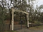 | 38°42′30″N 122°55′27″W / 38.7082432°N 122.9241657°W / 38.7082432; -122.9241657 (Olive Hill Cemetery) | [43] | |||
| 42 | Pleasant Hills Memorial Park | Sebastopol | 38°22′47″N 122°50′07″W / 38.3796366°N 122.8352702°W / 38.3796366; -122.8352702 (Pleasant Hills Memorial Park) | [44] | ||||
| 43 | Pythian Home Cemetery | Kenwood | 38°26′36″N 122°34′50″W / 38.4433580°N 122.5806907°W / 38.4433580; -122.5806907 (Pythian Home Cemetery) | [45] | ||||
| 44 | Redwood Memorial Gardens | Guerneville | 38°30′29″N 122°59′32″W / 38.5079685°N 122.9922211°W / 38.5079685; -122.9922211 (Redwood Memorial Gardens) | [46][47] | ||||
| 45 | Riverside Cemetery | Cloverdale | [48] | |||||
| 46 | Rouff–Thomas Cemetery | Cloverdale | 38°32′26″N 123°17′10″W / 38.5404637°N 123.2861059°W / 38.5404637; -123.2861059 (Rouff–Thomas Cemetery) | [49] | ||||
| 47 | Saint Catherine's Church Cemetery | Monte Rio | 38°28′09″N 123°00′38″W / 38.4691010°N 123.01049°W / 38.4691010; -123.01049 (Saint Catherine's Church Cemetery) | |||||
| 48 | Saint Francis Solano Catholic Cemetery | Sonoma | 38°17′28″N 122°26′46″W / 38.2910259°N 122.4460927°W / 38.2910259; -122.4460927 (Saint Francis Solano Catholic Cemetery) | [50] | ||||
| 49 | Santa Rosa Memorial Park Cemetery | Santa Rosa | lawn + mausaleums | 38°27′35″N 122°42′21″W / 38.4598009°N 122.7058992°W / 38.4598009; -122.7058992 (Santa Rosa Memorial Park) | [51][52] | |||
| 50 | Santa Rosa Odd Fellows Cemetery | Santa Rosa | traditional | Now managed by Santa Rosa Memorial Park. | 38°27′25″N 122°42′22″W / 38.4570300°N 122.7061787°W / 38.4570300; -122.7061787 (Santa Rosa Odd Fellows Cemetery) | [53][54] | ||
| 51 | Santa Rosa Rural Cemetery | Santa Rosa |  | rural | Santa Rosa Rural Cemetery has two entrances: the McDonald Entrance (main entrance) and the Franklin Gate Entrance. The Fulkerson Cemetery[55] and Moke Cemetery are within.[56] | 38°27′20″N 122°42′17″W / 38.4556233°N 122.7047218°W / 38.4556233; -122.7047218 (Santa Rosa Rural Cemetery) | [51][57][58] | |
| 52 | Seaview Cemetery | Seaview | 38°32′36″N 123°13′27″W / 38.5432459°N 123.2241736°W / 38.5432459; -123.2241736 (Seaview Cemetery) | [59] | ||||
| 53 | Sebastopol Memorial Lawn Cemetery | Sebastopol | lawn + traditional | 38°23′51″N 122°50′13″W / 38.3974140°N 122.8369367°W / 38.3974140; -122.8369367 (Sebastopol Memorial Lawn Cemetery) | [60] | |||
| 54 | Sharp Creek Cemetery | Santa Rosa | Also known as Oak Knoll Cemetery and Sharp Cemetery[1] | 38°33′02″N 122°40′17″W / 38.5505981°N 122.67130°W / 38.5505981; -122.67130 (Sharp Creek Cemetery) | ||||
| 55 | Shiloh Cemetery | Windsor | 38°31′32″N 122°48′55″W / 38.5254660°N 122.8152716°W / 38.5254660; -122.8152716 (Shiloh Cemetery) | [61] | ||||
| 56 | Sonoma Mountain Cemetery | Sonoma | Notable burial: Mariano Guadalupe Vallejo | 38°18′00″N 122°27′22″W / 38.3001163°N 122.4561024°W / 38.3001163; -122.4561024 (Mountain Cemetery) | [62][63] | |||
| 57 | Sonoma State Home Cemetery | Eldridge | Sonoma County Historic Landmarks and Districts #38 | 38°20′50″N 122°31′07″W / 38.34713°N 122.51859°W / 38.34713; -122.51859 (Sonoma State Home) | [64] | |||
| 58 | Spring Hill Cemetery | Sebastopol | 38°23′49″N 122°51′51″W / 38.3968540°N 122.8641466°W / 38.3968540; -122.8641466 (Spring Hill Cemetery) | [65] | ||||
| 59 | Stanley Cemetery | Santa Rosa | 38°27′21″N 122°42′18″W / 38.4557724°N 122.7049417°W / 38.4557724; -122.7049417 (Stanley Cemetery) | [66] | ||||
| 60 | Steele Family Cemetery | Santa Rosa |  | 38°27′08″N 122°48′24″W / 38.4522394°N 122.8065339°W / 38.4522394; -122.8065339 (Steele Family Cemetery) | [67] | |||
| 61 | Stewarts Point Cemetery | Stewarts Point | 38°39′00″N 123°23′47″W / 38.6499077°N 123.3963843°W / 38.6499077; -123.3963843 (Stewarts Point Cemetery) | [68] | ||||
| 62 | Sugarloaf Cemetery | Annapolis | 38°39′14″N 123°15′53″W / 38.6537955°N 123.2647168°W / 38.6537955; -123.2647168 (Sugarloaf Cemetery) | [69] | ||||
| 63 | Two Rock Presbyterian Church Cemetery | Two Rock | Sonoma County Historic Landmarks and Districts #158. Also known as the Presbyterian Church Cemetery. | 38°15′24″N 122°46′47″W / 38.2566572°N 122.7795849°W / 38.2566572; -122.7795849 (Two Rock Presbyterian Church Cemetery) | [70] | |||
| 64 | Valley Cemetery | Sonoma | 38°17′00″N 122°27′02″W / 38.2833492°N 122.4505985°W / 38.2833492; -122.4505985 (Sonoma Valley Cemetery) | [71][72] | ||||
| 65 | Veterans Memorial Park Cemetery | Sonoma | 38°17′57″N 122°27′24″W / 38.299279°N 122.456639°W / 38.299279; -122.456639 (Veterans Memorial Park Cemetery) | [73] |
See also
 Lists portal

Footnotes
- ^ a b c d Nichols, Jeremy Dwight (2008) [2002]. Cemeteries of Sonoma County, California: A History and Guide. Bowie, MD: Heritage Books. pp. 4, 57, 60. ISBN 978-0788422690. OCLC 52204884.
- ^ U.S. Geological Survey Geographic Names Information System: Annapolis Church Cemetery
- ^ U.S. Geological Survey Geographic Names Information System: B'nai Israel Cemetery
- ^ U.S. Geological Survey Geographic Names Information System: Beeson Cemetery
- ^ U.S. Geological Survey Geographic Names Information System: Benitz Ranch Cemetery
- ^ U.S. Geological Survey Geographic Names Information System: Bennett Valley Cemetery
- ^ U.S. Geological Survey Geographic Names Information System: Beth Ami Cemetery
- ^ U.S. Geological Survey Geographic Names Information System: Bloomfield Cemetery
- ^ U.S. Geological Survey Geographic Names Information System: Bodega Bay Cemetery
- ^ U.S. Geological Survey Geographic Names Information System: Bodega Calvary Cemetery
- ^ U.S. Geological Survey Geographic Names Information System: Bridgehaven Cemetery
- ^ U.S. Geological Survey Geographic Names Information System: Calvary Catholic Cemetery
- ^ "Calvary Catholic Cemetery in Santa Rosa, California – Diocese of Santa Rosa". www.catholiccemeteries-dsr.org.
- ^ U.S. Geological Survey Geographic Names Information System: Canfield Cemetery
- ^ U.S. Geological Survey Geographic Names Information System: Chapel of the Chimes Cemetery
- ^ U.S. Geological Survey Geographic Names Information System: Cloverdale Cemetery
- ^ U.S. Geological Survey Geographic Names Information System: Cooper Cemetery
- ^ "Cypress Hill Memorial Park, Petaluma, CA". www.cypresshillmemorialpark.com.
- ^ U.S. Geological Survey Geographic Names Information System: Cypress Hill Memorial Park
- ^ U.S. Geological Survey Geographic Names Information System: Cyrus Alexander Family. Cemetery
- ^ U.S. Geological Survey Geographic Names Information System: Druids Occidental Cemetery
- ^ U.S. Geological Survey Geographic Names Information System: Duncans Mills Cemetery
- ^ U.S. Geological Survey Geographic Names Information System: Eldridge Cemetery
- ^ U.S. Geological Survey Geographic Names Information System: Evergreen Cemetery
- ^ U.S. Geological Survey Geographic Names Information System: Faught Cemetery
- ^ U.S. Geological Survey Geographic Names Information System: Forestview Cemetery
- ^ Fulton Cemetery, interment.net
- ^ U.S. Geological Survey Geographic Names Information System: Fulton Cemetery
- ^ Gilliam Cemetery, interment.net
- ^ U.S. Geological Survey Geographic Names Information System: Gilliam Cemetery
- ^ "Methodist Church and parsonage at Green Valley built on Sullivan land in 1899". digital.sonomalibrary.org.
- ^ U.S. Geological Survey Geographic Names Information System: List of cemeteries in Sonoma County, California [dead link]
- ^ U.S. Geological Survey Geographic Names Information System: Hall Cemetery
- ^ Coursey, Chris (March 27, 2013). "Burial laws are easy to break". Santa Rosa Press Democrat. Retrieved 2021-01-02.
- ^ U.S. Geological Survey Geographic Names Information System: Liberty Cemetery
- ^ U.S. Geological Survey Geographic Names Information System: Long Ranch Family Cemetery
- ^ Luther Burbank Home & Gardens, LutherBurbank.org
- ^ U.S. Geological Survey Geographic Names Information System: Macedonia Cemetery
- ^ U.S. Geological Survey Geographic Names Information System: McPeak Cemetery
- ^ Official Sonoma State Historic Park website
- ^ U.S. Geological Survey Geographic Names Information System: Mission San Francisco Solano
- ^ U.S. Geological Survey Geographic Names Information System: Oak Mound Cemetery
- ^ U.S. Geological Survey Geographic Names Information System: Olive Hill Cemetery
- ^ U.S. Geological Survey Geographic Names Information System: Pleasant Hills Memorial Park
- ^ U.S. Geological Survey Geographic Names Information System: Pythian Home Cemetery
- ^ U.S. Geological Survey Geographic Names Information System: Redwood Memorial Gardens
- ^ "Redwood Memorial Gardens". www.uscemeteryproj.com.
- ^ "Cloverdale Cemetery". 30 January 2015. Archived from the original on 30 January 2015.
- ^ U.S. Geological Survey Geographic Names Information System: Ruoff–Thomas Cemetery
- ^ U.S. Geological Survey Geographic Names Information System: Saint Francis Solano Catholic Cemetery
- ^ a b U.S. Geological Survey Geographic Names Information System: Santa Rosa Memorial Park
- ^ "Santa Rosa Memorial Park". www.srmp.org.
- ^ U.S. Geological Survey Geographic Names Information System: Santa Rosa Odd Fellows Cemetery
- ^ "Odd Fellows Cemetery Association". Retrieved 2021-01-01.
- ^ 38°27′21″N 122°42′18″W / 38.4557979°N 122.7051106°W / 38.4557979; -122.7051106 (Fulkerson Cemetery) – U.S. Geological Survey Geographic Names Information System: Fulkerson Cemetery
- ^ Nichols, Jeremy Dwight (2008). Cemeteries of Sonoma County California: A History and Guide. Heritage Books. p. ix.
- ^ srcity.org Archived 2015-03-02 at the Wayback Machine[dead link]
- ^ U.S. Geological Survey Geographic Names Information System: Santa Rosa Rural Cemetery
- ^ U.S. Geological Survey Geographic Names Information System: Seaview Cemetery
- ^ U.S. Geological Survey Geographic Names Information System: Sebastopol Memorial Lawn Cemetery
- ^ U.S. Geological Survey Geographic Names Information System: Shiloh Cemetery
- ^ U.S. Geological Survey Geographic Names Information System: Mountain Cemetery
- ^ "Mountain Cemetery". City of Sonoma.
- ^ U.S. Geological Survey Geographic Names Information System: Sonoma State Home
- ^ U.S. Geological Survey Geographic Names Information System: Spring Hill Cemetery
- ^ U.S. Geological Survey Geographic Names Information System: Stanley Cemetery
- ^ U.S. Geological Survey Geographic Names Information System: Steele Family Cemetery
- ^ U.S. Geological Survey Geographic Names Information System: Stewarts Point Cemetery
- ^ U.S. Geological Survey Geographic Names Information System: Sugarloaf Cemetery
- ^ U.S. Geological Survey Geographic Names Information System: Two Rock Presbyterian Church Cemetery
- ^ U.S. Geological Survey Geographic Names Information System: Valley Cemetery
- ^ "Valley Cemetery". City of Sonoma.
- ^ "Veterans' Cemetery". City of Sonoma.
Further reading
- Sonoma County Genealogical Society, Inc. (2012) [1999]. Sonoma County, California Cemetery Records 1846–1921 (3rd ed.). Santa Rosa, CA & Westminster, MD: Heritage Books. ISBN 978-0788412080. OCLC 144674262.
- Sonoma County Genealogical Society, Inc. (2015). Burial of Indigents Sonoma County, California, 1937–1967. Santa Rosa, CA & Raleigh, NC: Lulu. ISBN 978-1329530898. OCLC 960238152.
- Culbertson, Judi; Randall, Tom (1989). Permanent Californians: an illustrated guide to the cemeteries of California. Chelsea, VT: Chelsea Green. ISBN 978-0930031213. OCLC 19322965.
- Brooks, Patricia; Brooks, Jonathan (2006). Laid to Rest in California: a guide to the cemeteries and grave sites of the rich and famous. Guilford, CT: Globe Pequot Press. ISBN 978-0762741014. OCLC 70284362.
External links
- Sonoma County cemeteries at Find a Grave
- Sonoma County at Histopolis
- v
- t
- e
- Alabama
- Alaska
- Arizona
- Arkansas
- California
- Riverside County
- San Bernardino County
- San Diego
- Sonoma County
- Colorado
- Connecticut
- Delaware
- Florida
- Georgia
- Hawaii
- Idaho
- (A–L)
- (M–Z)
- Illinois
- Indiana
- Iowa
- Kansas
- Kentucky
- Louisiana
- Maine
- Maryland
- Massachusetts
- Michigan
- Minnesota
- Mississippi
- Missouri
- Montana
- Nebraska
- Nevada
- New Hampshire
- New Jersey
- New Mexico
- New York
- North Carolina
- North Dakota
- Ohio
- Oklahoma
- Oregon
- Pennsylvania
- Rhode Island
- South Carolina
- South Dakota
- Tennessee
- Texas
- Utah
- Vermont
- Virginia
- Washington
- West Virginia
- Wisconsin
- Wyoming
- Washington, D.C.
- American Samoa
- Guam
- Northern Mariana Islands
- Puerto Rico
- U.S. Virgin Islands


