| Site name | Photograph | B | G | Area[a] | Public access | Location[a] | Other classifications | Map[b] | Citation[c] | Description |
| Alex Farm Pastures |  |  Y Y | | 4.5 hectares
(11 acres)[6] | NO | Ashford
51°05′49″N 0°48′22″E / 51.097°N 0.806°E / 51.097; 0.806 (Alex Farm Pastures)
TQ 966 368[6] | | Map | Citation | This site has unimproved neutral grassland, which is a nationally rare habitat. Some of it has been lost to scrub, but in other areas it is maintained by rabbit grazing. There are several uncommon butterflies, including the nationally scarce pearl-bordered fritillary and small pearl-bordered fritillary.[7] |
| Alkham, Lydden and Swingfield Woods |  | Y | | 228.3 hectares
(564 acres)[8] | PP | Dover
51°08′53″N 1°13′48″E / 51.148°N 1.23°E / 51.148; 1.23 (Alkham, Lydden and Swingfield Woods)
TR 260 437[8] | NCR[9] | Map | Citation | This site is composed of several steeply sloping woods on chalk soil, together with an area of chalk grassland. The ground flora is diverse, including some unusual plants such as lady orchid in the woods and burnt orchid in the meadow.[10] |
| Allington Quarry |  | | Y | 0.8 hectares
(2.0 acres)[11] | NO | Maidstone
51°17′24″N 0°29′53″E / 51.29°N 0.498°E / 51.29; 0.498 (Allington Quarry)
TQ 743 575[11] | GCR[12] | Map | Citation | This Pleistocene site has an extensive section through gulls (cracks in the rock) which are filled with loess. These were probably produced by seasonal freezing and thawing during the last ice age.[13] |
| Aylesford Pit |  | | Y | 1.5 hectares
(3.7 acres)[14] | NO | Aylesford
51°18′29″N 0°28′52″E / 51.308°N 0.481°E / 51.308; 0.481 (Aylesford Pit)
TQ 730 595[14] | GCR[15] | Map | Citation | This Pleistocene site in the terrace of the River Medway has yielded many mammalian bones and paleolithic artefacts, but its geographical isolation from the main Thames sequence makes precise correlation of Aylesford rocks with those laid down at the same time in Thames sites uncertain.[16] |
| Baker's Hole |  | | Y | 6.9 hectares
(17 acres)[17] | NO | Swanscombe
51°26′38″N 0°19′01″E / 51.444°N 0.317°E / 51.444; 0.317 (Baker's Hole)
TQ 611 742[17] | GCR[18] | Map | Citation | This internationally renowned site has yielded the largest number of stone tools and flakes in Britain dating to the Early Middle Paleolithic (325,000 to 180,000 year ago). Most of them were produced by Neanderthals using the Levallois technique.[19][20] |
| Bourne Alder Carr |  | Y | | 13.5 hectares
(33 acres)[21] | PP | Sevenoaks
51°16′16″N 0°18′04″E / 51.271°N 0.301°E / 51.271; 0.301 (Bourne Alder Carr)
TQ 606 549[21] | | Map | Citation | The River Bourne runs through a shallow valley, and frequent flushing of the woodland on the banks with water rich in nutrients creates a rich ground flora. There is also an area of swamp around a fish pond.[22] |
| Brookland Wood |  | Y | | 10.9 hectares
(27 acres)[23] | PP | Tunbridge Wells
51°07′26″N 0°22′16″E / 51.124°N 0.371°E / 51.124; 0.371 (Brookland Wood)
TQ 660 387[23] | | Map | Citation | This site has diverse types of woodland and ground flora. Alder is dominant in wet areas and hazel, ash and field maple in drier ones. Small streams have a variety of mosses and liverworts.[24] |
| Charing Beech Hangers |  | Y | | 52.6 hectares
(130 acres)[25] | PP | Ashford
51°12′04″N 0°49′52″E / 51.201°N 0.831°E / 51.201; 0.831 (Charing Beech Hangers)
TQ 979 484[25] | | Map | Citation | This steeply sloping site has mature beech and oak, and the ground flora is varied with some uncommon species. Invertebrates include the rare slug Limax tenellus and several scarce moths.[26] |
| Chattenden Woods and Lodge Hill |  | Y | | 351.0 hectares
(867 acres)[27] | PP | Rochester
51°25′55″N 0°31′30″E / 51.432°N 0.525°E / 51.432; 0.525 (Chattenden Woods and Lodge Hill)
TQ 756 734[27] | | Map | Citation | This site has diverse habitats, including ancient semi-natural woodland, grassland and scrub. There are nationally important numbers of nightingales in the woods and scrub during the breeding season, and invertebrates include nationally scarce moths.[28] |
| Chequer's Wood and Old Park |  | Y | Y | 106.9 hectares
(264 acres)[29] | NO | Canterbury
51°17′06″N 1°06′54″E / 51.285°N 1.115°E / 51.285; 1.115 (Chequer's Wood and Old Park)
TR 173 586[29] | GCR[30] | Map | Citation | This site includes Fordwich Pit, which has yielded a large collection of early Acheulian handaxes, between 550,000 and 300,000 old. Habitats include alder wood in a valley bottom, acidic grassland on dry sandy soil, oak and birch woodland, scrub and a pond.[31][32] |
| Church Woods, Blean |  | Y | | 526.7 hectares
(1,302 acres)[33] | YES | Canterbury
51°18′04″N 1°00′54″E / 51.301°N 1.015°E / 51.301; 1.015 (Church Woods, Blean)
TR 103 601[33] | NCR,[34] NNR,[35][36] RSPB,[37] SAC[38] | Map | Citation | This broadleaved coppice with standards wood has a diverse range of trees, a rich ground flora, a wide variety of birds and many uncommon invertebrates, including the nationally rare heath fritillary butterfly.[39] |
| Cobham Woods |  | Y | | 242.7 hectares
(600 acres)[40] | YES | Rochester
51°23′17″N 0°26′20″E / 51.388°N 0.439°E / 51.388; 0.439 (Cobham Woods)
TQ 698 683[40] | AONB,[41] NT[42] | Map | Citation | These woods are partly on acidic Thanet Sands and partly on chalk soils. There is also an area of arable land which has some uncommon plants, including the very rare and protected rough marsh-mallow, which has been recorded on the site since 1792.[43] |
| Combwell Wood |  | Y | | 110.6 hectares
(273 acres)[44] | FP | Cranbrook
51°04′52″N 0°26′02″E / 51.081°N 0.434°E / 51.081; 0.434 (Combwell Wood)
TQ 706 341[44] | AONB[45] | Map | Citation | Much of this ancient wood has traditionally been coppiced, but there has probably been undisturbed woodland on steep slopes, and uncommon bryophytes here are thought to be survivors from the Atlantic warm period around 5,000 years ago. There are also several nationally scarce water beetles.[46] |
| Cowden Meadow |  | Y | | 1.1 hectares
(2.7 acres)[47] | FP | Edenbridge
51°09′11″N 0°06′54″E / 51.153°N 0.115°E / 51.153; 0.115 (Cowden Meadow)
TQ 480 414[47] | | Map | Citation | This site has flora which are found on grassland sites which have not been cultivated for many years, such as quaking grass, oxeye daisy and pepper saxifrage. Wetter areas are dominated by hard rush.[48] |
| Cowden Pound Pastures |  | Y | | 5.9 hectares
(15 acres)[49] | NO | Edenbridge
51°10′08″N 0°05′10″E / 51.169°N 0.086°E / 51.169; 0.086 (Cowden Pound Pastures)
TQ 459 432[49] | KWT[50] | Map | Citation | This is unimproved neutral grassland, which is a nationally rare habitat, and it is grazed to prevent scrub invading the pasture. Grasses include crested dog's tail and common knapweed, and an area of wet grassland by a stream has jointed rush and water mint.[51] |
| Dalham Farm |  | | Y | 8.8 hectares
(22 acres)[52] | PP | Rochester
51°26′56″N 0°33′25″E / 51.449°N 0.557°E / 51.449; 0.557 (Dalham Farm)
TQ 778 753[52] | GCR[53] | Map | Citation | The farm shows mass movement of rock and soil on a shallow 8% slope of London Clay, which is seen in ridges across the site. It may be the lowest angled slope failure in Britain, and is important in demonstrating slope degradation where there is no coastal erosion.[54] |
| Darenth Wood |  | Y | | 122.9 hectares
(304 acres)[55] | YES | Dartford
51°25′34″N 0°16′01″E / 51.426°N 0.267°E / 51.426; 0.267 (Darenth Wood)
TQ 577 721[55] | | Map | Citation | This ancient semi-natural wood has many rare invertebrates, including thirty-two which are nationally scarce and two which are nationally rare: these are beetles which live in dead and dying oak timber, Grilis pannonicus and Platypus cylindricus.[56] |
| Dover to Kingsdown Cliffs |  | Y | Y | 207.7 hectares
(513 acres)[57] | YES | Dover
51°08′46″N 1°22′16″E / 51.146°N 1.371°E / 51.146; 1.371 (Dover to Kingsdown Cliffs)
TR 359 439[57] | GCR,[58] NT,[59] SAC[60] | Map | Citation | The cliffs expose fossiliferous rocks dating to 99 and 86 million years ago, during the Late Cretaceous, which are historically important as many geological principles were tested there. The cliffs have many breeding sea birds, and there are diverse algae on the foreshore.[61] |
| Down Bank |  | Y | | 5.9 hectares
(15 acres)[62] | FP | Canterbury
51°13′48″N 0°58′55″E / 51.23°N 0.982°E / 51.23; 0.982 (Down Bank)
TR 083 521[62] | | Map | Citation | This sloping chalk meadow has the nationally endangered black-veined moth and twenty-eight species of butterfly, including the nationally scarce Duke of Burgundy. Grassland flora include two nationally scarce species, small bedstraw and man orchid.[63] |
| Dryhill |  | | Y | 11.7 hectares
(29 acres)[64] | YES | Sevenoaks
51°16′34″N 0°08′56″E / 51.276°N 0.149°E / 51.276; 0.149 (Dryhill)
TQ 500 552[64] | GCR,[65] LNR[66] | Map | Citation | This former quarry exposes rocks dating to the Aptian stage in the early Cretaceous, around 120 million years ago. It is famous for its rich and diverse brachiopod and bivalve fossils, which are important for palaeoecological research.[67] |
| Dungeness, Romney Marsh and Rye Bay |  | Y | Y | 10,172.9 hectares
(25,138 acres)[68] | PP | Romney Marsh
50°56′46″N 0°51′25″E / 50.946°N 0.857°E / 50.946; 0.857 (Dungeness, Romney Marsh and Rye Bay)
TR 008 202[68] | AONB,[68] GCR,[69] KWT,[70] LNR,[71] NNR,[36][72] Ramsar,[73] RSPB,[74] SAC,[75] SPA[76] | Map[d] | Citation | Nationally important habitats in this site are saltmarsh, sand dunes, vegetated shingle, saline lagoons, standing waters, lowland ditch systems, and basin fens, and it has many rare and endangered species of fauna and flora. It is geologically important as its deposits display the chronology of coastal evolution.[77] |
| East Blean Woods |  | Y | | 151.3 hectares
(374 acres)[78] | YES | Canterbury
51°20′06″N 1°08′24″E / 51.335°N 1.14°E / 51.335; 1.14 (East Blean Woods)
TR 188 642[78] | KWT,[79] NCR,[34] NNR[35][36] SAC[38] | Map | Citation | This site has mixed coppice with some mature oaks. Insects include the rare and protected heath fritillary butterfly, and there is a wide variety of woodland birds.[80] |
| Ellenden Wood |  | Y | | 90.6 hectares
(224 acres)[81] | YES | Whitstable
51°19′19″N 1°00′50″E / 51.322°N 1.014°E / 51.322; 1.014 (Ellenden Wood)
TR 101 624[81] | NCR,[82] SAC[38] | Map | Citation | This wood has diverse flora with over 250 species of vascular plants and 300 of fungi. Insects include 3 species which are nationally rare, and there are mammals such as wood mice, dormice and two species of shrew.[83] |
| Farningham Wood |  | Y | | 74.2 hectares
(183 acres)[84] | YES | Dartford
51°23′28″N 0°12′47″E / 51.391°N 0.213°E / 51.391; 0.213 (Farningham Wood)
TQ 541 681[84] | LNR[85] | Map | Citation | This wood has a variety of soil conditions, resulting in diverse ground flora and invertebrates, some of which are typical ancient woodland. Ponds in the middle support several species of amphibian, and the nationally rare hoverfly Volucella inanis has been recorded on the site.[86] |
| Folkestone to Etchinghill Escarpment |  | Y | Y | 263.2 hectares
(650 acres)[87] | PP | Folkestone
51°06′11″N 1°07′48″E / 51.103°N 1.13°E / 51.103; 1.13 (Folkestone to Etchinghill Escarpment)
TR 192 384[87] | GCR,[88][89] NCR,[90] SAC[91] | Map | Citation | A large area of chalk grassland has three nationally rare plants, late spider orchid, early spider orchid and bedstraw broomrape. Asholt Wood has outstanding lichen flora. The site also includes Holywell Coombe, a key geological site displaying the sequence of mollusc fossils in the late Pleistocene and Holocene.[92] |
| Folkestone Warren |  | Y | Y | 316.3 hectares
(782 acres)[93] | PP | Folkestone
51°05′56″N 1°14′13″E / 51.099°N 1.237°E / 51.099; 1.237 (Folkestone Warren)
TR 267 383[93] | GCR,[58][94][95][96] LNR,[97] NCR[98] | Map | Citation | These chalk cliffs have several nationally rare plants and they provide a location for cliff nesting and wintering birds. The SSSI also contains two internationally important reference sites for study of the Cretaceous period.[99] |
| Gibbin's Brook |  | Y | | 16.8 hectares
(42 acres)[100] | YES | Ashford
51°06′25″N 1°01′16″E / 51.107°N 1.021°E / 51.107; 1.021 (Gibbin's Brook)
TR 116 385[100] | | Map | Citation | This site is mainly marshy grassland, but it also has a stream, a pond and small areas of bog and dry acidic grassland. It is notable for its invertebrates, especially moths.[101] |
| Great Crabbles Wood |  | Y | | 33.0 hectares
(82 acres)[102] | YES | Gravesend
51°24′22″N 0°26′46″E / 51.406°N 0.446°E / 51.406; 0.446 (Great Crabbles Wood)
TQ 702 703[102] | | Map | Citation | Most of the wood is mixed coppice, with sweet chestnut dominant and oak standards. There are scarce flora such as lady and man and bird's nest orchids, white helleborine and wild liquorice.[103] |
| Great Shuttlesfield Down |  | Y | | 21.8 hectares
(54 acres)[104] | FP | Folkestone
51°07′34″N 1°06′29″E / 51.126°N 1.108°E / 51.126; 1.108 (Great Shuttlesfield Down)
TR 176 409[104] | | Map | Citation | This unimproved grassland is dominated by sheep's fescue, upright brome and tor-grass, and it is grazed by sheep and cattle. Notable invertebrates are the rare adonis blue butterfly and two solitary wasps, Crossocerus cetratus and Crossocerus styrius.[105] |
| Greatness Brickworks |  | | Y | 7.8 hectares
(19 acres)[106] | NO | Sevenoaks
51°17′53″N 0°12′00″E / 51.298°N 0.200°E / 51.298; 0.200 (Greatness Brickworks)
TQ 535 577[106] | GCR,[107] | Map | Citation | This Cretaceous site is highly fossiliferous, with many ammonites. It is described by Natural England as "of vital importance in biostratigraphic research on the Gault of the Weald".[108] |
| Halling to Trottiscliffe Escarpment |  | Y | | 600.6 hectares
(1,484 acres)[109] | PP | Rochester
51°21′00″N 0°24′14″E / 51.350°N 0.404°E / 51.350; 0.404 (Halling to Trottiscliffe Escarpment)
TQ 675 640[109] | NCR,[110] SAC[111] | Map | Citation | This site on the North Downs has grassland and beech woodland on chalk soil. It is entomologically important, with uncommon insects such as the bug Psylla viburni, and it is the only known location in Britain for the moth Hypercallia citrinalis.[112] |
| Ham Street Woods |  | Y | | 175.2 hectares
(433 acres)[113] | YES | Ashford
51°04′23″N 0°51′58″E / 51.073°N 0.866°E / 51.073; 0.866 (Ham Street Woods)
TR 009 343[113] | NCR,[114] NNR[36][115] | Map | Citation | This semi-natural wood is more than 400 years old, and it has rich and diverse invertebrates, including 12 rare or scarce dead wood species, such as the nationally rare beetle, Tomoxia biguttata.[116] |
| Hart Hill |  | | Y | 1.4 hectares
(3.5 acres)[117] | NO | Ashford
51°13′19″N 0°46′48″E / 51.222°N 0.780°E / 51.222; 0.780 (Hart Hill)
TQ 942 506[117] | GCR[118] | Map | Citation | This site is controversial as it exposes the Lenham Beds, the date of which have been disputed, but they are now thought to be Pliocene on the basis of their marine bivalves and gastropods.[119] |
| Hatch Park |  | Y | | 71.8 hectares
(177 acres)[120] | NO | Ashford
51°07′44″N 0°56′46″E / 51.129°N 0.946°E / 51.129; 0.946 (Hatch Park)
TR 062 408[120] | RHPG[121] | Map | Citation | This site has species-rich acidic grassland which is the remnant of a larger deer park, and is still managed by a herd of deer. There are also ancient pollard woods which are the richest for epiphytic lichens in the county. Several ponds have adjacent areas of marsh.[122] |
| High Rocks |  | | Y | 3.3 hectares
(8.2 acres)[123] | PP | Tunbridge Wells
51°06′47″N 0°13′34″E / 51.113°N 0.226°E / 51.113; 0.226 (High Rocks)
TQ 559 383[123] | GCR[124] | Map[d] | Citation | This Pleistocene site is described by Natural England as "a key geomorphological site for sandstone weathering features developed on the highest cliffs in the Weald". The Ardingly Sandstone has micro-cracking of unknown origin.[125] |
| Hoad's Wood |  | Y | | 80.5 hectares
(199 acres)[126] | NO | Ashford
51°08′53″N 0°47′24″E / 51.148°N 0.790°E / 51.148; 0.790 (Hoad's Wood)
TQ 952 425[126] | | Map | Citation | This oak and hornbeam wood is outstanding for its insects, especially butterflies and moths, with two which are nationally rare, the broad-bordered beehawk and black-veined moths. There are diverse breeding birds.[127] |
| Holborough to Burham Marshes |  | Y | | 149.8 hectares
(370 acres)[128] | YES | Snodland
51°19′41″N 0°27′22″E / 51.328°N 0.456°E / 51.328; 0.456 (Holborough to Burham Marshes)
TQ 712 616[128] | KWT[129] | Map | Citation | This site is in the tidal flood plain of the River Medway. It has diverse habitats, with reedbeds, fen, grassland, woodland, scrub and a flooded gravel pit, which attracts wintering wildfowl. There are five rare invertebrates, including three bee species.[130] |
| Hollingbourne Downs |  | Y | | 60.9 hectares
(150 acres)[131] | YES | Maidstone
51°16′12″N 0°38′56″E / 51.270°N 0.649°E / 51.270; 0.649 (Hollingbourne Downs)
TQ 849 557[131] | | Map | Citation | This escarpment has unimproved chalk grassland and beech woodland. The dominant grasses are tor-grass, upright brome and sheep's fescue, and shrub species on woodland margins include the wayfaring-tree and traveller's-joy.[132] |
| Hothfield Common |  | Y | | 56.5 hectares
(140 acres)[133] | YES | Ashford
51°10′41″N 0°48′50″E / 51.178°N 0.814°E / 51.178; 0.814 (Hothfield Common)
TQ 968 458[133] | KWT,[134] LNR[135] | Map | Citation | This site has areas of heath and the best valley bog in the county, both habitats which are uncommon in Kent. Over a thousand insect species have been recorded, several of which are nationally rare, such as the bee Lasioglossum semilucens and the cranefly Tipula holoptera.[136] |
| Houlder and Monarch Hill Pits, Upper Halling |  | | Y | 0.7 hectares
(1.7 acres)[137] | NO | Rochester
51°20′42″N 0°25′30″E / 51.345°N 0.425°E / 51.345; 0.425 (Houlder and Monarch Hill Pits, Upper Halling)
TQ 690 634[137] | GCR[138] | Map | Citation | This site has a sequence of deposits covering the end of the last glacial period, with two sheets of glacial deposits separated by a fossil soil assigned to the late glacial interstadial around 13,000 years ago. It provides evidence of lithostratigraphic and biostratigraphic changes during this period.[139] |
| Hubbard's Hill |  | | Y | 66.6 hectares
(165 acres)[140] | YES | Sevenoaks
51°14′49″N 0°11′46″E / 51.247°N 0.196°E / 51.247; 0.196 (Hubbard's Hill)
TQ 534 520[140] | GCR[141] | Map | Citation | This Quaternary site exhibits solifluction (erosion by freezing and thawing). The main deposits date to the Wolstonian glaciation around 130,000 years ago, but the latest have radiocarbon dates of only 12,500 years, during the most recent Younger Dryas ice age.[142] |
| Ileden and Oxenden Woods |  | Y | | 86.4 hectares
(213 acres)[143] | YES | Canterbury
51°13′41″N 1°10′30″E / 51.228°N 1.175°E / 51.228; 1.175 (Ileden and Oxenden Woods)
TR 218 524[143] | | Map | Citation | These woods have a variety of soil types and diverse habitats. There is a rich bird community and ground flora, including two nationally rare orchids, narrow-lipped helleborine and lady orchid.[144] |
| Knole Park |  | Y | | 383.4 hectares
(947 acres)[145] | YES | Sevenoaks
51°15′43″N 0°12′36″E / 51.262°N 0.210°E / 51.262; 0.210 (Knole Park)
TQ 543 538[145] | AONB.[146]NT[147] | Map | Citation | The park has acidic woodland, parkland, woods and ponds. It has the best ancient woodland invertebrates in the county, including the nationally rare beetle Platypus cylindrus and several nationally scarce species, and it also has a rich fungus flora.[146] |
| Larkey Valley Wood |  | Y | | 44.1 hectares
(109 acres)[148] | YES | Canterbury
51°15′25″N 1°02′38″E / 51.257°N 1.044°E / 51.257; 1.044 (Larkey Valley Wood)
TR 125 553[148] | LNR[149] | Map | Citation | This wood has diverse ground flora with some uncommon plants and many breeding birds, such as tree pipits, nuthatches and hawfinches. Flora include the scarce lady orchid.[150] |
| Lenham Quarry |  | | Y | 4.0 hectares
(9.9 acres)[151] | YES | Maidstone
51°14′24″N 0°44′28″E / 51.240°N 0.741°E / 51.240; 0.741 (Lenham Quarry)
TQ 914 525[151] | GCR[152] | Map | Citation | This site has been assigned to the Pliocene on the basis of its gastropod, bivalve and serpulid worm fossils. It is important because there are few exposures dating from this period in Britain.[153] |
| Lullingstone Park |  | Y | | 66.4 hectares
(164 acres)[154] | YES | Sevenoaks
51°21′18″N 0°10′16″E / 51.355°N 0.171°E / 51.355; 0.171 (Lullingstone Park)
TQ 513 640[154] | SM,[155] | Map | Citation | Some of the pollards in this wood are over 400 years old, and it is important for invertebrates, lichens, breeding birds and fungi. Over 340 beetle species have been recorded, including two which are nationally rare.[156] |
| Lydden and Temple Ewell Downs |  | Y | | 63.2 hectares
(156 acres)[157] | YES | Dover
51°09′43″N 1°15′07″E / 51.162°N 1.252°E / 51.162; 1.252 (Lydden and Temple Ewell Downs)
TR 275 453[157] | AONB,[158] KWT[159] NCR,[157] NNR[36][160] SAC[161] | Map | Citation | This site has some of the richest chalk downland in the county. The invertebrate community is outstanding, including butterflies such as marbled whites, adonis blue and the very rare silver-spotted skipper.[158] |
| Lympne Escarpment |  | Y | | 140.2 hectares
(346 acres)[162] | PP | Hythe
51°04′12″N 1°01′48″E / 51.070°N 1.030°E / 51.070; 1.030 (Lympne Escarpment)
TR 124 344[162] | SM.[163] | Map | Citation | This steeply sloping site has woodland and grassland on Kentish ragstone, with many springs and flushes at the base. It is close to the sea, and the resulting high humidity allows plants such as stinking iris, which are usually confined to woods, to grow in grassland.[164] |
| Lynsore Bottom |  | Y | | 70.6 hectares
(174 acres)[165] | YES | Canterbury
51°11′20″N 1°05′24″E / 51.189°N 1.090°E / 51.189; 1.090 (Lynsore Bottom)
TR 160 479[165] | | Map | Citation | These coppice with standards woods have a variety of tree species. The ground flora is diverse, and the woods are also important for their breeding birds, including tawny owls, grasshopper warblerss and hawfinches.[166] |
| Magpie Bottom |  | Y | | 51.9 hectares
(128 acres)[167] | YES | Sevenoaks
51°19′44″N 0°12′58″E / 51.329°N 0.216°E / 51.329; 0.216 (Magpie Bottom)
TQ 545 612[167] | | Map | Citation | This steeply sloping area of chalk grassland has diverse herb flora, including the nationally rare Kentish milkwort and seven species of orchid, such as the scarce man orchid. There are also areas of woodland and scrub.[168] |
| Marden Meadows |  | Y | | 3.7 hectares
(9.1 acres)[169] | PP | Tonbridge
51°10′23″N 0°31′05″E / 51.173°N 0.518°E / 51.173; 0.518 (Marden Meadows)
TQ 761 445[169] | KWT[170] | Map | Citation | These unimproved neutral meadows are cut for hay each year and then grazed. There are also ponds and hedgerows which are probably of ancient origin, and trees include midland hawthorns and wild service-trees.[171] |
| Medway Estuary and Marshes |  | Y | | 4,478.8 hectares
(11,067 acres)[172] | PP | Sittingbourne
51°24′29″N 0°39′25″E / 51.408°N 0.657°E / 51.408; 0.657 (Medway Estuary and Marshes)
TQ 849 710[172] | NCR,[173] Ramsar,[174] SPA[175] | Map | Citation | This site is internationally important for its wintering birds, and nationally important for its breeding birds. It is also has an outstanding flora, such as the nationally rare oak-leaved goosefoot and the nationally scarce slender hare's-ear.[176] |
| Northward Hill |  | Y | | 52.5 hectares
(130 acres)[177] | YES | Rochester
51°27′25″N 0°33′43″E / 51.457°N 0.562°E / 51.457; 0.562 (Northward Hill)
TQ 781 762[177] | NCR,[178] NNR,[36][179] RSPB.[180] | Map | Citation | This site has mixed woodland, scrub, ponds, grassland and bracken. It has the largest heronry in Britain, with more than 200 pairs, and insects include the scarce sloe carpet and least carpet moths.[181] |
| Oaken Wood |  | | Y | 18.7 hectares
(46 acres)[182] | YES | Maidstone
51°16′01″N 0°26′13″E / 51.267°N 0.437°E / 51.267; 0.437 (Oaken Wood)
TQ 701 548[182] | GCR,[183] | Map | Citation | This site provides the best example of a very unusual topography, with cracking and tilting of underlying weaker strata during the Pleistocene by periglacial processes producing crests and troughs in the surface rocks.[184] |
| Oldbury and Seal Chart |  | Y | | 212.4 hectares
(525 acres)[185] | YES | Sevenoaks
51°16′44″N 0°15′18″E / 51.279°N 0.255°E / 51.279; 0.255 (Oldbury and Seal Chart)
TQ 574 557[185] | AONB,[186] NT[187] | Map | Citation | More than 250 species of fungi have been recorded in this site, including 10 which are rare or scarce. There are also molluscs which are characteristic of ancient woodland, including the rare snail Phenacolumax major and the scarce slug Limax tenellus.[186] |
| One Tree Hill and Bitchet Common |  | Y | | 79.2 hectares
(196 acres)[188] | YES | Sevenoaks
51°15′29″N 0°14′38″E / 51.258°N 0.244°E / 51.258; 0.244 (One Tree Hill and Bitchet Common)
TQ 567 534[188] | AONB,[189] NT[190] | Map | Citation | This site has mixed woodland on the Lower Greensand, some of it of ancient origin. The habitats are varied, including acidic soils on Bitchet Common and damp, base-rich soils in Martins Wood. There are several rare plants and invertebrates.[189] |
| Orlestone Forest |  | Y | | 347.6 hectares
(859 acres)[191] | PP | Ashford
51°04′48″N 0°49′48″E / 51.080°N 0.830°E / 51.080; 0.830 (Orlestone Forest)
TQ 983 350[191] | NCR[114] | Map | Citation | This site is described by Natural England as "an important invertebrate locality of national significance". Hundreds of invertebrate species have been recorded, including 39 which are nationally rare and 134 which are nationally scarce. Several are only known in Britain on this site.[192] |
| Otford to Shoreham Downs |  | Y | | 145.1 hectares
(359 acres)[193] | PP | Sevenoaks
51°20′06″N 0°11′56″E / 51.335°N 0.199°E / 51.335; 0.199 (Otford to Shoreham Downs)
TQ 533 618[193] | AONB,[193] KWT[194] | Map | Citation | These downs have woodland, scrub and species-rich chalk grassland, which has been traditionally managed by grazing. A decline in grazing has caused the chalk downland to become overgrown, but it is still very species diverse, with over a hundred plants recorded.[195] |
| Otterpool Quarry | 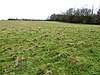 | | Y | 10.2 hectares
(25 acres)[196] | NO | Lympne
51°05′17″N 1°00′50″E / 51.088°N 1.014°E / 51.088; 1.014 (Otterpool Quarry)
TR 112 364[196] | GCR[197] | Map | Citation | This quarry exposes rocks dating to the Cretaceous period, and shows the contact between the Hythe and Sandgate beds. It is very rich in fossil ammonites, with species which can be correlated elsewhere.[198] |
| Park Wood, Chilham |  | Y | | 31.1 hectares
(77 acres)[199] | YES | Canterbury
51°14′10″N 0°55′30″E / 51.236°N 0.925°E / 51.236; 0.925 (Park Wood, Chilham)
TR 043 526[199] | | Map | Citation | This wood is mainly hazel and hornbeam coppice with oak standards, and diverse shrub and ground layers. There are many breeding birds and invertebrates, including two which are rare, the wasp Crossocerus distinguendus and the fly Stratiomys potamida.[200] |
| Parkgate Down |  | Y | | 7.0 hectares
(17 acres)[201] | YES | Canterbury
51°10′16″N 1°00′36″E / 51.171°N 1.010°E / 51.171; 1.010 (Parkgate Down)
TR 168 459[201] | KWT,[202] SAC[203] | Map | Citation | This downland site has grassland which is grazed by sheep and cattle on the lower slopes and dense scrub on the upper ones. There are a variety of orchids including the uncommon lady and musk orchids.[204] |
| Parsonage Wood |  | Y | | 9.7 hectares
(24 acres)[205] | YES | Cranbrook
51°03′58″N 0°33′47″E / 51.066°N 0.563°E / 51.066; 0.563 (Parsonage Wood)
TQ 797 328[205] | KWT[206] | Map | Citation | This is an example of a woodland ghyll in the High Weald. The trees are mainly coppiced, but some of the ground flora are species which are indicative of ancient woods, such as butcher's broom, violet helleborine and pendulous sedge.[207] |
| Pembury Cutting and Pit |  | | Y | 1.6 hectares
(4.0 acres)[208] | PP | Tunbridge Wells
51°08′56″N 0°18′11″E / 51.149°N 0.303°E / 51.149; 0.303 (Pembury Cutting and Pit)
TQ 612 414[208] | GCR[209] | Map | Citation | This site exposes rocks of the Tunbridge Wells Sand Formation, dating to the Early Cretaceous around 140 to 100 million years ago. There are many fossils of Lycopodites, an extinct plant.[210] |
| Peter's Pit |  | Y | | 28.7 hectares
(71 acres)[211] | FP | Rochester
51°20′13″N 0°27′50″E / 51.337°N 0.464°E / 51.337; 0.464 (Peter's Pit)
TQ 717 627[211] | SAC[212][213] | Map | Citation | This was formerly a chalk quarry and it has an undulating terrain. There are many ponds, some of which have populations of the great crested newt, a protected species under the Wildlife and Countryside Act 1981. The site has two reptiles, grass snakes and common European adders.[214] |
| Polebrook Farm |  | Y | | 13.0 hectares
(32 acres)[215] | PP | Edenbridge
51°12′29″N 0°09′18″E / 51.208°N 0.155°E / 51.208; 0.155 (Polebrook Farm)
TQ 506 476[215] | | Map | Citation | The field layout of this farm is believed to have remained unchanged for over 700 years. The hedges and meadows have a rich variety of flora, with at least 19 species of grasses.[216] |
| Preston Marshes |  | Y | | 43.4 hectares
(107 acres)[217] | NO | Canterbury
51°17′49″N 1°12′07″E / 51.297°N 1.202°E / 51.297; 1.202 (Preston Marshes)
TR 233 602[217] | | Map | Citation | This site in the valley of the River Little Stour is dominated by common reed, with areas of willow scrub and pasture. There are many beeding and wintering birds, such as reed buntings and sedge warblers.[218] |
| Purple Hill |  | Y | | 14.9 hectares
(37 acres)[219] | NO | Maidstone
51°19′48″N 0°36′00″E / 51.330°N 0.600°E / 51.330; 0.600 (Purple Hill)
TQ 812 622[219] | NCR[220] | Map | Citation | This chalk downland site has herb-rich grassland, scrub and woods. Flora include the nationally rare Kentish milkwort and several uncommon orchids.[221] |
| Queendown Warren |  | Y | | 22.2 hectares
(55 acres)[222] | YES | Sittingbourne
51°20′10″N 0°37′23″E / 51.336°N 0.623°E / 51.336; 0.623 (Queendown Warren)
TQ 828 629[222] | AONB,[223] KWT,[223] LNR,[224] NCR,[220] Plant,[225] SAC[226][227] | Map | Citation | This site has dry grassland and woodland on a south facing slope. It has two rare plants, early spider orchid and meadow clary, and a rich variety of insects.[228] |
| River Beult |  | Y | | 29.1 hectares
(72 acres)[229] | PP | Tonbridge
51°11′35″N 0°31′34″E / 51.193°N 0.526°E / 51.193; 0.526 (River Beult)
TQ 766 468[229] | | Map | Citation | The river has a varied clay river flora, with nearly 100 recorded species. There are floating plants such as yellow water-lily in the channel and flora on the banks include amphibious bistort and celery-leaved buttercup.[230] |
| Robins Wood |  | Y | | 47.7 hectares
(118 acres)[231] | FP | Cranbrook
51°04′34″N 0°31′19″E / 51.076°N 0.522°E / 51.076; 0.522 (Robins Wood)
TQ 768 338[231] | | Map | Citation | This is a deep valley along a stream in the Weald, and has the humid conditions typical of such areas. It has a diverse flora of mosses, ferns and liverworts, and woodland which is thought to date back to recolonisation after the last ice age ended 11,700 years ago.[232] |
| Rusthall Common |  | | Y | 2.7 hectares
(6.7 acres)[233] | YES | Tunbridge Wells
51°07′59″N 0°14′24″E / 51.133°N 0.240°E / 51.133; 0.240 (Rusthall Common)
TQ 568 395[233] | GCR[234] | Map | Citation | This Quaternary site is important for its examples of sandstone weathering, especially Toad Rock, which stands on a narrow base moulded by periglacial wind erosion.[235] |
| Sandwich Bay to Hacklinge Marshes |  | Y | Y | 1,790.1 hectares
(4,423 acres)[236] | PP | Sandwich
51°16′59″N 1°22′16″E / 51.283°N 1.371°E / 51.283; 1.371 (Sandwich Bay to Hacklinge Marshes)
TR 352 592[236] | GCR,[237][238] KWT,[239] LNR,[240] NCR,[241] NNR,[36][242] Ramsar,[243] SAC,[244][245] SPA[246] | Map | Citation | This site has over 30 plant species and 168 invertebrates which are nationally rare and nationally scarce, and several wintering birds are present in nationally important numbers. It is also a geologically important site, with diverse fish fossils dating to the Thanetian around 57 million years ago.[247] |
| Scord's Wood and Brockhoult Mount |  | Y | | 252.3 hectares
(623 acres)[248] | PP | Westerham
51°14′53″N 0°06′43″E / 51.248°N 0.112°E / 51.248; 0.112 (Scord's Wood and Brockhoult Mount)
TQ 475 520[248] | NCR[9] | Map | Citation | This sloping site has the best sessile oak stands in the county. Grasslands on acidic soils are mainly common bent, heath bedstraw and sheep's sorrel, together with some heather and bracken.[249] |
| Scotney Castle |  | Y | | 112.5 hectares
(278 acres)[250] | YES | Tunbridge Wells
51°05′28″N 0°24′36″E / 51.091°N 0.410°E / 51.091; 0.410 (Scotney Castle)
TQ 689 352[250] | NT[251] | Map | Citation | This site has parkland, grassland, woodland. There are dormice, a protected species, and several nationally scarce invertebrates, such as Rolph's door snail. There are man-made ponds and a moat.[252] |
| Seabrook Stream | 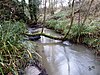 | Y | | 24.1 hectares
(60 acres)[253] | PP | Folkestone
51°05′13″N 1°06′32″E / 51.087°N 1.109°E / 51.087; 1.109 (Seabrook Stream)
TR 178 366[253] | | Map | Citation | The main biological interest of this site lies in the sixty-seven species of cranefly which have been recorded in areas of alder carr and fen. Four are nationally scarce, including Erioptera limbata, which is only known on two other British sites, and there are also fourteen other nationally scarce invertebrate species.[254] |
| Sevenoaks Gravel Pits | 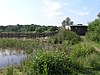 | Y | | 73.7 hectares
(182 acres)[255] | PP | Sevenoaks
51°17′28″N 0°10′52″E / 51.291°N 0.181°E / 51.291; 0.181 (Sevenoaks Gravel Pits)
TQ 522 569[255] | KWT[256] | Map | Citation | This site has flooded gravel pits which have a variety of breeding and wintering birds. There are thirteen species of dragonfly, and there are also areas of reedbeds and woodland.[257] |
| Sheppey Cliffs and Foreshore |  | Y | Y | 303.6 hectares
(750 acres)[258] | PP | Sheerness
51°25′16″N 0°51′54″E / 51.421°N 0.865°E / 51.421; 0.865 (Sheppey Cliffs and Foreshore)
TQ 993 730[258] | GCR[259][260][261][262][263] | Map | Citation | This site exposes Eocene London Clay with well preserved fossil fauna and flora, which have been studied since the eighteenth century. Flora include tropical lianas. The site is botanically important for the nationally rare dragon's teeth.[264] |
| Shorne and Ashenbank Woods |  | Y | | 197.4 hectares
(488 acres)[265] | YES | Gravesend
51°24′11″N 0°24′50″E / 51.403°N 0.414°E / 51.403; 0.414 (Shorne and Ashenbank Woods)
TQ 680 699[265] | | Map | Citation | These woods have diverse and important invertebrates, especially dragonflies, beetles and true bugs, including the rare beetles Mordella holomelaena and Peltodytes caesus. Several clay workings have been landscaped to create shallow ponds designed for wildlife.[266] |
| Sissinghurst Park Wood |  | Y | | 34.1 hectares
(84 acres)[267] | NO | Cranbrook
51°07′12″N 0°34′23″E / 51.120°N 0.573°E / 51.120; 0.573 (Sissinghurst Park Wood)
TQ 802 388[267] | | Map | Citation | This wood is mainly sweet chestnut coppice, and the importance of the site lies in the number of rare plants found in its rides. It is the most eastern locality in Britain for ivy-leaved bellflower.[268] |
| South Thames Estuary and Marshes |  | Y | | 5,289.0 hectares
(13,069 acres)[269] | PP | Rochester
51°28′16″N 0°34′34″E / 51.471°N 0.576°E / 51.471; 0.576 (South Thames Estuary and Marshes)
TQ 790 778[269] | NCR,[178] Ramsar,[270] RSPB,[271] SPA[272] | Map | Citation | Over 20,000 waterfowl use this site, and some species are present in internationally important numbers. There are nationally scarce plants on dykes, and the diverse invertebra include nationally rare beetles, flies and true bugs.[273] |
| Southborough Pit |  | | Y | 1.1 hectares
(2.7 acres)[274] | PP | Tunbridge Wells
51°09′11″N 0°16′34″E / 51.153°N 0.276°E / 51.153; 0.276 (Southborough Pit)
TQ 593 418[274] | GCR[275] | Map | Citation | This site dates to the Valanginian age, around 140 million years ago in the Lower Cretaceous. It is the type locality for the High Brooms Soil Bed, which contains the aquatic horsetail Equisetes lyellii.[276] |
| Spot Lane Quarry |  | | Y | 0.1 hectares
(0.25 acres)[277] | YES | Maidstone
51°15′29″N 0°34′05″E / 51.258°N 0.568°E / 51.258; 0.568 (Spot Lane Quarry)
TQ 793 541[277] | GCR[278][279] | Map | Citation | This site exposes loess, probably dating to the glacial Wolstonian Stage between 352,000 and 130,000 years ago. It contains the fossils of land snails, and as loess in Britain is usually unfossiliferous, it is one of the few sites where loess fauna can be studied.[280] |
| Stodmarsh |  | Y | | 623.2 hectares
(1,540 acres)[281] | PP | Canterbury
51°18′29″N 1°10′19″E / 51.308°N 1.172°E / 51.308; 1.172 (Stodmarsh)
TR 212 613[281] | NCR,[282] NNR,[36][283] Ramsar,[284] SAC,[285] SPA[286] | Map | Citation | This site has flooded gravel pits, scrub, reed beds, grassland and alder carr, with a diverse flora and fauna. Several scarce moths have been recorded and two rare birds, cetti's warbler and the bearded tit, breed in nationally significant numbers.[287] |
| Sturry Pit | 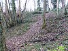 | | Y | 0.7 hectares
(1.7 acres)[288] | YES | Canterbury
51°18′14″N 1°07′12″E / 51.304°N 1.120°E / 51.304; 1.120 (Sturry Pit)
TR 176 607[288] | GCR[289] | Map | Citation | This former gravel quarry has yielded many hand axes of Middle Acheulian style from the third terrace of the River Stour. It is important for understanding the chronologies of the terraces of the Thames basin in the Pleistocene.[290] |
| The Swale |  | Y | | 6,509.4 hectares
(16,085 acres)[291] | PP | Faversham
51°21′43″N 0°52′23″E / 51.362°N 0.873°E / 51.362; 0.873 (The Swale)
TR 001 665[291] | KWT,[292] LNR,[293] NCR,[173] NNR,[294][295][36] Ramsar,[296] SPA[297] | Map | Citation | This site has mudflats, saltmarsh and fresh water marsh. It has many wildfowl and waders, including internationally important numbers of teal, wigeon and grey plover. The Swale also has a rich variety of invertebrates and plants.[298] |
| Swanscombe Skull Site |  | | Y | 3.9 hectares
(9.6 acres)[299] | YES | Swanscombe
51°26′38″N 0°17′49″E / 51.444°N 0.297°E / 51.444; 0.297 (Swanscombe Skull Site)
TQ 597 742[299] | GCR,[300][301] NNR[36][302] | Map | Citation | The large stone in the photograph marks the place where in 1935 dentist Alvan Marston found the first Lower Paleolithic human fossil in Britain. It is part of the skull of a 400,000 year old early Neanderthal woman, and is one of only two British sites to have yielded human remains from this early period.[303][304] |
| Tankerton Slopes | 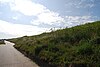 | Y | | 2.3 hectares
(5.7 acres)[305] | YES | Whitstable
51°21′50″N 1°02′42″E / 51.364°N 1.045°E / 51.364; 1.045 (Tankerton Slopes)
TR 121 672[305] | SAC[306] | Map | Citation | This north facing slope has a population of tall herbs, including the largest population in Britain of hog's fennel, a nationally rare umbellifer. Fauna include Agonopterix putridella, a nationally rare moth whose larvae feed exclusively on hog's fennel.[307] |
| Thanet Coast |  | Y | Y | 816.9 hectares
(2,019 acres)[308] | PP | Birchington
51°22′48″N 1°16′44″E / 51.380°N 1.279°E / 51.380; 1.279 (Thanet Coast)
TR 283 696[308] | GCR,[309] LNR,[310] Ramsar,[243] SAC,[245][306] SPA[246] | Map | Citation | This site has unstable cliffs and foreshore, saltmarsh, lagoons, woodland and grassland. It has internationally important numbers of wintering birds and three nationally rare invertebrates. It is also an important Palaeocene site and paleobotanical locality.[311] |
| Tower Hill to Cockham Wood |  | Y | Y | 48.8 hectares
(121 acres)[312] | PP | Rochester
51°24′36″N 0°31′52″E / 51.410°N 0.531°E / 51.410; 0.531 (Tower Hill to Cockham Wood)
TQ 761 709[312] | GCR[313][314] | Map | Citation | This site contains typical woodland on Tertiary deposits, and sandy areas which have diverse invertebrates, including seven nationally rare bees and wasps. Upnor Quarry exposes a complete sequence of Tertiary rocks.[315] |
| Trottiscliffe Meadows | 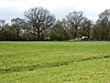 | Y | | 4.8 hectares
(12 acres)[316] | FP | West Malling
51°18′40″N 0°21′22″E / 51.311°N 0.356°E / 51.311; 0.356 (Trottiscliffe Meadows)
TQ 643 595[316] | NCR[317] | Map | Citation | These meadows on gault clay are crossed by calcareous streams, and they are two of the few remaining areas of unimproved grassland in the county. They have a number of uncommon plants, such as marsh valerian, carnation sedge, brown sedge and the rare moss Cratoneuron filicinum.[318] |
| Wansunt Pit |  | | Y | 1.9 hectares
(4.7 acres)[319] | PP | Dartford
51°26′35″N 0°10′44″E / 51.443°N 0.179°E / 51.443; 0.179 (Wansunt Pit)
TQ 515 738[319] | GCR[320] | Map[e] | Citation | The site exposes the Dartford Heath Gravel. The relationship of this exposure to the Swanscombe sequence and the Thames Terraces is a controversial issue in Thames Pleistocene studies.[321] Stone tools have been found of Homo heidelbergensis, dating from the Hoxnian Stage, an interglacial period between 424,000 and 374,000 years ago.[322] |
| Wateringbury | 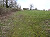 | | Y | 0.2 hectares
(0.49 acres)[323] | NO | Maidstone
51°15′18″N 0°24′58″E / 51.255°N 0.416°E / 51.255; 0.416 (Wateringbury)
TQ 687 534[323] | GCR[324] | Map | Citation | This site contains tufa which displays a complete sequence of molluscs, especially terrestrial snails, dating to the early Holocene, and thus gives a full record of the order in which species colonised the area after the end of the last ice age, the Younger Dryas.[325] |
| West Blean and Thornden Woods |  | Y | | 781.0 hectares
(1,930 acres)[326] | PP | Herne Bay
51°19′41″N 1°05′17″E / 51.328°N 1.088°E / 51.328; 1.088 (West Blean and Thornden Woods)
TR 152 633[326] | KWT,[327] NCR[34] | Map | Citation | These woods have more than fifty species of breeding birds, and the diverse invertebrate fauna include five nationally rare and thirteen nationally scarce species. There is also a population of the declining and protected hazel dormouse.[328] |
| Westerham Mines |  | Y | | 25.4 hectares
(63 acres)[329] | PP | Westerham
51°15′25″N 0°05′02″E / 51.257°N 0.084°E / 51.257; 0.084 (Westerham Mines)
TQ 455 529[329] | | Map | Citation | The main interest of this site lies in the use of former mines by five species of bats for hibernation. They are the whiskered, Brandt's, Daubenton's, Natterer's and long-eared bats. Some moths also hibernate in the mines.[330] |
| Westerham Wood |  | Y | | 43.3 hectares
(107 acres)[331] | NO | Westerham
51°16′34″N 0°03′43″E / 51.276°N 0.062°E / 51.276; 0.062 (Westerham Wood)
TQ 439 550[331] | | Map | Citation | This ancient oak wood on Gault Clay is traditionally managed, and it has a diverse ground flora and an outstanding range of breeding birds. The insect fauna is also diverse, and 77 bryophyte and nearly 300 fungus species have been recorded.[332] |
| Wouldham to Detling Escarpment |  | Y | Y | 311.2 hectares
(769 acres)[333] | PP | Chatham
51°19′19″N 0°30′50″E / 51.322°N 0.514°E / 51.322; 0.514 (Wouldham to Detling Escarpment)
TQ 753 611[333] | AONB,[334] GCR,[335] KWT,[336][337][338] LNR,[339] NCR,[340] SAC[111] | Map | Citation | This stretch of chalk escarpment has woodland, unimproved grassland and scrub. Plants include the nationally rare meadow clary and there are several scarce invertebrates. There are many Mesozoic fossil fishes in an excellent state of preservation.[341] |
| Wye and Crundale Downs |  | Y | Y | 358.3 hectares
(885 acres)[342] | PP | Ashford
51°10′34″N 0°58′08″E / 51.176°N 0.969°E / 51.176; 0.969 (Wye and Crundale Downs)
TR 076 460[342] | AONB,[342] GCR,[343][344] NCR,[345] NNR,[36][346] SAC[347][348] | Map | Citation | This site has a variety of habitats, including grassland, calacreous fen meadow, scrub, dry woodland on chalk and wet alder woodland. The Devil's Kneading Trough, found within the site, is an important geological site displaying periglacial changes dating to the late glacial period.[349] |
| Yockletts Bank |  | Y | | 25.4 hectares
(63 acres)[350] | YES | Canterbury
51°11′17″N 1°02′24″E / 51.188°N 1.040°E / 51.188; 1.040 (Yockletts Bank)
TR 125 476[350] | AONB,[351] KWT[351] | Map | Citation | This sloping site has woodland on dry chalk soils with diverse woodland breeding birds. The ground flora, dominated by bluebells, also contains many orchids.[352] |


