Kráľova Lehota
Village and municipality in Slovakia

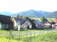
Kráľova Lehota (Hungarian: Királylehota) is a village and municipality in Liptovský Mikuláš District in the Žilina Region of northern Slovakia.
History
In historical records the village was first mentioned in 1361. Before the establishment of independent Czechoslovakia in 1918, it was part of Liptó County within the Kingdom of Hungary. From 1939 to 1945, it was part of the Slovak Republic.
Geography
The municipality lies at an altitude of 677 metres and covers an area of 19.609 km2. It has a population of about 634 people.
Genealogical resources
The records for genealogical research are available at the state archive "Statny Archiv in Bytca, Slovakia"
- Roman Catholic church records (births/marriages/deaths): 1675-1923 (parish B)
- Lutheran church records (births/marriages/deaths): 1784-1897 (parish A)
See also
External links
- https://web.archive.org/web/20080111223415/http://www.statistics.sk/mosmis/eng/run.html
- http://www.kralovalehota.sk (added by Andrej Hyben)
- http://www.seas.sk/?ide=888 Pumped Storage Power Plant Čierny Váh
- Surnames of living people in Kralova Lehota
- v
- t
- e
Municipalities of Liptovský Mikuláš District
- Beňadiková
- Bobrovček
- Bobrovec
- Bobrovník
- Bukovina
- Demänovská Dolina
- Dúbrava
- Galovany
- Gôtovany
- Huty
- Hybe
- Ižipovce
- Jakubovany
- Jalovec
- Jamník
- Konská
- Kráľova Lehota
- Kvačany
- Lazisko
- Liptovská Anna
- Liptovská Kokava
- Liptovská Porúbka
- Liptovská Sielnica
- Liptovské Beharovce
- Liptovské Kľačany
- Liptovské Matiašovce
- Liptovský Ján
- Liptovský Ondrej
- Liptovský Peter
- Liptovský Trnovec
- Ľubeľa
- Malatíny
- Malé Borové
- Malužiná
- Nižná Boca
- Partizánska Ľupča
- Pavčina Lehota
- Pavlova Ves
- Podtureň
- Pribylina
- Prosiek
- Smrečany
- Svätý Kríž
- Trstené
- Uhorská Ves
- Vavrišovo
- Važec
- Veľké Borové
- Veterná Poruba
- Vlachy
- Východná
- Vyšná Boca
- Závažná Poruba
- Žiar

49°01′20″N 19°47′37″E / 49.02222°N 19.79361°E / 49.02222; 19.79361
Authority control databases | |
|---|---|
| International |
|
| National |
|
 | This Žilina Region geography article is a stub. You can help Wikipedia by expanding it. |
- v
- t
- e


