Klasov
Municipality of Slovakia
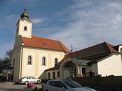
Municipality in Nitra Region, Slovakia
Klasov Kalász | |
|---|---|
 | |
48°17′N 18°16′E / 48.28°N 18.27°E / 48.28; 18.27 | |
| Country |  Slovakia Slovakia |
| Region |  Nitra Region Nitra Region |
| District | Nitra District |
| First mentioned | 1232 |
| Area [1] | |
| • Total | 12.23 km2 (4.72 sq mi) |
| Elevation [2] | 180 m (590 ft) |
| Population (2021)[3] | |
| • Total | 1,429 |
| Time zone | UTC+1 (CET) |
| • Summer (DST) | UTC+2 (CEST) |
| Postal code | 951 53[2] |
| Area code | +421 37[2] |
| Car plate | NR |
| Website | www |
Klasov (Hungarian: Kalász) is a village and municipality in the Nitra District in western central Slovakia, in the Nitra Region.[4]
History
In historical records the village was first mentioned in 1232.
Geography
The village lies at an altitude of 177 metres (581 ft) and covers an area of 12.231 square kilometres (4.722 sq mi). It has a population of about 1,210 people.
Ethnicity
The village is approximately 55% Slovak, 45% Magyar.
Facilities
The village has a public library and football pitch, and tennis pitch in Penzion Agroland.
See also
References
- ^ "Hustota obyvateľstva - obce [om7014rr_ukaz: Rozloha (Štvorcový meter)]". www.statistics.sk (in Slovak). Statistical Office of the Slovak Republic. 2022-03-31. Retrieved 2022-03-31.
- ^ a b c "Základná charakteristika". www.statistics.sk (in Slovak). Statistical Office of the Slovak Republic. 2015-04-17. Retrieved 2022-03-31.
- ^ "Počet obyvateľov podľa pohlavia - obce (ročne)". www.statistics.sk (in Slovak). Statistical Office of the Slovak Republic. 2022-03-31. Retrieved 2022-03-31.
- ^ "Klasov - Okres Nitra - E-OBCE.sk". www.e-obce.sk. Retrieved 2021-08-14.
Genealogical resources
The records for genealogical research are available at the state archive "Statny Archiv in Nitra, Slovakia"
- Roman Catholic church records (births/marriages/deaths): 1728-1913 (parish B)
External links
- MOS - Městská a Obecní Statistika
- Surnames of living people in Klasov
- v
- t
- e
Municipalities of Nitra District
- Alekšince
- Báb
- Babindol
- Bádice
- Branč
- Cabaj-Čápor
- Čab
- Čakajovce
- Čechynce
- Čeľadice
- Čifáre
- Dolné Lefantovce
- Dolné Obdokovce
- Golianovo
- Horné Lefantovce
- Hosťová
- Hruboňovo
- Ivanka pri Nitre
- Jarok
- Jelenec
- Jelšovce
- Kapince
- Klasov
- Kolíňany
- Lehota
- Lúčnica nad Žitavou
- Lukáčovce
- Lužianky
- Ľudovítová
- Malé Chyndice
- Malé Zálužie
- Malý Cetín
- Malý Lapáš
- Melek
- Mojmírovce
- Nitrianske Hrnčiarovce
- Nová Ves nad Žitavou
- Nové Sady
- Paňa
- Podhorany
- Pohranice
- Poľný Kesov
- Rišňovce
- Rumanová
- Svätoplukovo
- Štefanovičová
- Štitáre
- Šurianky
- Tajná
- Telince
- Veľká Dolina
- Veľké Chyndice
- Veľké Zálužie
- Veľký Cetín
- Veľký Lapáš
- Vinodol
- Výčapy-Opatovce
- Zbehy
- Žirany
- Žitavce

 | This Nitra Region geography article is a stub. You can help Wikipedia by expanding it. |
- v
- t
- e


