Kangnam County
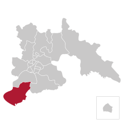
County in P'yŏngyang-Chikhalsi, North Korea
Kangnam County 강남군 | |
|---|---|
| Korean transcription(s) | |
| • Hangul | 강남군 |
| • Hanja | 江南郡 |
| • McCune-Reischauer | Kangnam-gun |
| • Revised Romanization | Gangnam-gun |
 | |
| Country |  North Korea North Korea |
| Direct-administered city | P'yŏngyang-Chikhalsi |
| Administrative divisions | 1 up, 18 ri |
| Area | |
| • Total | 149.1 km2 (57.6 sq mi) |
| Population (2008[1]) | |
| • Total | 69,279 |
| • Density | 460/km2 (1,200/sq mi) |
Kangnam County is one of the two suburban counties of Pyongyang, North Korea. It is north-west of Songrim, north-east of Hwangju County, west of Chunghwa County, and south of Nakrang-guyok. It is the location of cooperative farms and smaller industrial complexes. It became part of Pyongyang in May 1963, when it was separated from South P'yŏngan.[citation needed] In 2010, it was administratively reassigned from Pyongyang to North Hwanghae; foreign media attributed the change as an attempt to relieve shortages in Pyongyang's food distribution system.[2] However, it was returned to Pyongyang in 2011.[3]
Divisions
The county is divided into one town (up), and 18 'ri' (villages).[4]
|
|
References
- v
- t
- e
Pyongyang
| Districts |
|
|---|---|
| Counties |
|
| Neighbourhoods | |
| Rivers | |
| Scenery |
| Banks | |
|---|---|
| Politics |
|
| Transport |
|
|---|
| Squares | |
|---|---|
| Bridges |
| Buildings | |
|---|---|
| Hotels | |
| Structures |
 Category

38°54′13″N 125°38′55″E / 38.9035°N 125.6486°E / 38.9035; 125.6486
 | This North Korea location article is a stub. You can help Wikipedia by expanding it. |
- v
- t
- e


