Kandreho
Place in Betsiboka, Madagascar
17°29′S 46°06′E / 17.483°S 46.100°E / -17.483; 46.100 Madagascar
 (2018)Census
411
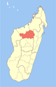
Kandreho is a municipality in western Madagascar in Betsiboka Region approximately 200 kilometres (120 mi) north-west of the capital Antananarivo. It is situated at 144 km from Maevatanana.[2]
See also
- Mahavavy Sud River
- Kandreho Formation
- Kasijy Reserve
References
- ^ Estimated based on DEM data from Shuttle Radar Topography Mission
- ^ Consommation des menages Commune de Behazomaty and Kandreho
- Alimentation en Eau potable - Ville de Kandreho
- v
- t
- e
Communes in the Betsiboka Region of the Republic of MadagascarCapital: Maevatanana
- Ambaliha
- Andasibe
- Antanimbaribe
- Behazomaty
- Betaimboay
- Kandreho
- Mahatsinjo Sud
3 districts; 32 communes
 | This Betsiboka location article is a stub. You can help Wikipedia by expanding it. |
- v
- t
- e


