Huimbayoc District
District in San Martín, Peru
Huimbayoc Wimpayuq | |
|---|---|
District | |
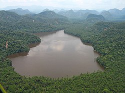 Laguna del Mundo Perdido, Huimbayoc District, Cordillera Azul National Park | |
| Country |  Peru Peru |
| Region | San Martín |
| Province | San Martín |
| Founded | December 30, 1953 |
| Capital | Huimbayoc |
| Government | |
| • Mayor | Lucas Reynaldo Arevalo Cumapa |
| Area | |
| • Total | 1,609.07 km2 (621.27 sq mi) |
| Elevation | 120 m (390 ft) |
| Population (2005 census) | |
| • Total | 4,539 |
| • Density | 2.8/km2 (7.3/sq mi) |
| Time zone | UTC-5 (PET) |
| UBIGEO | 220907 |
Huimbayoc or Wimpayuq (Quechua) is one of fourteen districts of the province San Martín in Peru.[1]
Part of the district is located in the Cordillera Azul National Park.
Climate
| Climate data for Navarro, Huimbayoc, elevation 148 m (486 ft), (1991–2020) | |||||||||||||
|---|---|---|---|---|---|---|---|---|---|---|---|---|---|
| Month | Jan | Feb | Mar | Apr | May | Jun | Jul | Aug | Sep | Oct | Nov | Dec | Year |
| Mean daily maximum °C (°F) | 31.6 (88.9) | 31.5 (88.7) | 31.2 (88.2) | 31.5 (88.7) | 31.7 (89.1) | 31.4 (88.5) | 31.9 (89.4) | 32.1 (89.8) | 32.5 (90.5) | 32.3 (90.1) | 32.0 (89.6) | 31.6 (88.9) | 31.8 (89.2) |
| Mean daily minimum °C (°F) | 21.7 (71.1) | 21.5 (70.7) | 21.5 (70.7) | 21.4 (70.5) | 21.2 (70.2) | 20.5 (68.9) | 20.0 (68.0) | 20.2 (68.4) | 20.9 (69.6) | 21.5 (70.7) | 21.7 (71.1) | 21.7 (71.1) | 21.2 (70.1) |
| Average precipitation mm (inches) | 171.7 (6.76) | 211.9 (8.34) | 225.2 (8.87) | 191.6 (7.54) | 127.2 (5.01) | 93.3 (3.67) | 75.3 (2.96) | 72.2 (2.84) | 133.0 (5.24) | 158.9 (6.26) | 193.6 (7.62) | 208.1 (8.19) | 1,862 (73.3) |
| Source: National Meteorology and Hydrology Service of Peru[2] | |||||||||||||
References
- ^ (in Spanish) Instituto Nacional de Estadística e Informática. Banco de Información Distrital Archived 2008-04-23 at the Wayback Machine. Retrieved April 11, 2008.
- ^ "Normales Climáticas Estándares y Medias 1991-2020". National Meteorology and Hydrology Service of Peru. Archived from the original on 21 August 2023. Retrieved 17 June 2024.
- v
- t
- e

- Districts of San Martín Region
- Peru

 | This San Martín Region geography article is a stub. You can help Wikipedia by expanding it. |
- v
- t
- e
6°25′08″S 75°46′16″W / 6.4190°S 75.7710°W / -6.4190; -75.7710


