Huaribamba District
District in Huancavelica, Peru
Huaribamba Wari Pampa | |
|---|---|
District | |
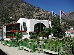 Huaribamba government building | |
| Country |  Peru Peru |
| Region | Huancavelica |
| Province | Tayacaja |
| Capital | Huaribamba |
| Government | |
| • Mayor | Nilton Fortunato Minaya Romani |
| Area | |
| • Total | 359.93 km2 (138.97 sq mi) |
| Elevation | 2,996 m (9,829 ft) |
| Population (2005 census) | |
| • Total | 7,962 |
| • Density | 22/km2 (57/sq mi) |
| Time zone | UTC-5 (PET) |
| UBIGEO | 090709 |
Huaribamba District is one of sixteen districts of the Tayacaja Province in Peru.[1]
Geography
One of the highest peaks of the district is Yana Urqu at approximately 4,600 m (15,100 ft). Other mountains are listed below:[2]
- Hatun Chaka
- Hatun Wayq'u
- Luychus
- Muchka Urqu
- Rayusqa
- Saqsa Kunka
- Uqsa Q'asa
- Wamani
Ethnic groups
The people in the district are mainly Indigenous citizens of Quechua descent. Quechua is the language which the majority of the population (65.63%) learnt to speak in childhood, 34.07% of the residents started speaking using the Spanish language (2007 Peru Census).[3]
References
- ^ (in Spanish) Instituto Nacional de Estadística e Informática. Banco de Información Distrital Archived 2008-04-23 at the Wayback Machine. Retrieved April 11, 2008.
- ^ escale.minedu.gob.pe/ UGEL map Tayacaja Province (Apurímac Region)
- ^ inei.gob.pe Archived 2013-01-27 at the Wayback Machine INEI, Peru, Censos Nacionales 2007, Frequencias: Preguntas de Población: Idioma o lengua con el que aprendió hablar (in Spanish)
- v
- t
- e

- Districts of Huancavelica Region
- Peru

 | This Huancavelica Region geography article is a stub. You can help Wikipedia by expanding it. |
- v
- t
- e
12°16′46″S 74°56′18″W / 12.2795°S 74.9382°W / -12.2795; -74.9382


