Grizzly Peak (Mariposa County, California)
Mountain in California, United States


Grizzly Peak
Location in California
Show map of California
Grizzly Peak
Grizzly Peak (the United States)
Show map of the United StatesMariposa County, California, U.S.
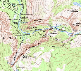

Map showing Grizzly Peak
Grizzly Peak in Yosemite Valley is a promontory on the southwest wall below the popular Half Dome. It can be seen on the hike to Vernal Fall and Nevada Fall, from northeastern Glacier Point, and various other locations in the Yosemite Valley. The top is not accessible by any trail, although rock climbers frequent the peak.[4]
References
- ^ a b "Grizzly Peak, California". Peakbagger.com. Retrieved 2012-12-17.
- ^ "Grizzly Peak". Geographic Names Information System. United States Geological Survey, United States Department of the Interior. Retrieved 2012-12-17.
- ^ Farquhar, Francis P. (1926). Place Names of the High Sierra. San Francisco: Sierra Club. Retrieved 2009-08-04.
- ^ a b "Grizzly Peak". SummitPost.org. Retrieved 2016-03-27.
- v
- t
- e
 | This Mariposa County, California–related article is a stub. You can help Wikipedia by expanding it. |
- v
- t
- e


