Grit Fell
Hill in Lancashire, England

Grit Fell
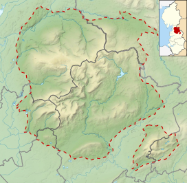
Location in the Forest of Bowland
Show map of the Forest of Bowland
Grit Fell
Location in Lancashire
Show map of Lancashire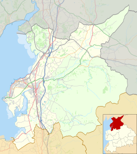
Grit Fell
Location in the City of Lancaster district
Show map of the City of Lancaster districtGrit Fell is a lonely hill between Clougha Pike and Ward's Stone in the Forest of Bowland in Lancashire, England.[1] Covered by heather and large bogs, it is difficult walking country. The path from Jubilee Tower car park in the south is difficult and treacherous, with sheer-sided bogs 6 feet (1.83 m) deep. The path from Clougha Pike in the west is better, but still contains bogs crossed by the odd plank of wood. The path from Ward's Stone is the most treacherous of all. Crossing Cabin Flat, it weaves its way across hidden pools of stagnant water, the presence of which is betrayed by a form of red grass.
The summit is fairly inconspicuous, with only cairns and a wall.
References
- ^ "LANCASHIRE RECOMMENDS - 5 best walks" - Lancashire Evening Post, 13 June 2016
- v
- t
- e
Geography of the City of Lancaster
- Carnforth
- Lancaster
- Morecambe
& suburbs
- Abbeystead
- Abraham Heights
- Aldcliffe
- Arkholme
- Aughton
- Bank Houses
- Bare
- Bay Horse
- Bolton-le-Sands
- Borwick
- Cantsfield
- Caton
- Claughton
- Cockerham
- Conder Green
- Cowan Bridge
- Dolphinholme
- Ellel
- Galgate
- Glasson
- Gressingham
- Halton
- Heysham
- Hornby
- Ireby
- Lower Thurnham
- Melling
- Middleton
- Nether Burrow
- Nether Kellet
- Over Kellet
- Overton
- Poulton-le-Sands
- Priest Hutton
- Quernmore
- Scotforth
- Silverdale
- Skerton
- Slyne
- Stodday
- Sunderland
- Tatham
- Tewitfield
- Torrisholme
- Tunstall
- Upper Thurnham
- Warton
- Wennington
- Whittington
- Wray
- Yealand Conyers
- Yealand Redmayne
- Yealand Storrs
- Aldcliffe-with-Stodday
- Arkholme-with-Cawood
- Bolton-le-Sands
- Borwick
- Burrow-with-Burrow
- Cantsfield
- Carnforth
- Caton-with-Littledale
- Claughton
- Cockerham
- Ellel
- Gressingham
- Halton-with-Aughton
- Heaton-with-Oxcliffe
- Hornby-with-Farleton
- Ireby
- Leck
- Melling-with-Wrayton
- Middleton
- Morecambe
- Nether Kellet
- Over Kellet
- Over Wyresdale
- Overton
- Priest Hutton
- Quernmore
- Roeburndale
- Scotforth
- Silverdale
- Slyne-with-Hest
- Tatham
- Thurnham
- Tunstall
- Warton
- Wennington
- Whittington
- Wray-with-Botton
- Yealand Conyers
- Yealand Redmayne
| Footpaths | |
|---|---|
| Hills |
|
| Rivers | |
| River features | |
| Other waterways | |
 | This Lancashire location article is a stub. You can help Wikipedia by expanding it. |
- v
- t
- e


