Griswold, Manitoba
Place in Manitoba, Canada
49°46′30″N 100°28′15″W / 49.77500°N 100.47083°W / 49.77500; -100.47083 Canada
 Manitoba
R0M 0S0
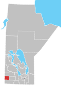
Griswold is an unincorporated place located within the Rural Municipality of Sifton in south-western Manitoba, Canada. It is located approximately 38 kilometers (24 miles) southwest of Brandon, Manitoba.[1]
References
- ^ "Geographical Names of Canada - Querying Distances". nrcan.gc.ca. October 24, 2011. Archived from the original on April 16, 2014. Retrieved February 23, 2013.
- v
- t
- e
| Former villages |
|---|
| Former RMs |
|---|
 | This Manitoba location article is a stub. You can help Wikipedia by expanding it. |
- v
- t
- e


