Ghiring Rural Municipality
Administrative division in Gandaki, Nepal
Gaunpalika in Gandaki, Nepal
Ghiring Rural Municipality घिरिङ्ग गाउँपालिका | |
|---|---|
Gaunpalika | |
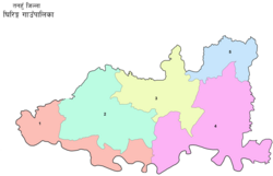 Ghiring Gaunpalika (rural municipality), Nepal map | |
| 28°03′54″N 83°56′21″E / 28.065029°N 83.939057°E / 28.065029; 83.939057 | |
| Country |  Nepal Nepal |
| Province | Gandaki |
| District | Tanahun District |
| Population | |
| • Total | 19,318 |
| Time zone | UTC+5:45 (Nepal Time) |
| Website | http://ghiringmun.gov.np |
Ghiring Rural Municipality (Ghiring Gaupalika) (Nepali: घिरिङ्ग गाउँपालिका) is a Gaunpalika in Tanahaun District in Gandaki Province of Nepal. On 12 March 2017, the government of Nepal implemented a new local administrative structure, in which VDCs have been replaced with municipal and Village Councils. Ghiring is one of these 753 local units.[1][2][3]
Demographics
At the time of the 2011 Nepal census, Ghiring Rural Municipality had a population of 19,318. Of these, 48.0% spoke Magar, 42.6% Nepali, 7.5% Newar, 1.3% Gurung, 0.2% Bhojpuri, 0.1% Doteli, 0.1% Kumhali, 0.1% Maithili and 0.2% other languages as their first language.[4]
In terms of ethnicity/caste, 50.7% were Magar, 10.1% Kami, 9.7% Kumal, 8.2% Newar, 4.9% Hill Brahmin, 4.8% Sarki, 3.5% Chhetri, 3.5% Damai/Dholi, 1.4% Gurung, 0.8% Darai, 0.5% Badi, 0.5% Gharti/Bhujel, 0.3% Sanyasi/Dasnami, 0.3% Thakuri, 0.3% Yadav, 0.1% Sunuwar, 0.1% Tharu and 0.2% others.[5]
In terms of religion, 92.7% were Hindu, 6.3% Buddhist, 0.6% Christian, 0.1% Muslim and 0.4% others.[6]
In terms of literacy, 67.5% could read and write, 1.7% could only read and 30.6% could neither read nor write.[7]
See also
- Dhakmar
References
- ^ "Ghiring" (PDF). Ghiring Gaupalika.
- ^ Collegenp. "Ghiring Rural Municipality, Tanahun". www.collegenp.com. Retrieved 2020-07-06.
- ^ "घिरिङ गाउँपालिका, गाउँकार्यपालिकाको कार्यालय | गण्डकी प्रदेश, तनहुँ, नेपाल". ghiringmun.gov.np. Retrieved 2020-07-06.
- ^ NepalMap Language [1]
- ^ NepalMap Caste [2]
- ^ NepalMap Religion [3]
- ^ NepalMap Literacy [4]
- v
- t
- e
Headquarters: Damauli (part of Vyas Municipality)

- Anbu Khaireni
- Devghat
- Bandipur
- Rishing
- Ghiring
- Myagde
- Arunodaya
- Baidi
- Bhanumati
- Bhirkot
- Bhirlung
- Chhang
- Chhimkeshwari
- Chhipchhipe
- Chok Chisapani
- Deurali
- Dharampani
- Gajarkot
- Ghansikuwa
- Ghiring Sundhara
- Jamune Bhanjyang
- Kabilas
- Kahu Shivapur
- Keshavtar
- Kihun
- Kota
- Kotdarbar
- Majhakot
- Manpang
- Phirphire
- Purkot
- Raipur
- Ramjakot
- Ranipokhari
- Risti
- Rupakot
- Satiswara
- Syamgha
- Tanahunsur
- Thaprek
 | This article about a location in the Tanahun District of Nepal is a stub. You can help Wikipedia by expanding it. |
- v
- t
- e


