Fanuatapu
Island in Atua District, Samoa
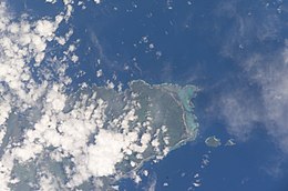 Satellite image of the Aleipata Islands | |
 | |
| Geography | |
|---|---|
| Area | 0.06 km2 (0.023 sq mi) |
| Coastline | 1.79 km (1.112 mi) |
Fanuatapu, an uninhabited island, is a volcanic tuff ring off the eastern tip of Upolu Island, Samoa, in central South Pacific Ocean. It is the smallest and easternmost of the four Aleipata Islands, with an area of 15 hectares. It has an automated lighthouse.
See also
 Islands portal

- Samoa Islands
- List of islands
- Desert island
References
- "Upolu". Global Volcanism Program. Smithsonian Institution. (includes Fanuatapu)
- v
- t
- e
 Atua District: Itūmālō
Traditional center: Lufilufi

- Nu'usafe'e Island
- Aleipata Islands (uninhabited, conservation areas):
- Nu'utele
- Nu'ulua
- Namua
- Fanuatapu
- Aleipata Itupa i Lalo
- Aleipata Itupa i Luga
- Anoamaa East
- Anoamaa West
- Falealili (2 seats)
- Lepa
- Lotofaga
14°00′50″S 171°24′1″W / 14.01389°S 171.40028°W / -14.01389; -171.40028
 | This article about a geographical location in Samoa is a stub. You can help Wikipedia by expanding it. |
- v
- t
- e


