Dávod
You can help expand this article with text translated from the corresponding article in Hungarian. (January 2014) Click [show] for important translation instructions.
- View a machine-translated version of the Hungarian article.
- Machine translation, like DeepL or Google Translate, is a useful starting point for translations, but translators must revise errors as necessary and confirm that the translation is accurate, rather than simply copy-pasting machine-translated text into the English Wikipedia.
- Do not translate text that appears unreliable or low-quality. If possible, verify the text with references provided in the foreign-language article.
- You must provide copyright attribution in the edit summary accompanying your translation by providing an interlanguage link to the source of your translation. A model attribution edit summary is
Content in this edit is translated from the existing Hungarian Wikipedia article at [[:hu:Dávod]]; see its history for attribution. - You may also add the template
{{Translated|hu|Dávod}}to the talk page. - For more guidance, see Wikipedia:Translation.
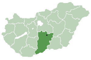
Place in Bács-Kiskun, Hungary

Coat of arms
 Hungary
 (2013)
6524
Dávod (Croatian: Dautovo) is a village in Bács-Kiskun county,[1] in the Southern Great Plain region of Hungary.
Geography
It covers an area of 69.21 km2 (27 sq mi) and has a population of 2,003 people (2013 estimate).[2]
Population
| Year | 1980 | 1990 | 2001 | 2010 | 2011 | 2013 |
|---|---|---|---|---|---|---|
| Population | 2,934 (census)[2] | 2,612 (census)[2] | 2,244 (census)[2] | 1,994 (estimate)[3] | 1,963 (census)[2] | 2,003 (estimate)[2] |
References
- ^ "Dávod City Info". CitySeek.org. Retrieved 5 January 2014.[permanent dead link]
- ^ a b c d e f "Dávod Population Table". citypopulation.de. Retrieved 5 January 2014.
- ^ "Helységnévkönyv adattár 2010". KSH (Hungarian Central Statisctical Office). 1 January 2010. Archived from the original on 7 November 2012. Retrieved 5 January 2014.
- v
- t
- e
- Kecskemét (county seat)


- Ágasegyháza
- Akasztó
- Apostag
- Bácsborsód
- Bácsszentgyörgy
- Bácsszőlős
- Ballószög
- Balotaszállás
- Bátmonostor
- Bátya
- Bócsa
- Borota
- Bugacpusztaháza
- Császártöltés
- Csátalja
- Csávoly
- Csengőd
- Csikéria
- Csólyospálos
- Dávod
- Drágszél
- Dunaegyháza
- Dunafalva
- Dunaszentbenedek
- Dunatetétlen
- Dusnok
- Érsekcsanád
- Érsekhalma
- Fajsz
- Felsőlajos
- Felsőszentiván
- Foktő
- Fülöpháza
- Fülöpjakab
- Fülöpszállás
- Gara
- Gátér
- Géderlak
- Harkakötöny
- Helvécia
- Hercegszántó
- Homokmégy
- Imrehegy
- Jakabszállás
- Jászszentlászló
- Kaskantyú
- Katymár
- Kelebia
- Kéleshalom
- Kisszállás
- Kömpöc
- Kunadacs
- Kunbaja
- Kunbaracs
- Kunfehértó
- Kunpeszér
- Kunszállás
- Ladánybene
- Madaras
- Mátételke
- Miske
- Móricgát
- Nagybaracska
- Nemesnádudvar
- Nyárlőrinc
- Ordas
- Öregcsertő
- Orgovány
- Páhi
- Pálmonostora
- Petőfiszállás
- Pirtó
- Rém
- Soltszentimre
- Szakmár
- Szalkszentmárton
- Szank
- Szentkirály
- Szeremle
- Tabdi
- Tass
- Tataháza
- Tázlár
- Tiszaug
- Újsolt
- Újtelek
- Uszód
- Városföld
- Vaskút
- Zsana
46°00′N 18°55′E / 46.000°N 18.917°E / 46.000; 18.917
 | This Bács-Kiskun location article is a stub. You can help Wikipedia by expanding it. |
- v
- t
- e


