Black Range
33°03′07″N 107°51′01″W / 33.05194°N 107.85028°W / 33.05194; -107.85028[1]Geography 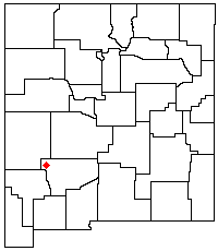
Location New Mexico Geology Mountain type Igneous mountain range Big Burro Mountains Big Hatchet Mountains Black Range Chuska Mountains Cookes Range Fra Cristobal Range Jemez Mountains Magdalena Mountains Mogollon Mountains Organ Mountains Oscura Mountains Peloncillo Mountains Pyramid Mountains Raton-Clayton Volcanic Field Sacramento Mountains San Andres Mountains San Mateo Mountains
(Cibola County) Sandia–Manzano Mountains
Sangre de Cristo Mountains
Zuñi Mountains Others

Location of the Black Range within New Mexico
Mountain range in southwest New Mexico
The Black Range (also called the Devil's Mountains or Sierra Diablo) is an igneous mountain range running north–south in Sierra, Grant, and Catron counties in southwest New Mexico, in the Southwestern United States.
Description
The range's central ridge forms the western and eastern borders, respectively, of the two counties through much of their contact. The range is about 55 miles (88 km) long from north to south and up to 18 miles (29 km) wide. The highest point is McKnight Mountain. The Black Range lies almost entirely within the Gila National Forest. The Mimbres River originates from the mountain snowpack. The Mimbres Mountains, the southernmost part of the range, are usually included as part of the Black Range.[2]
Access to the range is primarily via New Mexico State Road 152 (NM 152), which crosses the Black Range on its way from Kingston on the east towards San Lorenzo on the west. NM 152 crosses the range at 8,228-foot (2,508 m) Emory Pass, where there is a hiking trail that covers the entire length of the mountains along the central ridge. There are also a number of campgrounds, some with hiking trails, along NM 152 as it goes down Iron Canyon on the west side of the range. With the exception of the areas along NM 152, most of the range is very difficult to traverse and almost entirely undeveloped. The Aldo Leopold Wilderness, 202,016 acres (81,753 ha) in size, lies along the crest of the Black Range north of NM 152.
History
The southern portion of the Black Range, which are also known as the Mimbres Mountains, was occupied by the Mimbres people whose culture peaked about 1000 C.E. and ended about 1150 C.E.[2] Their most famous site is the Gila Cliff Dwellings. Silver was discovered in the Black Range in the late 1870s, first in 1876 at Lake Valley,[3] and then by Harry Pye in 1879 at Chloride.[4][5] This led to a silver rush,[4] and silver and gold mines flourished in the Black Range through the end of the 19th century.[5]
See also
 Mountains portal

References
- ^ a b U.S. Geological Survey Geographic Names Information System: Black Range
- ^ a b Ungnade, Herbert E. (1965) "Black Range" Guide to the New Mexico Mountains Sage Books, Denver, pp. 132-133
- ^ Charles R. Keyes, Genesis of the Lake Valley, New Mexico, silver deposits, American Institute of Mining Engineers Bulletin, Jan 1908, p.3.
- ^ a b Abarr, James (14 June 1998) "Frontier mining towns cling to life in southwestern New Mexico" Albuquerque Journal section I, p. 1
- ^ a b Twitchell, Ralph Emerson (1911) The Leading Facts of New Mexican History Torch Press, Cedar Rapids, Iowa, p. 271-272 OCLC 3828708
External links
![]() Media related to Black Range (New Mexico) at Wikimedia Commons
Media related to Black Range (New Mexico) at Wikimedia Commons
- v
- t
- e
- Black Mountain (Catron County)
- McKnight Mountain
- Cerro Grande
- Chicoma Mountain
- Redondo Peak
- South Baldy
- Pyramid Peak
(Cibola County)
- Mount Taylor
- West Blue Mountain
| Manzano Mountains | |
|---|---|
| Sandia Mountains |
| Cimarron Range |
|
|---|---|
| Taos Mountains |
|
| Others |
|
- Haystack Mountain
- Mount Sedgwick
- Aden Crater
- Alamo Hueco Mountains
- Animas Mountains
- Brazos Mountains
- Caballo Mountains
- Canjilón Mountain
- Canyon Creek Mountains
- Capitan Mountains
- Capulin Peak
- Cedar Mountain Range
- Datil Mountains
- Dirty Point
- Doña Ana Mountains
- Eagle Peak
- East Potrillo Mountains
- Elephant Butte (Hidalgo County)
- Elephant Butte (Sierra County)
- Fajada Butte
- Florida Mountains
- Franklin Mountains
- Granite Peak
- Guadalupe Mountains
- Guadalupe Mountains (Hidalgo County)
- Hosta Butte
- Hueco Mountains
- Huérfano Mountain
- Jicarilla Mountains
- Jornada del Muerto Volcano
- Ladron Peak
- Little Burro Mountains
- Little Hatchet Mountains
- Little San Pascual Mountain
- Luera Mountains
- Sierra Nacimiento
- Ocate Peak
- Ortiz Mountains
- Picacho Mountain
- Robledo Mountains
- San Antonio Mountain
- San Mateo Mountains (Socorro County)
- Sierra Aguilada
- Sierra Blanca
- Sierra de las Uvas
- West Potrillo Mountains
| Authority control databases: National |
|
|---|


