Bayburt District
District of Bayburt Province, Turkey
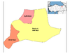
District in Bayburt, Turkey
40°16′N 40°14′E / 40.267°N 40.233°E / 40.267; 40.233 (2021)
Bayburt District (also: Merkez, meaning "central") is a district of Bayburt Province of Turkey. Its seat is the city Bayburt.[1] Its area is 2,705 km2,[2] and its population is 70,277 (2021).[3]
Composition
There is one municipality in Bayburt District:[1][4]
- Arpalı
- Bayburt
There are 121 villages in Bayburt District:[5]
- Adabaşı
- Ağören
- Akçakuzu
- Akduran
- Aksaçlı
- Akşar
- Alapelit
- Alıçlık
- Ardıçgöze
- Armutlu
- Arslandede
- Aşağıçimağıl
- Aşağıkışlak
- Aşağıpınarlı
- Aydıncık
- Balca
- Balkaynak
- Ballıkaya
- Başçımağıl
- Bayırtepe
- Bayraktar
- Buğdaylı
- Çakırbağ
- Çalıdere
- Çamdere
- Çamlıkoz
- Çayırözü
- Çayıryolu
- Çerçi
- Çiğdemtepe
- Çorak
- Dağçatı
- Dağtarla
- Danişment
- Darıca
- Değirmencik
- Demirışık
- Demirkaş
- Dikmetaş
- Dövmekaya
- Erenli
- Gençosman
- Gez
- Gökçeli
- Gökler
- Gökpınar
- Göldere
- Göloba
- Güder
- Güllüce
- Gümüşsu
- Güneydere
- Güzelce
- Hacıoğlu
- Harmanözü
- Helva
- Heybetepe
- Iğdır
- Kabaçayır
- Karlıca
- Karşıgeçit
- Kavacık
- Kavakyanı
- Kemertaş
- Kıratlı
- Kırkpınar
- Kitre
- Koçbayır
- Konursu
- Kop
- Kopuz
- Kozluk
- Kurbanpınar
- Kurugüney
- Maden
- Manas
- Masat
- Mutlu
- Nişantaşı
- Örence
- Ortaçımağıl
- Oruçbeyli
- Ozansu
- Pamuktaş
- Pelitli
- Petekkaya
- Polatlı
- Rüştü
- Sakızlı
- Salkımsu
- Sancaktepe
- Saraycık
- Sarıhan
- Sarımeşe
- Seydiyakup
- Sığırcı
- Sırakayalar
- Soğukgöze
- Söğütlü
- Taht
- Taşburun
- Taşçılar
- Taşkesen
- Taşocağı
- Tepetarla
- Tomlacık
- Uğrak
- Uğurgeldi
- Uluçayır
- Üzengili
- Yanıkçam
- Yaylalar
- Yaylapınar
- Yazyurdu
- Yedigöze
- Yeniköy
- Yerlice
- Yeşilyurt
- Yolaltı
- Yoncalı
- Yukarıkışlak
References
- ^ a b İl Belediyesi, Turkey Civil Administration Departments Inventory. Retrieved 30 January 2023.
- ^ "İl ve İlçe Yüz ölçümleri". General Directorate of Mapping. Retrieved 30 January 2023.
- ^ "Address-based population registration system (ADNKS) results dated 31 December 2021" (XLS) (in Turkish). TÜİK. Retrieved 30 January 2023.
- ^ Belde Belediyesi, Turkey Civil Administration Departments Inventory. Retrieved 30 January 2023.
- ^ Köy, Turkey Civil Administration Departments Inventory. Retrieved 30 January 2023.
- v
- t
- e
Bayburt District in Bayburt Province of Turkey

| Istanbul | |
|---|---|
| West Marmara | |
| Aegean | |
| East Marmara | |
| West Anatolia | |
| Mediterranean | |
| Central Anatolia | |
| West Black Sea | |
| East Black Sea | |
| Northeast Anatolia | |
| Central East Anatolia | |
| Southeast Anatolia | |
Metropolitan municipalities are bolded.

 | This geographical article about a location in Bayburt Province, Turkey is a stub. You can help Wikipedia by expanding it. |
- v
- t
- e


