B10 road (Namibia)
National highway of Namibia
 | ||||
|---|---|---|---|---|
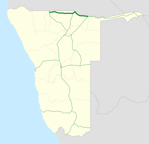 Map of the B10. | ||||
| Route information | ||||
| Maintained by Roads Authority Namibia | ||||
| Length | 439 km (273 mi) | |||
| Major junctions | ||||
| West end |  B1 near Oshikango B1 near Oshikango | |||
| Major intersections |  B15 near Mpungu B15 near Nkurenkuru B15 near Mpungu B15 near Nkurenkuru | |||
| East end |  B8 in Rundu B8 in Rundu | |||
| Location | ||||
| Country | Namibia | |||
| Highway system | ||||
| ||||
| ||||


The B10 is a national road in northern Namibia, running from west to east from the Ohangwena Region to Rundu directly along the Angola Border.[1]
References
- ^ "NamPol calls for vigilance on B10 road". Lela Mobile Online. Nampa. 11 August 2018.[permanent dead link]
- v
- t
- e
 Highways in Namibia
- A1
- A2

- B1
- B2
- B3
- B4
- B6
- B8
- B10
- B11
- B14
- B15
- C10
- C11
- C12
- C13
- C14
- C15
- C16
- C17
- C18
- C19
- C20
- C21
- C22
- C23
- C24
- C25
- C26
- C27
- C28
- C29
- C30
- C31
- C32
- C33
- C34
- C35
- C36
- C37
- C38
- C39
- C40
- C41
- C42
- C43
- C44
- C45
- C46
- C47
- C48
- C49
- Trans-Kalahari Corridor
- Tripoli-Cape Town Highway
- Walvis Bay-Ndola-Lubumbashi Development Road
 | This Namibia location article is a stub. You can help Wikipedia by expanding it. |
- v
- t
- e
 | This African road or road transport-related article is a stub. You can help Wikipedia by expanding it. |
- v
- t
- e


