Ayotlán
Municipality and town in Jalisco, Mexico

Coat of arms
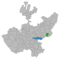
Location of the municipality in Jalisco
 Mexico
 (2020 census)[1]
Ayotlán is a municipality and town in Jalisco in central-western Mexico. The municipality covers an area of 430.9 km2.
As of 2005, the municipality had a total population of 35,150.[2]
Place Names
Ayotlán comes from "Ayotl" (its former name) and means "place of turtles" or "squashes"
Sofia vbnk,;
1583 the Spaniards called it "and Ayo el Chico" to distinguish it from large town that was near San Pedro Piedra Gorda, in the now state of Guanajuato. In the year 620 and 623 came the Aztecs found the place already populated by indigenous groups. About 10 km south of the town is a hill called "Old Town" which was the first seat of the population. Before the conquest had approximately 15,000 Indians living scattered throughout the Valley Coin. Manor depended Coin, whose capital was Tototlan. Worshiped "Ixtlacateolt", highly revered deity in the contours of Chapala lake. The natives had erected shrines or "cues" on the hill of the Villas.
Olidsent by Hernán Cortés in the conquest of Michoacán in 1521, and registered as a resident grabbed the Ayotl natural. Valley Coin was given instructed to Juan de Villaseñor the Elder, who ruled 9 years. When Nuño de Guzmán arrived in the population, the 16 February 1530, ignored the rights of Villaseñor. Ayotl was then under the jurisdiction of the Nueva Galicia. The people of Ayotl participated in the war Miztán in 1541 then was encomendero Verdugo Fco. They burned the church and their houses and went back to Peñoles Coin. The number of natives amounted to 12,000 rebels. On October 26 the same year, personally Viceroy Antonio de Mendoza besieged El Penol with a powerful army and gave them so fierce battle that nearly ended with them.
The town dates from October 8, 1884.
Geography
Location
Ayotlán is located at coordinates 20 ° 20 '05 "to 20 ° 37' 30" north latitude and 102 ° 15 '00 "102 ° 39' 40" west longitude at an altitude of 1.630 meters above sea level. The town is bordered on the north by the municipalities of the Atotonilco El Alto, Arandas and Jesús María, on the east by the municipalities of Jesús María, Degollado the south by the municipality of Yurécuaro the west by the municipalities of La Barca and Atotonilco El Alto.
Localities
has over 100 towns of Acahuales la colonia de villafuerte, La Isla, El Palo Blanco, la ladera grande, la ladera chica. (San Miguel de Acahuales), Agua Blanca, Ayotlán, Betania, Cañada de San Ignacio, Carboneras, Carretas, Colonia Lázaro Cárdenas (El Sicuicho), El Bajío (Bajío de Tejas), El Caracol, El Chaveño, El Edén, El Fraile, El Jaral, El Ojo de Agua, El Rosario, Granja Ballesteros, Granja la Gaby, La Concepción, Las Higueras, El Venado, El Guayabo, Mirandillas, El Volantin, La Raya, La Nopalera and La Esperanza.
References
- ^ Citypopulation.de
- ^ "Ayotlán". Enciclopedia de los Municipios de México. Instituto Nacional para el Federalismo y el Desarrollo Municipal. Archived from the original on May 28, 2007. Retrieved April 13, 2009.
- v
- t
- e
 State of Jalisco
Guadalajara (capital)

- Guadalajara
- Ocotlán
- Puerto Vallarta
and
(municipal seats)
- Acatic
- Acatlán de Juárez
- Ahualulco de Mercado
- Amacueca
- Amatitán
- Ameca
- Arandas
- Atemajac de Brizuela
- Atengo
- Atenguillo
- Atotonilco El Alto
- Atoyac
- Autlán de Navarro
- Ayotlán
- Ayutla
- Bolaños
- Cabo Corrientes (El Tuito)
- Cañadas de Obregón
- Casimiro Castillo
- Chapala
- Chimaltitán
- Chiquilistlán
- Cihuatlán
- Cocula
- Colotlán
- Concepción de Buenos Aires
- Cuautitlán de García Barragán
- Cuautla
- Cuquío
- Degollado
- Ejutla
- El Arenal
- El Grullo
- El Limón
- El Salto
- Encarnación de Díaz
- Etzatlán
- Gómez Farías (San Sebastián del Sur)
- Guachinango
- Guadalajara
- Hostotipaquillo
- Huejúcar
- Huejuquilla El Alto
- Ixtlahuacán de los Membrillos
- Ixtlahuacán del Río
- Jalostotitlán
- Jamay
- Jesús María
- Jilotlán de los Dolores
- Jocotepec
- Juanacatlán
- Juchitlán
- La Barca
- La Huerta
- La Manzanilla de La Paz
- Lagos de Moreno
- Magdalena
- Mascota
- Mazamitla
- Mexticacan
- Mezquitic
- Mixtlán
- Ocotlán
- Ojuelos de Jalisco
- Pihuamo
- Poncitlán
- Puerto Vallarta
- Quitupan
- San Cristóbal de la Barranca
- San Diego de Alejandría
- San Gabriel
- San Ignacio Cerro Gordo
- San Juan de los Lagos
- San Juanito de Escobedo (Antonio Escobedo)
- San Julián
- San Marcos
- San Martín de Bolaños
- San Martín de Hidalgo
- San Miguel el Alto
- San Sebastián del Oeste
- Santa María del Oro
- Santa María de los Ángeles
- Sayula
- Tala
- Talpa de Allende
- Tamazula de Gordiano
- Tapalpa
- Tecalitlán
- Techaluta de Montenegro
- Tecolotlán
- Tenamaxtlán
- Teocaltiche
- Teocuitatlán de Corona
- Tepatitlán de Morelos
- Tequila
- Teuchitlán
- Tizapan El Alto
- Tlajomulco de Zúñiga
- Tlaquepaque
- Tolimán
- Tomatlán
- Tonalá
- Tonaya
- Tonila
- Totatiche
- Tototlán
- Tuxcacuesco
- Tuxcueca
- Tuxpan
- Unión de San Antonio
- Unión de Tula
- Valle de Guadalupe
- Valle de Juárez
- Villa Corona
- Villa Guerrero
- Villa Hidalgo
- Villa Purificación
- Yahualica de González Gallo
- Zacoalco de Torres
- Zapopan
- Zapotiltic
- Zapotitlán de Vadillo
- Zapotlán del Rey
- Zapotlán el Grande
- Zapotlanejo
- Agave Landscape and Ancient Industrial Facilities of Tequila
- Barranca de Oblatos
- Bosque Mesófilo Nevado de Colima
- Chamela-Cuixmala
- Cuenca Alimentadora del Distrito Nacional de Riego 043 Estado de Nayarit
- La Primavera
- Laguna de Sayula
- Sierra de Manantlán
- Sierra de Quila
- Vallarta Botanical Gardens
- Volcán Nevado de Colima


