Ampataka
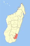
Place in Atsimo-Atsinanana, Madagascar
23°21′S 47°28′E / 23.350°S 47.467°E / -23.350; 47.467 Madagascar
[1]
(2001)[2]
Ampataka is a town and commune in Madagascar. It belongs to the district of Vangaindrano, which is a part of Atsimo-Atsinanana Region. The population of the commune was estimated to be approximately 19,000 in 2001 commune census.[2]
Only primary schooling is available. It is also a site of industrial-scale mining. The majority 93% of the population of the commune are farmers, while an additional 1% receives their livelihood from raising livestock. The most important crops are cassava and coffee, while other important agricultural products are pepper and rice. Industry and services provide employment for 1% and 5% of the population, respectively.[2]
References and notes
- ^ Estimated based on DEM data from Shuttle Radar Topography Mission
- ^ a b c "ILO census data". Cornell University. 2002. Retrieved 2008-05-05.
- v
- t
- e
Capital: Farafangana
- Ambalatany
- Ambalavato
- Ambohigogo
- Ambohimandroso
- Amporoforo
- Ankarana Miraihina
- Anosivelo
- Anosy Tsararafa
- Antsiranambe
- Beretra Bevoay
- Efatsy Anandroza
- Etrotroka Sud
- Evato
- Farafangana
- Fenoarivo
- Iabohazo
- Ihorombe
- Ivandrika
- Mahabo Mananivo
- Mahafasa Centre
- Mahavelo
- Maheriraty
- Manambotra Sud
- Marovandrika
- Sahamadio
- Tangainony
- Tovona
- Vohilengo
- Vohimasy
- Vohitromby
5 districts; 86 communes
23°21′S 47°28′E / 23.350°S 47.467°E / -23.350; 47.467
 | This Atsimo-Atsinanana location article is a stub. You can help Wikipedia by expanding it. |
- v
- t
- e


