A4 highway (Lithuania)
Highway in Lithuania
 | |
|---|---|
| Vilnius – Varėna – Druskininkai | |
 | |
| Route information | |
| Length | 134.46 km (83.55 mi) |
| Major junctions | |
| From | Vilnius |
| To | Grodno Belarus Belarus P 42 P 42 |
| Location | |
| Country | Lithuania |
| Major cities | Varėna, Druskininkai |
| Highway system | |
| |
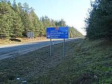
The A4 highway is a highway in Lithuania (Magistralinis kelias). It runs from Vilnius to the Belarus border, near Druskininkai. From there the road continues to Grodno as P 42. The length of the road is 134.46 km.
Most of the road has one lane per each direction and default 90 km/h speed limit. It is the main road connecting Vilnius with the Dzūkija region.
- v
- t
- e
Main roads in Lithuania

- A1
- A2
- A3
- A4
- A5
- A6
- A7
- A8
- A9
- A10
- A11
- A12
- A13
- A14
- A15
- A16
- A17
- A18
- A19
- A20
 Lithuania portal

 | This European road or road transport-related article is a stub. You can help Wikipedia by expanding it. |
- v
- t
- e
 | This article about transport in Lithuania is a stub. You can help Wikipedia by expanding it. |
- v
- t
- e


