Sara (Iloilo)

Municipality of Sara
Lage von Sara in der Provinz Iloilo
Karte
Basisdaten
Region: Western Visayas
Provinz: Iloilo
Barangays: 42
Distrikt: 5. Distrikt von Iloilo
PSGC: 063044000
Einkommensklasse: 3. Einkommensklasse
Haushalte: 8473
Zensus 1. Mai 2000
Einwohnerzahl: 52.631
Zensus 1. August 2015
Koordinaten: 11° 15′ N, 123° 1′ O11.257222222222123.01888888889Koordinaten: 11° 15′ N, 123° 1′ O
Postleitzahl: 5014
Vorwahl: +63 33
Website: www.sara.gov.ph
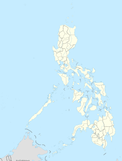
Geographische Lage auf den Philippinen
Sara (Philippinen)
Sara (Philippinen)
Sara

Sara ist eine philippinische Stadtgemeinde in der Provinz Iloilo. Sie hat 52.631 Einwohner (Zensus 1. August 2015).

Baranggays

Sara ist politisch in 42 Baranggays unterteilt.

  • Aguirre
  • Aldeguer
  • Alibayog
  • Anoring
  • Apelo
  • Apologista
  • Aposaga
  • Arante
  • Ardemil
  • Aspera
  • Aswe-Pabriaga
  • Bagaygay
  • Bakabak
  • Batitao
  • Bato
  • Del Castillo
  • Castor
  • Crespo
  • Devera
  • Domingo
  • Ferraris
  • Gildore
  • Improgo
  • Juaneza
  • Labigan
  • Lanciola
  • Latawan
  • Malapaya
  • Muyco
  • Padios
  • Pasig
  • Poblacion Ilawod
  • Poblacion Ilaya
  • Poblacion Market
  • Posadas
  • Preciosa
  • Salcedo
  • San Luis
  • Tady
  • Tentay
  • Villahermosa
  • Zerrudo
Städte und Gemeinden in der Provinz Iloilo

Städte: Iloilo City | Passi City

Gemeinden: Ajuy | Alimodian | Anilao | Badiangan | Balasan | Banate | Barotac Nuevo | Barotac Viejo | Batad | Bingawan | Cabatuan | Calinog | Carles | Concepcion | Dingle | Dueñas | Dumangas | Estancia | Guimbal | Igbaras | Janiuay | Lambunao | Leganes | Lemery | Leon | Maasin | Miagao | Mina | New Lucena | Oton | Pavia | Pototan | San Dionisio | San Enrique | San Joaquin | San Miguel | San Rafael | Santa Barbara | Sara | Tigbauan | Tubungan | Zarraga