Deer Park (New York)

40.760698-73.330072
  Deer Park (New York) |

Dieser Artikel oder nachfolgende Abschnitt ist nicht hinreichend mit Belegen (beispielsweise Einzelnachweisen) ausgestattet. Angaben ohne ausreichenden Beleg könnten demnächst entfernt werden. Bitte hilf Wikipedia, indem du die Angaben recherchierst und gute Belege einfügst.
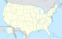
Deer Park ist ein Census-designated place in der nordwestlichen Ecke der Town of Babylon im Suffolk County, im Bundesstaat New York (USA). Die Volkszählung von 2020 ergab 28.837 Einwohner.
Geographie
Der Ort liegt auf Long Island, südlich des Long Island Expressway (Interstate 495) und rund 65 km östlich von Manhattan. Die New York State Route 231 verläuft in Nord-Süd-Richtung durch die Siedlung.
Nach den Angaben des United States Census Bureaus hat Deer Park eine Fläche von rund 16,2 Quadratkilometern.
Geschichte
Der später „Deer Park“ genannte Ort wurde im Jahr 1666 besiedelt. Seinen heutigen Namen erhielt die Ortschaft durch das nach dem Jahr 1808 hier eröffnete „Deer Park Hotel“.
Weblinks
Commons: Deer Park – Sammlung von Bildern, Videos und Audiodateien
V
Orte im Suffolk County im US-Bundesstaat New York County Seat: Riverhead
| Towns | Babylon • Brookhaven • East Hampton • Huntington • Islip • Riverhead • Shelter Island • Smithtown • Southampton • Southold | |
| Villages | Amityville • Asharoken • Babylon • Belle Terre • Bellport • Brightwaters • Dering Harbor • East Hampton • Greenport • Head of the Harbor • Huntington Bay • Islandia • Lake Grove • Lindenhurst • Lloyd Harbor • Nissequogue • North Haven • Northport • Ocean Beach • Old Field • Patchogue • Poquott • Port Jefferson • Quogue • Sag Harbor (New York) • Sagaponack • Saltaire • Shoreham • Southampton • Village of the Branch • West Hampton Dunes • Westhampton Beach | |
| CDPs | Amagansett • Aquebogue • Baiting Hollow • Bay Shore • Bayport • Baywood • Blue Point • Bohemia • Brentwood • Bridgehampton • Brookhaven • Calverton • Captree • Center Moriches • Centereach • Centerport • Central Islip • Cold Spring Harbor • Commack • Copiague • Coram • Cutchogue • Deer Park • Dix Hills • East Farmingdale • East Hampton North • East Islip • East Marion • East Moriches • East Northport • East Patchogue • East Quoque • East Setauket • East Shoreham • Eastport • Eatons Neck • Elwood • Farmingville • Fire Island • Fishers Island • Flanders • Fort Salonga • Gilgo • Gordon Heights • Great River • Greenlawn • Greenport West • Halesite • Hampton Bays • Hauppauge • Holbrook • Holtsville • Huntington • Huntington Station • Islip (CDP) • Islip Terrace • Jamesport • Kings Park • Lake Ronkonkoma • Laurel • Manorville • Mastic (CDP) • Mastic Beach • Mattituck • Medford • Melville • Middle Island • Miller Place • Montauk • Moriches • Mount Sinai • Napeague • Nesconset • New Suffolk • North Amityville • North Babylon • North Bay Shore • North Bellport • North Great River • North Lindenhurst • North Patchogue • North Sea (CDP) • Northampton • Northville (CDP) • Northwest Harbor • Noyack • Oak Beach • Oakdale • Orient • Peconic • Port Jefferson Station • Quiogue • Remsenburg-Speonk • Ridge (CDP) • Riverhead • Riverside • Rocky Point • Ronkonkoma • St. James • Sayville • Selden • Setauket • Shelter Island • Shelter Island Heights • Shinnecock (CDP) • Shirley • Smithtown • Sound Beach • South Huntington • Southold (CDP) • Springs • Stony Brook • Stony Brook University • Terryville • Tuckahoe • Wading River • Wainscott • Water Mill • West Babylon • West Bay Shore • West Hills • West Islip • West Sayville • Westhampton • Wheatley Heights • Wyandanch (CDP) • Yaphank | |
| Reservate | Poospatuck Reservation • Shinnecock Reservation |


